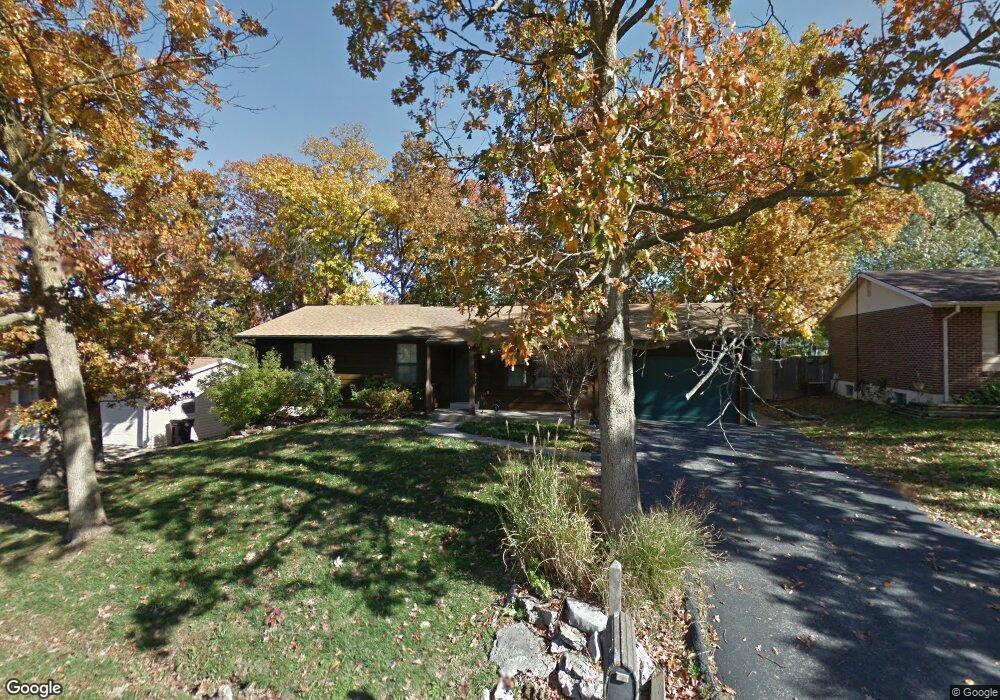
14 N Kern Dr O Fallon, MO 63366
Estimated Value: $262,000 - $290,972
3
Beds
3
Baths
1,220
Sq Ft
$228/Sq Ft
Est. Value
About This Home
This home is located at 14 N Kern Dr, O Fallon, MO 63366 and is currently estimated at $278,743, approximately $228 per square foot. 14 N Kern Dr is a home located in St. Charles County with nearby schools including Green Tree Elementary School, Wentzville South Middle School, and Timberland High School.
Ownership History
Date
Name
Owned For
Owner Type
Purchase Details
Closed on
Aug 20, 2009
Sold by
Wilhelm Beverly
Bought by
Shumway Susan P
Current Estimated Value
Home Financials for this Owner
Home Financials are based on the most recent Mortgage that was taken out on this home.
Original Mortgage
$142,373
Outstanding Balance
$92,591
Interest Rate
5.16%
Mortgage Type
FHA
Estimated Equity
$186,152
Purchase Details
Closed on
Jun 28, 2002
Sold by
Pedigo Christopher Scott and Pedigo Debra Lynn
Bought by
Wilhelm Beverly
Home Financials for this Owner
Home Financials are based on the most recent Mortgage that was taken out on this home.
Original Mortgage
$128,981
Interest Rate
6.78%
Mortgage Type
FHA
Create a Home Valuation Report for This Property
The Home Valuation Report is an in-depth analysis detailing your home's value as well as a comparison with similar homes in the area
Home Values in the Area
Average Home Value in this Area
Purchase History
| Date | Buyer | Sale Price | Title Company |
|---|---|---|---|
| Shumway Susan P | $145,000 | Inv | |
| Wilhelm Beverly | -- | -- |
Source: Public Records
Mortgage History
| Date | Status | Borrower | Loan Amount |
|---|---|---|---|
| Open | Shumway Susan P | $142,373 | |
| Previous Owner | Wilhelm Beverly | $128,981 |
Source: Public Records
Tax History Compared to Growth
Tax History
| Year | Tax Paid | Tax Assessment Tax Assessment Total Assessment is a certain percentage of the fair market value that is determined by local assessors to be the total taxable value of land and additions on the property. | Land | Improvement |
|---|---|---|---|---|
| 2025 | $4,221 | $44,868 | -- | -- |
| 2023 | $4,219 | $41,393 | $0 | $0 |
| 2022 | $3,876 | $33,622 | $0 | $0 |
| 2021 | $3,869 | $33,622 | $0 | $0 |
| 2020 | $3,649 | $30,227 | $0 | $0 |
| 2019 | $2,040 | $30,227 | $0 | $0 |
| 2018 | $1,831 | $25,804 | $0 | $0 |
| 2017 | $1,822 | $25,804 | $0 | $0 |
| 2016 | $1,717 | $24,140 | $0 | $0 |
| 2015 | $1,685 | $24,140 | $0 | $0 |
| 2014 | $1,455 | $21,345 | $0 | $0 |
Source: Public Records
Map
Nearby Homes
- 2 Carr Cir
- 11 S Meadow Dr
- 1001 Delmar Dr
- 527 Parkland Place Dr
- 26 S Meadow Dr
- 38 N Lang Dr
- 610 Lakewood Dr
- 1413 Sunview Dr
- 655 Lakewood Dr
- 725 Hyde Dr
- 307 Tyndale Dr Unit 21
- 818 Brookmead Dr
- 19 Briarmist Ct
- 904 Ampere Place
- 429 Charlemagne Dr
- 35 Monterey Cypress Dr Unit 2
- 152 Columbia Meadows Ln
- 3 Woodview Dr
- 147 Columbia Meadows Ln
- 1018 Lafayette Place