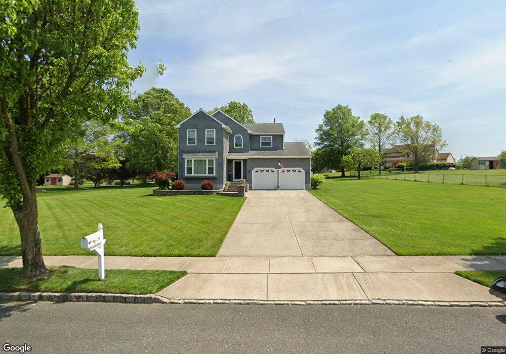
14 Olmsted Dr Sewell, NJ 08080
Washington Township NeighborhoodEstimated Value: $487,488 - $694,000
--
Bed
--
Bath
2,159
Sq Ft
$263/Sq Ft
Est. Value
About This Home
This home is located at 14 Olmsted Dr, Sewell, NJ 08080 and is currently estimated at $568,122, approximately $263 per square foot. 14 Olmsted Dr is a home located in Gloucester County with nearby schools including Washington Township High School, Hurffville Elementary School, and Chestnut Ridge Midle School.
Ownership History
Date
Name
Owned For
Owner Type
Purchase Details
Closed on
Nov 18, 1993
Sold by
Scarborough Corp
Bought by
Corcoran William and Corcoran Kimberly
Current Estimated Value
Home Financials for this Owner
Home Financials are based on the most recent Mortgage that was taken out on this home.
Original Mortgage
$105,000
Interest Rate
6.77%
Create a Home Valuation Report for This Property
The Home Valuation Report is an in-depth analysis detailing your home's value as well as a comparison with similar homes in the area
Home Values in the Area
Average Home Value in this Area
Purchase History
| Date | Buyer | Sale Price | Title Company |
|---|---|---|---|
| Corcoran William | $182,241 | -- |
Source: Public Records
Mortgage History
| Date | Status | Borrower | Loan Amount |
|---|---|---|---|
| Closed | Corcoran William | $105,000 |
Source: Public Records
Tax History Compared to Growth
Tax History
| Year | Tax Paid | Tax Assessment Tax Assessment Total Assessment is a certain percentage of the fair market value that is determined by local assessors to be the total taxable value of land and additions on the property. | Land | Improvement |
|---|---|---|---|---|
| 2025 | $10,228 | $276,500 | $67,800 | $208,700 |
| 2024 | $9,940 | $276,500 | $67,800 | $208,700 |
| 2023 | $9,940 | $276,500 | $67,800 | $208,700 |
| 2022 | $9,614 | $276,500 | $67,800 | $208,700 |
| 2021 | $7,083 | $276,500 | $67,800 | $208,700 |
| 2020 | $9,348 | $276,500 | $67,800 | $208,700 |
| 2019 | $9,408 | $258,100 | $60,300 | $197,800 |
| 2018 | $9,302 | $258,100 | $60,300 | $197,800 |
| 2017 | $9,186 | $258,100 | $60,300 | $197,800 |
| 2016 | $9,132 | $258,100 | $60,300 | $197,800 |
| 2015 | $9,003 | $258,100 | $60,300 | $197,800 |
| 2014 | $8,719 | $258,100 | $60,300 | $197,800 |
Source: Public Records
Map
Nearby Homes
- 536 Delsea Dr
- 109 Covered Bridge Ct Unit 109
- 111 Belfry Place
- 137 Meridian Ln
- 1052 Noble Place
- 1072 Prime Place
- 8 Elk Ct
- 224 Hurffville Grenloch Rd
- 30 N Woodbury Rd
- 38 Freedom Rd
- 117 Shire Dr
- 149 N Fernwood Ave
- 606 Hurffville Crosskeys Rd
- 368 Pitman Ave
- 602 Hurffville Crosskeys Rd
- 174 Pitman Downer Rd
- 178 Esplanade Ave
- 184 Pitman Downer Rd
- 11 Pony Run
- 302 Montgomery Ave