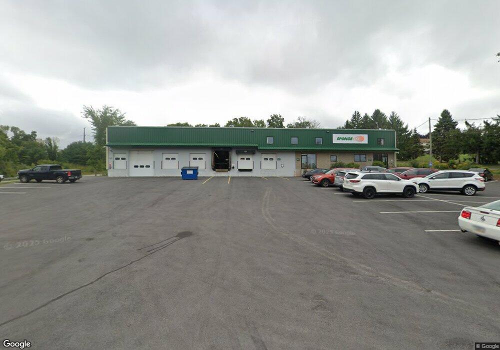
14 Patterson Ln Newington, NH 03801
Estimated Value: $2,839,048
--
Bed
--
Bath
29,145
Sq Ft
$97/Sq Ft
Est. Value
About This Home
This home is located at 14 Patterson Ln, Newington, NH 03801 and is currently estimated at $2,839,048, approximately $97 per square foot. 14 Patterson Ln is a home located in Rockingham County with nearby schools including Newington Public School.
Ownership History
Date
Name
Owned For
Owner Type
Purchase Details
Closed on
Jun 7, 2011
Sold by
Newington Industrial
Bought by
Sponge-Jet Realty Hold
Current Estimated Value
Home Financials for this Owner
Home Financials are based on the most recent Mortgage that was taken out on this home.
Original Mortgage
$1,150,000
Interest Rate
4.85%
Mortgage Type
Commercial
Create a Home Valuation Report for This Property
The Home Valuation Report is an in-depth analysis detailing your home's value as well as a comparison with similar homes in the area
Home Values in the Area
Average Home Value in this Area
Purchase History
| Date | Buyer | Sale Price | Title Company |
|---|---|---|---|
| Sponge-Jet Realty Hold | $1,230,000 | -- |
Source: Public Records
Mortgage History
| Date | Status | Borrower | Loan Amount |
|---|---|---|---|
| Open | Sponge-Jet Realty Hold | $1,568,000 | |
| Closed | Sponge-Jet Realty Hold | $1,150,000 |
Source: Public Records
Tax History Compared to Growth
Tax History
| Year | Tax Paid | Tax Assessment Tax Assessment Total Assessment is a certain percentage of the fair market value that is determined by local assessors to be the total taxable value of land and additions on the property. | Land | Improvement |
|---|---|---|---|---|
| 2024 | $19,428 | $2,465,500 | $1,104,600 | $1,360,900 |
| 2023 | $28,641 | $1,700,800 | $452,500 | $1,248,300 |
| 2022 | $16,804 | $1,700,800 | $452,500 | $1,248,300 |
| 2021 | $16,974 | $1,700,800 | $452,500 | $1,248,300 |
| 2020 | $5,463 | $1,700,800 | $452,500 | $1,248,300 |
| 2018 | $13,914 | $1,501,000 | $249,400 | $1,251,600 |
| 2017 | $7,233 | $1,501,000 | $249,400 | $1,251,600 |
| 2016 | $344 | $1,501,000 | $249,400 | $1,251,600 |
| 2015 | $14,260 | $1,501,000 | $249,400 | $1,251,600 |
| 2014 | $14,390 | $1,480,500 | $618,730 | $861,770 |
| 2011 | $12,490 | $1,395,500 | $249,400 | $1,146,100 |
Source: Public Records
Map
Nearby Homes
- 0 Franks Fort Island Unit 1631886
- 10 Shipwright Way
- 36 Shipwright Way
- 71 Shipwright Way
- 10 Shipping Ln
- 15 Shipping Ln
- 493 Main St
- SLIP 15 Little Bay Marina
- 1116 State Rd
- 18 Little Bay Dr
- 33 Little Bay Dr
- 1338 Woodbury Ave Unit 10
- 1092 State Rd
- 51 Granite St
- 171 Echo Ave
- 27 Wentworth Terrace
- 28 Little Bay Dr
- 37 Shearwater Dr Unit 1906
- 19 Shearwater Dr Unit 1903
- 15 Shearwater Dr Unit 1902
- 2299 Woodbury Ave
- 48 Patterson Ln
- 15 River Rd
- 177 Shattuck Way
- 2204 Woodbury Ave
- 46 Patterson Ln
- 148 Old Dover Rd
- 54 Patterson Ln
- 138 Old Dover Rd
- 144 Old Dover Rd
- 58 Patterson Ln
- 140 Old Dover Rd
- 66 Patterson Ln
- 25 Fox Run Rd
- 25 Fox Run Rd
- 23 River Rd
- 92 Patterson Ln
- 33 Fox Run Rd
- 90 Patterson Ln
- 40 Old Dover Rd