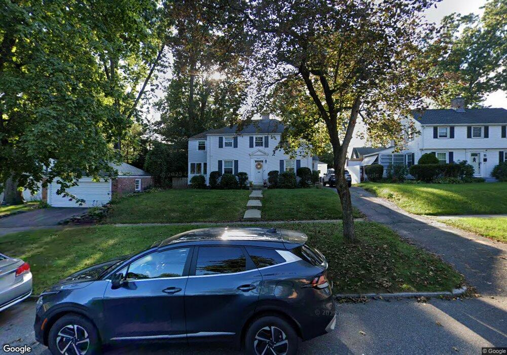
14 Pennsylvania Ave Springfield, MA 01118
East Forest Park NeighborhoodEstimated Value: $313,506 - $336,000
3
Beds
2
Baths
1,316
Sq Ft
$246/Sq Ft
Est. Value
About This Home
This home is located at 14 Pennsylvania Ave, Springfield, MA 01118 and is currently estimated at $323,627, approximately $245 per square foot. 14 Pennsylvania Ave is a home located in Hampden County with nearby schools including Mary A. Dryden Veterans Memorial School, M Marcus Kiley Middle, and Springfield High School of Science and Technology.
Ownership History
Date
Name
Owned For
Owner Type
Purchase Details
Closed on
Feb 18, 1997
Sold by
Nicholson Paul A and Nicholson Christine M
Bought by
Spear Gerald E and Spear Laurel A
Current Estimated Value
Home Financials for this Owner
Home Financials are based on the most recent Mortgage that was taken out on this home.
Original Mortgage
$91,800
Interest Rate
7.6%
Mortgage Type
Purchase Money Mortgage
Purchase Details
Closed on
Jun 8, 1987
Sold by
Flynn Roselle C
Bought by
Nicholson Paul A
Create a Home Valuation Report for This Property
The Home Valuation Report is an in-depth analysis detailing your home's value as well as a comparison with similar homes in the area
Home Values in the Area
Average Home Value in this Area
Purchase History
| Date | Buyer | Sale Price | Title Company |
|---|---|---|---|
| Spear Gerald E | $90,000 | -- | |
| Nicholson Paul A | $106,900 | -- |
Source: Public Records
Mortgage History
| Date | Status | Borrower | Loan Amount |
|---|---|---|---|
| Open | Nicholson Paul A | $30,000 | |
| Open | Nicholson Paul A | $92,138 | |
| Closed | Nicholson Paul A | $91,800 | |
| Previous Owner | Nicholson Paul A | $86,000 |
Source: Public Records
Tax History Compared to Growth
Tax History
| Year | Tax Paid | Tax Assessment Tax Assessment Total Assessment is a certain percentage of the fair market value that is determined by local assessors to be the total taxable value of land and additions on the property. | Land | Improvement |
|---|---|---|---|---|
| 2025 | $4,517 | $288,100 | $47,400 | $240,700 |
| 2024 | $4,392 | $273,500 | $47,400 | $226,100 |
| 2023 | $4,668 | $273,800 | $45,100 | $228,700 |
| 2022 | $4,562 | $242,400 | $45,100 | $197,300 |
| 2021 | $4,253 | $225,000 | $41,000 | $184,000 |
| 2020 | $4,105 | $210,200 | $41,000 | $169,200 |
| 2019 | $3,533 | $179,500 | $41,000 | $138,500 |
| 2018 | $3,497 | $177,700 | $41,000 | $136,700 |
| 2017 | $3,334 | $169,600 | $41,000 | $128,600 |
| 2016 | $3,140 | $159,700 | $41,000 | $118,700 |
| 2015 | $3,118 | $158,500 | $41,000 | $117,500 |
Source: Public Records
Map
Nearby Homes
- 274 Abbott St
- 100 Derryfield Ave
- 225 Gillette Ave
- 96 Chesterfield Ave
- 135 Dayton St
- 138 Abbott St
- 19 Dennis St
- 384 Abbott St
- 115 Abbott St
- 95 Benz St
- 62 Wayside St
- 283 Plumtree Rd
- 196 Sawmill Rd
- 104 Grandview St
- 97 Lancaster St
- 941 Allen St
- 26 Harkness Ave
- 134 Eddywood St
- 19 Roosevelt Ave
- 54 Ellsworth Ave
- 20 Pennsylvania Ave
- 486 Plumtree Rd
- 480 Plumtree Rd Unit SF
- 480 Plumtree Rd
- 480 Plumtree Rd Unit 1
- 480 Plumtree Rd Unit Single Res
- 26 Pennsylvania Ave
- 23 Derryfield Ave
- 27 Derryfield Ave
- 19 Derryfield Ave
- 474 Plumtree Rd
- 502 Plumtree Rd
- 32 Pennsylvania Ave
- 37 Derryfield Ave
- 11 Derryfield Ave
- 23 Pennsylvania Ave
- 43 Derryfield Ave
- 508 Plumtree Rd
- 38 Pennsylvania Ave
- 499 Plumtree Rd