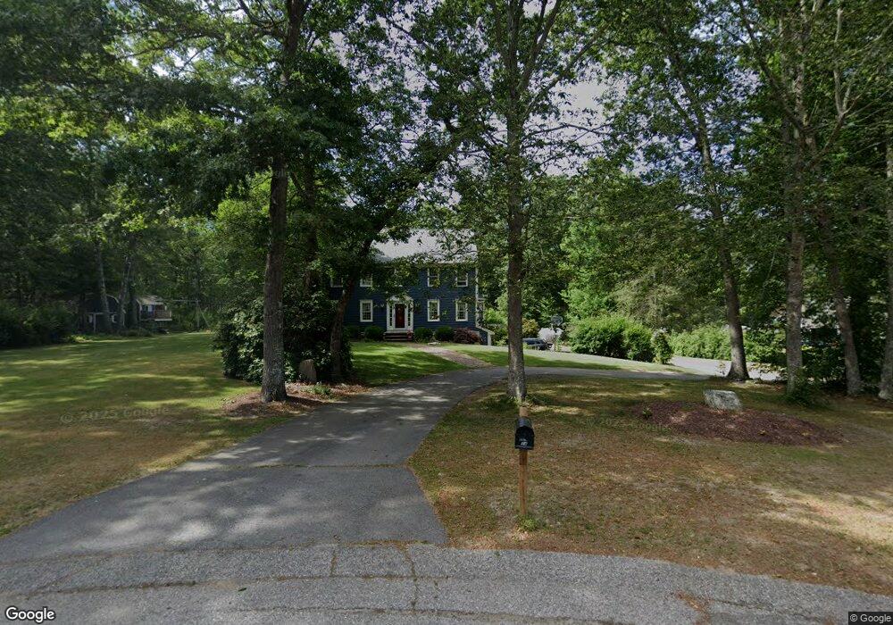
14 Pheasant Hill Rd Halifax, MA 02338
Estimated Value: $717,000 - $810,000
4
Beds
3
Baths
2,830
Sq Ft
$272/Sq Ft
Est. Value
About This Home
This home is located at 14 Pheasant Hill Rd, Halifax, MA 02338 and is currently estimated at $770,276, approximately $272 per square foot. 14 Pheasant Hill Rd is a home located in Plymouth County with nearby schools including Silver Lake Regional High School, Halifax Elementary School, and Silver Lake Regional Middle School.
Ownership History
Date
Name
Owned For
Owner Type
Purchase Details
Closed on
Dec 28, 2006
Sold by
Campbell Stephen J and Campbell Suzanne M
Bought by
Sherry Patrick and Sherry Kerry L
Current Estimated Value
Home Financials for this Owner
Home Financials are based on the most recent Mortgage that was taken out on this home.
Original Mortgage
$260,000
Interest Rate
6.29%
Mortgage Type
Purchase Money Mortgage
Purchase Details
Closed on
Oct 27, 2006
Sold by
Campbell Stephen J and Campbell Suzanne M
Bought by
Wechter David S and Fowler-Wechter Heather
Create a Home Valuation Report for This Property
The Home Valuation Report is an in-depth analysis detailing your home's value as well as a comparison with similar homes in the area
Home Values in the Area
Average Home Value in this Area
Purchase History
| Date | Buyer | Sale Price | Title Company |
|---|---|---|---|
| Sherry Patrick | $490,000 | -- | |
| Wechter David S | $245,000 | -- |
Source: Public Records
Mortgage History
| Date | Status | Borrower | Loan Amount |
|---|---|---|---|
| Open | Wechter David S | $256,350 | |
| Closed | Wechter David S | $260,000 |
Source: Public Records
Tax History Compared to Growth
Tax History
| Year | Tax Paid | Tax Assessment Tax Assessment Total Assessment is a certain percentage of the fair market value that is determined by local assessors to be the total taxable value of land and additions on the property. | Land | Improvement |
|---|---|---|---|---|
| 2025 | $9,246 | $647,900 | $201,100 | $446,800 |
| 2024 | $9,056 | $628,900 | $193,300 | $435,600 |
| 2023 | $8,724 | $586,300 | $187,700 | $398,600 |
| 2022 | $8,472 | $529,200 | $167,600 | $361,600 |
| 2021 | $8,248 | $474,300 | $161,100 | $313,200 |
| 2020 | $7,942 | $455,400 | $161,100 | $294,300 |
| 2019 | $7,793 | $446,100 | $156,500 | $289,600 |
| 2018 | $7,496 | $424,700 | $147,600 | $277,100 |
| 2017 | $7,479 | $403,600 | $147,600 | $256,000 |
| 2016 | $7,327 | $380,600 | $138,000 | $242,600 |
| 2015 | $7,283 | $383,500 | $138,000 | $245,500 |
Source: Public Records
Map
Nearby Homes
- 780 Old Plymouth St
- 118 Lingan St
- 8 10th Ave
- 0 Morse St Unit 73387111
- 148 Lot 1a Elm St
- 2 Lydon Ln Unit A1
- 40 3rd Ave
- 343 Monponsett St
- 139 Fairway Dr
- 266 Monponsett St Unit 1105
- 266 Monponsett St Unit 202
- 266 Monponsett St Unit 307
- 266 Monponsett St Unit 1208
- 266 Monponsett St Unit 103
- 266 Monponsett St Unit 309
- 266 Monponsett St Unit 305
- 266 Monponsett St Unit 1101
- 266 Monponsett St Unit 302
- 266 Monponsett St Unit 303
- 266 Monponsett St Unit 1210
- 16 Pheasant Hill Rd
- 6 Pheasant Hill Rd
- 19 Pheasant Hill Rd
- 11 Pheasant Hill Rd
- 131 Stoney Weir Rd
- 142 Stoney Weir Rd
- 134 Stoney Weir Rd
- 123 Stoney Weir Rd
- 126 Stoney Weir Rd
- 127 Clyde o Bosworth Rd
- 121 Clyde o Bosworth Rd
- 118 Stoney Weir Rd
- 111 Cranberry Dr
- 103 Cranberry Dr
- 117 Cranberry Dr
- 110 Stoney Weir Rd
- 114 Clyde o Bosworth Rd
- 126 Clyde o Bosworth Rd
- 95 Cranberry Dr
- 114 Cranberry Dr