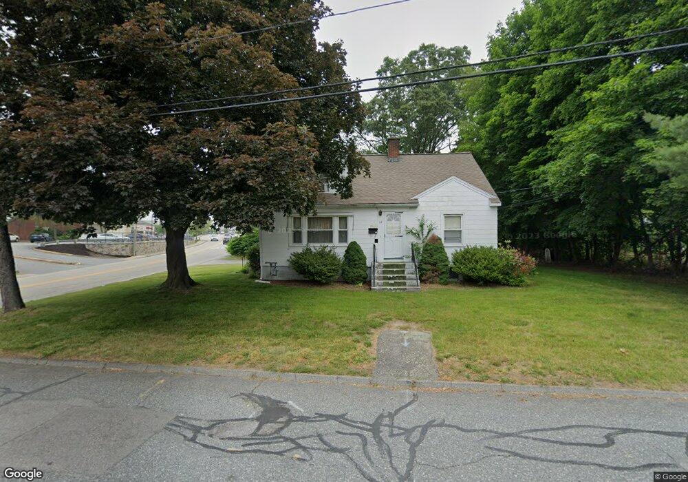
14 Power Ave Shrewsbury, MA 01545
Estimated Value: $529,000 - $608,943
4
Beds
2
Baths
1,592
Sq Ft
$355/Sq Ft
Est. Value
About This Home
This home is located at 14 Power Ave, Shrewsbury, MA 01545 and is currently estimated at $565,236, approximately $355 per square foot. 14 Power Ave is a home located in Worcester County with nearby schools including Calvin Coolidge Elementary School, Sherwood Middle School, and Oak Middle School.
Ownership History
Date
Name
Owned For
Owner Type
Purchase Details
Closed on
Oct 14, 2011
Sold by
Thompson Alicia M
Bought by
Wong Yuk P and Wong Kin S
Current Estimated Value
Create a Home Valuation Report for This Property
The Home Valuation Report is an in-depth analysis detailing your home's value as well as a comparison with similar homes in the area
Home Values in the Area
Average Home Value in this Area
Purchase History
| Date | Buyer | Sale Price | Title Company |
|---|---|---|---|
| Wong Yuk P | $187,000 | -- | |
| Wong Yuk P | $187,000 | -- | |
| Wong Yuk P | $187,000 | -- |
Source: Public Records
Mortgage History
| Date | Status | Borrower | Loan Amount |
|---|---|---|---|
| Previous Owner | Wong Yuk P | $42,000 |
Source: Public Records
Tax History Compared to Growth
Tax History
| Year | Tax Paid | Tax Assessment Tax Assessment Total Assessment is a certain percentage of the fair market value that is determined by local assessors to be the total taxable value of land and additions on the property. | Land | Improvement |
|---|---|---|---|---|
| 2025 | $6,091 | $505,900 | $232,100 | $273,800 |
| 2024 | $5,653 | $456,600 | $221,000 | $235,600 |
| 2023 | $5,440 | $414,600 | $221,000 | $193,600 |
| 2022 | $5,444 | $385,800 | $192,200 | $193,600 |
| 2021 | $4,587 | $347,800 | $178,700 | $169,100 |
| 2020 | $4,565 | $366,100 | $192,200 | $173,900 |
| 2019 | $4,185 | $332,900 | $164,700 | $168,200 |
| 2018 | $3,799 | $300,100 | $149,200 | $150,900 |
| 2017 | $3,671 | $286,100 | $135,200 | $150,900 |
| 2016 | $3,654 | $281,100 | $126,200 | $154,900 |
| 2015 | $3,072 | $232,700 | $107,300 | $125,400 |
Source: Public Records
Map
Nearby Homes
- 26 Browne Rd
- 10 Gleason Rd
- 40 Shrewsbury Green Dr Unit A
- 22 Shrewsbury Green Dr Unit C
- 6 Selina St
- 73 S Quinsigamond Ave
- 105 S Quinsigamond Ave
- 40 Phillips Ave
- 67 N Quinsigamond Ave Unit 23
- 315 Maple Ave
- 15 Eagle Dr
- 135 Lake Ave
- 7 Tern Dr
- 175 Oak St
- 96 Lake Ave
- 5 Fyrbeck Ave
- 65 Lake Ave Unit 831
- 65 Lake Ave Unit 1008
- 26 Williamsburg Ct Unit 22
- 190 S Quinsigamond Ave Unit 102
- 12 Power Ave
- 17 Svenson Rd
- 11 Power Ave
- 6 Power Ave
- 21 Svenson Rd
- 7 Power Ave
- 18 Svenson Rd
- 25 Svenson Rd
- 196 Boston Turnpike
- 16 Worthington Ave
- 5 Power Ave
- 20 Worthington Ave
- 26 Worthington Ave
- 26 Worthington Ave Unit 1
- 13 Edgewater Ave
- 28 Svenson Rd Unit B
- 28 Svenson Rd Unit A
- 28A Svenson Rd
- 28A Svenson Rd Unit 28 A
- 13 Worthington Ave