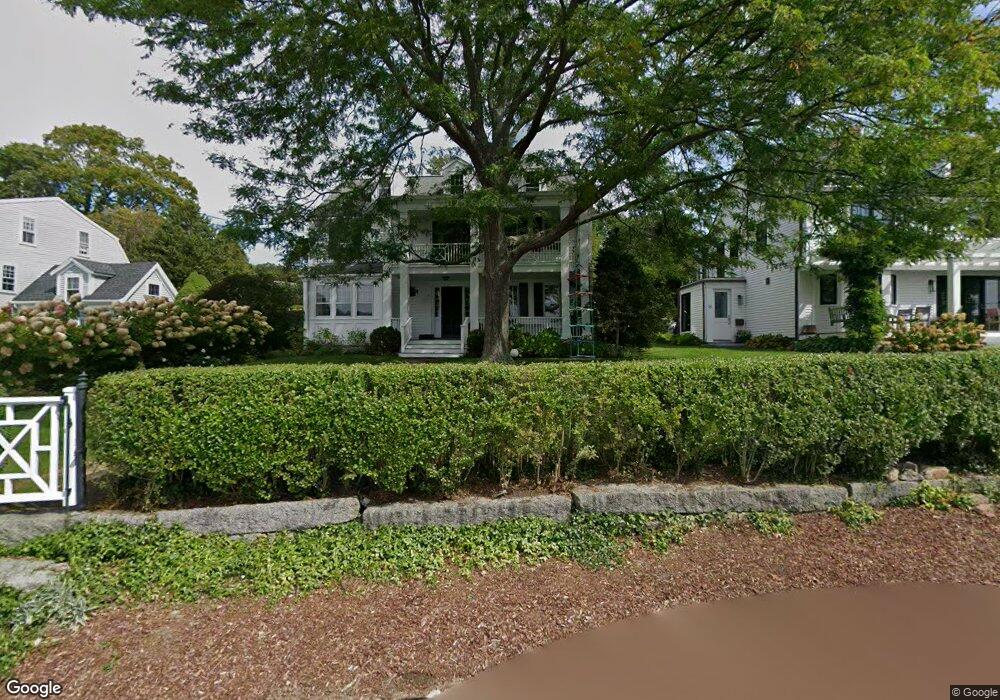
14 River Rd Gloucester, MA 01930
Annisquam NeighborhoodEstimated Value: $1,321,000 - $2,361,000
4
Beds
4
Baths
2,316
Sq Ft
$819/Sq Ft
Est. Value
About This Home
This home is located at 14 River Rd, Gloucester, MA 01930 and is currently estimated at $1,897,007, approximately $819 per square foot. 14 River Rd is a home located in Essex County with nearby schools including Plum Cove School, Ralph B O'maley Middle School, and Gloucester High School.
Ownership History
Date
Name
Owned For
Owner Type
Purchase Details
Closed on
Sep 22, 2023
Sold by
Brooks Thomas R
Bought by
14 River Rd Nt and Brooks
Current Estimated Value
Purchase Details
Closed on
Feb 24, 2012
Sold by
14 River Road Nt and Brooks
Bought by
Brooks Thomas R
Purchase Details
Closed on
Nov 10, 2008
Sold by
Brooks Thomas R
Bought by
14 River Road Nt and Newman
Create a Home Valuation Report for This Property
The Home Valuation Report is an in-depth analysis detailing your home's value as well as a comparison with similar homes in the area
Home Values in the Area
Average Home Value in this Area
Purchase History
| Date | Buyer | Sale Price | Title Company |
|---|---|---|---|
| 14 River Rd Nt | -- | None Available | |
| Brooks Thomas R | -- | -- | |
| 14 River Road Nt | -- | -- | |
| 14 River Road Nt | -- | -- |
Source: Public Records
Tax History
| Year | Tax Paid | Tax Assessment Tax Assessment Total Assessment is a certain percentage of the fair market value that is determined by local assessors to be the total taxable value of land and additions on the property. | Land | Improvement |
|---|---|---|---|---|
| 2025 | $19,629 | $2,019,400 | $1,427,000 | $592,400 |
| 2024 | $19,575 | $2,011,800 | $1,320,900 | $690,900 |
| 2023 | $16,125 | $1,522,700 | $917,800 | $604,900 |
| 2022 | $15,848 | $1,351,100 | $798,000 | $553,100 |
| 2021 | $15,309 | $1,230,600 | $725,800 | $504,800 |
| 2020 | $15,224 | $1,234,700 | $725,800 | $508,900 |
| 2019 | $14,625 | $1,152,500 | $692,000 | $460,500 |
| 2018 | $14,259 | $1,102,800 | $675,100 | $427,700 |
| 2017 | $13,842 | $1,049,400 | $643,100 | $406,300 |
| 2016 | $13,394 | $984,100 | $615,300 | $368,800 |
| 2015 | -- | $942,900 | $601,300 | $341,600 |
Source: Public Records
Map
Nearby Homes
- 672 Washington St
- 136 Leonard St
- 2 Breezy Point Rd
- 226 Atlantic St
- 178 Atlantic St
- 167 Atlantic St
- 4 Ciaramitaro Ct
- 7 Colburn St
- 3 Deacon Farm Ln
- 13 Honeysuckle Rd
- 31 Echo Ave
- 9 Hickory St
- 1030 Washington St
- 43 High St Unit B
- 13 Mystic Ave
- 3 Rockland St
- 8 Mystic Ave
- 117 Bray St
- 6 Monroe Ct
- 98 Maplewood Ave
Your Personal Tour Guide
Ask me questions while you tour the home.