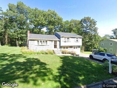
14 Roach Rd Stoughton, MA 02072
Estimated Value: $487,000 - $610,000
3
Beds
1
Bath
1,412
Sq Ft
$398/Sq Ft
Est. Value
About This Home
This home is located at 14 Roach Rd, Stoughton, MA 02072 and is currently estimated at $562,402, approximately $398 per square foot. 14 Roach Rd is a home located in Norfolk County with nearby schools including South Elementary School, O'Donnell Middle School, and Stoughton High School.
Ownership History
Date
Name
Owned For
Owner Type
Purchase Details
Closed on
Apr 7, 2017
Sold by
Lang Christina E
Bought by
Lang Christina E and Lang Robert T
Current Estimated Value
Purchase Details
Closed on
Apr 17, 2007
Sold by
Lang Christina E and Lang Robert T
Bought by
Lang Christina E
Purchase Details
Closed on
Nov 25, 1997
Sold by
Campanelli John D and Campanelli Joyce A
Bought by
Lang Robert T and Lang Christina E
Home Financials for this Owner
Home Financials are based on the most recent Mortgage that was taken out on this home.
Original Mortgage
$143,900
Interest Rate
7.17%
Mortgage Type
Purchase Money Mortgage
Create a Home Valuation Report for This Property
The Home Valuation Report is an in-depth analysis detailing your home's value as well as a comparison with similar homes in the area
Home Values in the Area
Average Home Value in this Area
Purchase History
| Date | Buyer | Sale Price | Title Company |
|---|---|---|---|
| Lang Christina E | -- | -- | |
| Lang Christina E | -- | -- | |
| Lang Christina E | -- | -- | |
| Lang Christina E | -- | -- | |
| Lang Christina E | -- | -- | |
| Lang Robert T | $159,900 | -- |
Source: Public Records
Mortgage History
| Date | Status | Borrower | Loan Amount |
|---|---|---|---|
| Open | Lang Robert T | $50,001 | |
| Previous Owner | Lang Christina E | $205,000 | |
| Previous Owner | Lang Robert T | $195,000 | |
| Previous Owner | Campanelli John D | $172,500 | |
| Previous Owner | Campanelli John D | $143,900 | |
| Previous Owner | Campanelli John D | $75,000 |
Source: Public Records
Tax History Compared to Growth
Tax History
| Year | Tax Paid | Tax Assessment Tax Assessment Total Assessment is a certain percentage of the fair market value that is determined by local assessors to be the total taxable value of land and additions on the property. | Land | Improvement |
|---|---|---|---|---|
| 2025 | $5,835 | $471,300 | $206,500 | $264,800 |
| 2024 | $5,642 | $443,200 | $188,600 | $254,600 |
| 2023 | $5,400 | $398,500 | $172,400 | $226,100 |
| 2022 | $5,410 | $375,400 | $165,900 | $209,500 |
| 2021 | $5,222 | $345,800 | $146,300 | $199,500 |
| 2020 | $5,149 | $345,800 | $146,300 | $199,500 |
| 2019 | $5,051 | $329,300 | $146,300 | $183,000 |
| 2018 | $4,484 | $302,800 | $139,800 | $163,000 |
| 2017 | $4,196 | $289,600 | $138,200 | $151,400 |
| 2016 | $4,069 | $271,800 | $125,200 | $146,600 |
| 2015 | $3,793 | $250,700 | $118,700 | $132,000 |
| 2014 | $3,545 | $225,200 | $108,900 | $116,300 |
Source: Public Records
Map
Nearby Homes
- 89 Lucas Dr
- 1426 Washington St
- 84 Murray Cir
- 119 Esten Rd
- 0 Atkinson Ave
- 24 Penniman Cir
- 82 Brickel Rd
- 23 Brickel Rd
- 26 Thompson Ct
- 20 Washington St Unit 1-5
- 3 and 23 Morton St
- 827 Park St
- 31 7th St
- 981 Washington St
- Lot 9 Lawler Ln
- 959 Washington St
- 39 Riverside Terrace
- 31 Riverside Terrace
- 15 Cathy Ln
- 68 Boylston St