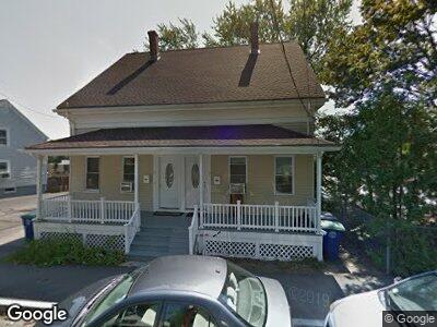
14 Taylor St Unit 16 Braintree, MA 02184
South Braintree NeighborhoodEstimated Value: $700,000 - $831,000
6
Beds
2
Baths
2,261
Sq Ft
$339/Sq Ft
Est. Value
About This Home
This home is located at 14 Taylor St Unit 16, Braintree, MA 02184 and is currently estimated at $765,814, approximately $338 per square foot. 14 Taylor St Unit 16 is a home located in Norfolk County with nearby schools including Braintree High School, Meeting House Montessori School, and Thayer Academy.
Ownership History
Date
Name
Owned For
Owner Type
Purchase Details
Closed on
Dec 12, 2012
Sold by
Dan Kai L
Bought by
14 Taylor Street Llc
Current Estimated Value
Purchase Details
Closed on
Aug 13, 2009
Sold by
14-16 Taylor Street Rt and Younie Stephen A
Bought by
Dan Kai Lan
Create a Home Valuation Report for This Property
The Home Valuation Report is an in-depth analysis detailing your home's value as well as a comparison with similar homes in the area
Home Values in the Area
Average Home Value in this Area
Purchase History
| Date | Buyer | Sale Price | Title Company |
|---|---|---|---|
| 14 Taylor Street Llc | -- | -- | |
| Dan Kai Lan | $255,000 | -- |
Source: Public Records
Mortgage History
| Date | Status | Borrower | Loan Amount |
|---|---|---|---|
| Previous Owner | Dan Kai L | $100,000 |
Source: Public Records
Tax History Compared to Growth
Tax History
| Year | Tax Paid | Tax Assessment Tax Assessment Total Assessment is a certain percentage of the fair market value that is determined by local assessors to be the total taxable value of land and additions on the property. | Land | Improvement |
|---|---|---|---|---|
| 2025 | $7,022 | $703,600 | $306,300 | $397,300 |
| 2024 | $6,100 | $643,500 | $285,600 | $357,900 |
| 2023 | $5,751 | $589,200 | $256,600 | $332,600 |
| 2022 | $5,616 | $564,400 | $231,800 | $332,600 |
| 2021 | $5,393 | $542,000 | $209,400 | $332,600 |
| 2020 | $4,923 | $499,300 | $190,400 | $308,900 |
| 2019 | $4,606 | $456,500 | $182,100 | $274,400 |
| 2018 | $4,513 | $428,200 | $165,600 | $262,600 |
| 2017 | $4,328 | $403,000 | $157,300 | $245,700 |
| 2016 | $3,873 | $352,700 | $132,400 | $220,300 |
| 2015 | $3,887 | $351,100 | $130,800 | $220,300 |
| 2014 | $3,569 | $312,500 | $119,200 | $193,300 |
Source: Public Records
Map
Nearby Homes
- 1 Meadowbrook Rd
- 8 Hall Ave Unit 2
- 45 Hobart Ave
- 35 Hobart Ave
- 199 Franklin St
- 5 Woodsum Dr Unit 7
- 150 Academy St
- 35 Woodsum Dr Unit 3
- 0 Talmadge Ave Unit 73283456
- 258 Pearl St
- 418 John Mahar Hwy Unit 105
- 569 Washington St
- 422 John Mahar Hwy Unit 305
- 26 Sherman Rd
- 428 John Mahar Hwy Unit 412
- 17 Carter Rd
- 426 John Mahar Hwy Unit 107
- 131 Jefferson St
- 121 West St
- 176 West St
- 14 Taylor St Unit 16
- 14 Taylor St Unit 14
- 16 Taylor St Unit 16
- 10 Taylor St
- 6 Taylor St
- 19 Taylor St
- 11 Taylor St
- 15 Taylor St
- 9 Taylor St Unit 11
- 28 Central St
- 25 Taylor St Unit 4L
- 25 Taylor St Unit 3R
- 25 Taylor St Unit 3
- 25 Taylor St
- 26 Central St
- 31 Taylor St
- 33 Taylor St
- 817 Washington St Unit 201
- 817 Washington St Unit 202
- 817 Washington St