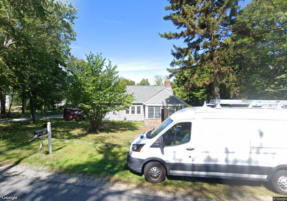
14 Utility Rd Scituate, MA 02066
Estimated Value: $675,000 - $809,000
3
Beds
1
Bath
1,200
Sq Ft
$596/Sq Ft
Est. Value
About This Home
This home is located at 14 Utility Rd, Scituate, MA 02066 and is currently estimated at $714,984, approximately $595 per square foot. 14 Utility Rd is a home located in Plymouth County with nearby schools including Cushing Elementary School, Lester J. Gates Middle School, and Scituate High School.
Ownership History
Date
Name
Owned For
Owner Type
Purchase Details
Closed on
Mar 25, 2022
Sold by
Best Rodney O and Best Stacey A
Bought by
Best Rodney O
Current Estimated Value
Home Financials for this Owner
Home Financials are based on the most recent Mortgage that was taken out on this home.
Original Mortgage
$294,490
Outstanding Balance
$274,062
Interest Rate
3.89%
Mortgage Type
Purchase Money Mortgage
Estimated Equity
$440,922
Purchase Details
Closed on
Nov 30, 2004
Sold by
Seastrand Rt and Pavlosky
Bought by
Best Rodney O and Best Stacey A
Home Financials for this Owner
Home Financials are based on the most recent Mortgage that was taken out on this home.
Original Mortgage
$320,000
Interest Rate
5.75%
Mortgage Type
Purchase Money Mortgage
Purchase Details
Closed on
Jun 18, 2004
Sold by
Pavlosky Helen
Bought by
Seastrand Rt and Pavlosky
Home Financials for this Owner
Home Financials are based on the most recent Mortgage that was taken out on this home.
Original Mortgage
$350,000
Interest Rate
5.47%
Mortgage Type
Purchase Money Mortgage
Purchase Details
Closed on
May 14, 2004
Sold by
Bonney Allerton L
Bought by
Pavlosky Helen
Home Financials for this Owner
Home Financials are based on the most recent Mortgage that was taken out on this home.
Original Mortgage
$350,000
Interest Rate
5.47%
Mortgage Type
Purchase Money Mortgage
Create a Home Valuation Report for This Property
The Home Valuation Report is an in-depth analysis detailing your home's value as well as a comparison with similar homes in the area
Home Values in the Area
Average Home Value in this Area
Purchase History
| Date | Buyer | Sale Price | Title Company |
|---|---|---|---|
| Best Rodney O | $142,000 | None Available | |
| Best Rodney O | $434,000 | -- | |
| Seastrand Rt | -- | -- | |
| Pavlosky Helen | $420,000 | -- |
Source: Public Records
Mortgage History
| Date | Status | Borrower | Loan Amount |
|---|---|---|---|
| Open | Best Rodney O | $294,490 | |
| Previous Owner | Pavlosky Helen | $268,000 | |
| Previous Owner | Pavlosky Helen | $320,000 | |
| Previous Owner | Pavlosky Helen | $350,000 |
Source: Public Records
Tax History
| Year | Tax Paid | Tax Assessment Tax Assessment Total Assessment is a certain percentage of the fair market value that is determined by local assessors to be the total taxable value of land and additions on the property. | Land | Improvement |
|---|---|---|---|---|
| 2025 | $6,046 | $605,200 | $391,400 | $213,800 |
| 2024 | $5,859 | $565,500 | $355,800 | $209,700 |
| 2023 | $5,668 | $492,300 | $342,000 | $150,300 |
| 2022 | $5,668 | $449,100 | $315,800 | $133,300 |
| 2021 | $5,617 | $421,400 | $300,800 | $120,600 |
| 2020 | $5,523 | $409,100 | $289,200 | $119,900 |
| 2019 | $5,526 | $402,200 | $283,500 | $118,700 |
| 2018 | $5,660 | $405,700 | $281,400 | $124,300 |
| 2017 | $5,551 | $394,000 | $269,700 | $124,300 |
| 2016 | $5,239 | $370,500 | $246,200 | $124,300 |
| 2015 | $4,700 | $358,800 | $234,500 | $124,300 |
Source: Public Records
Map
Nearby Homes
- 327 Country Way
- 74 Branch St Unit 15
- 20 Lawson Rd
- 49 Whittier Dr
- 54 Woodland Rd
- 20 Grace Way Unit 20
- 6 Grace Way Unit 6
- 27 Grace Way
- 59 Captain Peirce Rd
- 49 Jackson Rd
- 115 Elm St
- 537 First Parish Rd
- 111 Elm St
- 67 Pratt Rd
- 20 Lee Ave
- 1 Washington Ln
- 629 Country Way
- 627 First Parish Rd
- 38 Lauren Ln
- 701 Country Way
Your Personal Tour Guide
Ask me questions while you tour the home.