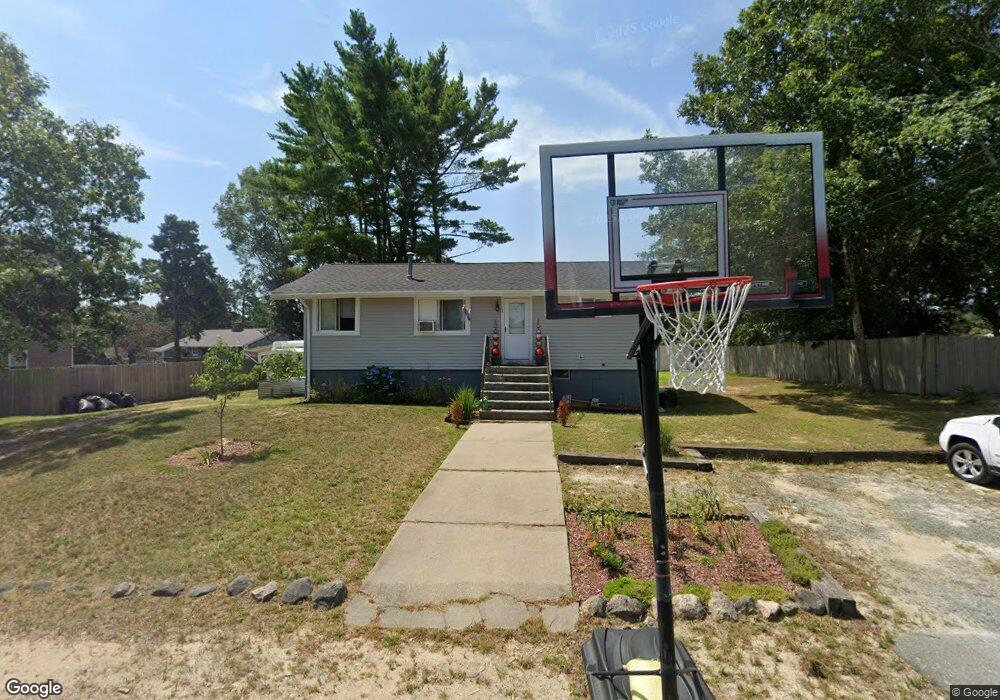
14 Whipoorwill Way Wareham, MA 02571
Estimated Value: $387,000 - $430,000
2
Beds
1
Bath
792
Sq Ft
$512/Sq Ft
Est. Value
About This Home
This home is located at 14 Whipoorwill Way, Wareham, MA 02571 and is currently estimated at $405,824, approximately $512 per square foot. 14 Whipoorwill Way is a home located in Plymouth County.
Ownership History
Date
Name
Owned For
Owner Type
Purchase Details
Closed on
May 21, 1998
Sold by
Soccorso Phillip J
Bought by
Ferranti Antoinette M
Current Estimated Value
Home Financials for this Owner
Home Financials are based on the most recent Mortgage that was taken out on this home.
Original Mortgage
$59,800
Outstanding Balance
$11,613
Interest Rate
7.03%
Mortgage Type
Purchase Money Mortgage
Estimated Equity
$394,211
Create a Home Valuation Report for This Property
The Home Valuation Report is an in-depth analysis detailing your home's value as well as a comparison with similar homes in the area
Home Values in the Area
Average Home Value in this Area
Purchase History
| Date | Buyer | Sale Price | Title Company |
|---|---|---|---|
| Ferranti Antoinette M | $35,000 | -- | |
| Ferranti Antoinette M | $35,000 | -- |
Source: Public Records
Mortgage History
| Date | Status | Borrower | Loan Amount |
|---|---|---|---|
| Open | Ferranti Antoinette M | $59,800 | |
| Closed | Ferranti Antoinette M | $59,800 |
Source: Public Records
Tax History Compared to Growth
Tax History
| Year | Tax Paid | Tax Assessment Tax Assessment Total Assessment is a certain percentage of the fair market value that is determined by local assessors to be the total taxable value of land and additions on the property. | Land | Improvement |
|---|---|---|---|---|
| 2025 | $3,304 | $317,100 | $109,800 | $207,300 |
| 2024 | $3,340 | $297,400 | $85,800 | $211,600 |
| 2023 | $3,201 | $266,100 | $78,000 | $188,100 |
| 2022 | $3,012 | $228,500 | $78,000 | $150,500 |
| 2021 | $2,978 | $221,400 | $78,000 | $143,400 |
| 2020 | $2,781 | $209,700 | $78,000 | $131,700 |
| 2019 | $2,673 | $201,100 | $75,000 | $126,100 |
| 2018 | $2,522 | $185,000 | $75,000 | $110,000 |
| 2017 | $2,335 | $173,600 | $75,000 | $98,600 |
| 2016 | $2,128 | $157,300 | $72,500 | $84,800 |
| 2015 | $2,056 | $157,300 | $72,500 | $84,800 |
| 2014 | $1,921 | $149,500 | $68,900 | $80,600 |
Source: Public Records
Map
Nearby Homes
- 2731 Cranberry Hwy
- 125 Jeffreys Path
- 24 Kimberly Ct
- 6 Back St
- 50 Avenue A St
- 2783 Cranberry Hwy
- 12 Linwood Ave
- 51 Minot Ave Unit 1
- 110 Mayflower Ridge Dr
- 5 Oak Hill Rd
- 2596 Cranberry Hwy
- 57 Oak St
- 2838 Cranberry Hwy
- 3 Cedar St
- 425 Main St Unit E
- 437 Main St
- 124 Minot Ave Unit 1
- 7 Knowles Ave
- 10 Nimrod Way
- 1 Chapel Ln
- 16 Whippoorwill Way
- 16 Whipoorwill Way
- 5 Partridge Path
- 12 Whippoorwill Way
- 7 Partridge Path
- 19 Whipoorwill Way
- 19 Whippoorwill Way
- 17 Whipoorwill Way
- 3 Partridge Path
- 18 Whipoorwill Way
- 21 Whipoorwill Way
- 10 Whipoorwill Way
- 10 Whippoorwill Way
- 9 Partridge Path
- 6 Partridge Path
- 15 Whipoorwill Way
- 15 Whippoorwill Way
- 23 Whipoorwill Way
- 4 Partridge Path
- 13 Whipoorwill Way