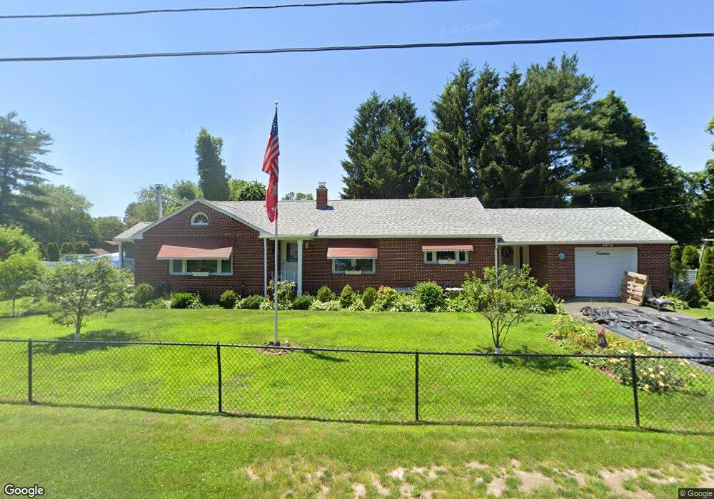
14 Wilson St Wilbraham, MA 01095
Estimated Value: $358,703 - $398,000
3
Beds
2
Baths
1,452
Sq Ft
$263/Sq Ft
Est. Value
About This Home
This home is located at 14 Wilson St, Wilbraham, MA 01095 and is currently estimated at $381,676, approximately $262 per square foot. 14 Wilson St is a home located in Hampden County with nearby schools including Minnechaug Regional High School, St John The Baptist School, and Wilbraham & Monson Academy.
Ownership History
Date
Name
Owned For
Owner Type
Purchase Details
Closed on
Jan 20, 2026
Sold by
14 Wilson St Rt and Cox
Bought by
Cox Kevin E and Cox Nancy E
Current Estimated Value
Purchase Details
Closed on
Nov 30, 2012
Sold by
Dean Scott
Bought by
V & F Realty Partnership
Purchase Details
Closed on
Apr 22, 2010
Sold by
Andre Adela A
Bought by
Wilson Street Rt
Purchase Details
Closed on
Oct 17, 2003
Sold by
Mccave Jeannette C
Bought by
Dean Scott
Home Financials for this Owner
Home Financials are based on the most recent Mortgage that was taken out on this home.
Original Mortgage
$119,000
Interest Rate
6.43%
Mortgage Type
Purchase Money Mortgage
Create a Home Valuation Report for This Property
The Home Valuation Report is an in-depth analysis detailing your home's value as well as a comparison with similar homes in the area
Home Values in the Area
Average Home Value in this Area
Purchase History
| Date | Buyer | Sale Price | Title Company |
|---|---|---|---|
| Cox Kevin E | -- | -- | |
| V & F Realty Partnership | $230,000 | -- | |
| Wilson Street Rt | $168,000 | -- | |
| Dean Scott | $121,000 | -- | |
| Dean Scott | $121,000 | -- |
Source: Public Records
Mortgage History
| Date | Status | Borrower | Loan Amount |
|---|---|---|---|
| Previous Owner | Dean Scott | $119,000 | |
| Previous Owner | Dean Scott | $50,000 |
Source: Public Records
Tax History
| Year | Tax Paid | Tax Assessment Tax Assessment Total Assessment is a certain percentage of the fair market value that is determined by local assessors to be the total taxable value of land and additions on the property. | Land | Improvement |
|---|---|---|---|---|
| 2025 | $5,509 | $308,100 | $65,100 | $243,000 |
| 2024 | $5,191 | $280,600 | $65,100 | $215,500 |
| 2023 | $46 | $257,700 | $65,100 | $192,600 |
| 2022 | $4,600 | $224,500 | $65,100 | $159,400 |
| 2021 | $4,356 | $189,700 | $76,100 | $113,600 |
| 2020 | $4,245 | $189,700 | $76,100 | $113,600 |
| 2019 | $4,135 | $189,700 | $76,100 | $113,600 |
| 2018 | $3,887 | $171,700 | $76,100 | $95,600 |
| 2017 | $3,777 | $171,700 | $76,100 | $95,600 |
| 2016 | $3,456 | $160,000 | $75,600 | $84,400 |
| 2015 | $3,341 | $160,000 | $75,600 | $84,400 |
Source: Public Records
Map
Nearby Homes
- 46 Washington Rd
- 4 Hillcrest Dr
- 35 Lake Dr
- 104 High Pine Cir
- 3 Mohawk St
- 1 Aspen Dr
- 22 Brainard Rd
- 67 Hill Terrace
- 16 Maple St
- 6 Teak Terrace Unit 24
- 25 Dale St
- 36 Maple St
- 24 Lodge Ln Unit 24
- 2205 Boston Rd Unit E43
- 2205 Boston Rd Unit M120
- 57 Sandalwood Dr Unit site 61
- 103 Sandalwood Dr Unit site 00
- 111 Sandalwood Dr Unit site 00
- 84 Sandalwood Dr Unit site 00
- 26 Sandalwood Dr
- 8 Wilson St
- 11 Wilson St Unit 13
- 11-13 Wilson St
- 6 Wilson St
- 7 Wilson St
- 15 Wilson St
- 4 Wilson St
- 12 Hunter St
- 7 White St
- 8 White St
- 4 Hunter St
- 2511 & 2493 Boston Rd
- 15 Magnolia St
- 16 Wilson St Unit 18
- 2489 Boston Rd
- 11 Magnolia Lane Lot A
- 11 Magnolia St
- 22 Magnolia Lane Lot Bj(s)
- 2525 Boston Rd
- 4 Grant St
Your Personal Tour Guide
Ask me questions while you tour the home.