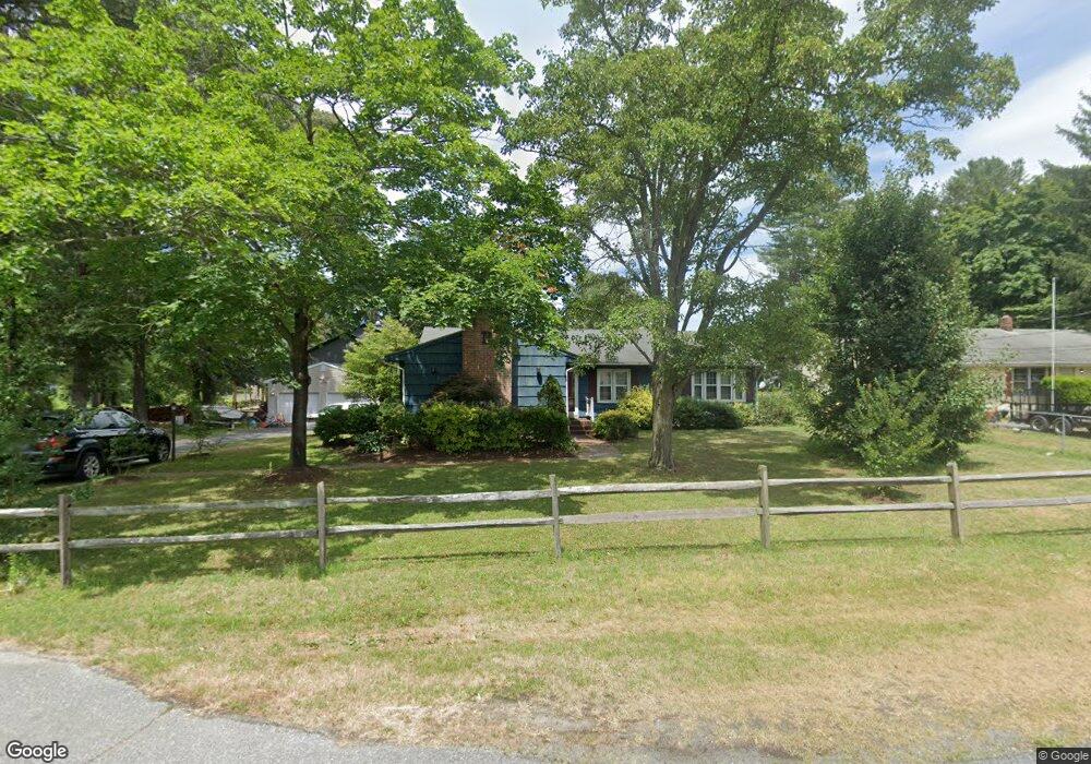
14 Woodside Dr Milford, DE 19963
Estimated Value: $334,316 - $383,000
3
Beds
--
Bath
1,296
Sq Ft
$279/Sq Ft
Est. Value
About This Home
This home is located at 14 Woodside Dr, Milford, DE 19963 and is currently estimated at $361,579, approximately $278 per square foot. 14 Woodside Dr is a home located in Sussex County with nearby schools including Mispillion Elementary School, Milford Central Academy, and Milford Senior High School.
Ownership History
Date
Name
Owned For
Owner Type
Purchase Details
Closed on
Aug 12, 2013
Sold by
Hudson George W and Hudson Sandra Kay
Bought by
Brittingham Samuel J
Current Estimated Value
Home Financials for this Owner
Home Financials are based on the most recent Mortgage that was taken out on this home.
Original Mortgage
$160,047
Outstanding Balance
$119,542
Interest Rate
4.5%
Mortgage Type
FHA
Estimated Equity
$242,037
Purchase Details
Closed on
Aug 9, 2013
Sold by
Hudson George W and Hudson Sandra Kay
Bought by
Brittingham Samuel J
Home Financials for this Owner
Home Financials are based on the most recent Mortgage that was taken out on this home.
Original Mortgage
$160,047
Outstanding Balance
$119,542
Interest Rate
4.5%
Mortgage Type
FHA
Estimated Equity
$242,037
Create a Home Valuation Report for This Property
The Home Valuation Report is an in-depth analysis detailing your home's value as well as a comparison with similar homes in the area
Home Values in the Area
Average Home Value in this Area
Purchase History
| Date | Buyer | Sale Price | Title Company |
|---|---|---|---|
| Brittingham Samuel J | $163,000 | -- | |
| Brittingham Samuel J | $163,000 | -- |
Source: Public Records
Mortgage History
| Date | Status | Borrower | Loan Amount |
|---|---|---|---|
| Open | Brittingham Samuel J | $160,047 | |
| Closed | Brittingham Samuel J | $160,047 |
Source: Public Records
Tax History Compared to Growth
Tax History
| Year | Tax Paid | Tax Assessment Tax Assessment Total Assessment is a certain percentage of the fair market value that is determined by local assessors to be the total taxable value of land and additions on the property. | Land | Improvement |
|---|---|---|---|---|
| 2025 | $1,000 | $14,500 | $2,350 | $12,150 |
| 2024 | $777 | $14,500 | $2,350 | $12,150 |
| 2023 | $806 | $14,500 | $2,350 | $12,150 |
| 2022 | $794 | $14,500 | $2,350 | $12,150 |
| 2021 | $803 | $14,500 | $2,350 | $12,150 |
| 2020 | $454 | $14,500 | $2,350 | $12,150 |
| 2019 | $458 | $14,500 | $2,350 | $12,150 |
| 2018 | $460 | $14,500 | $0 | $0 |
| 2017 | $465 | $14,500 | $0 | $0 |
| 2016 | $504 | $14,500 | $0 | $0 |
| 2015 | $371 | $14,500 | $0 | $0 |
| 2014 | $356 | $14,500 | $0 | $0 |
Source: Public Records
Map
Nearby Homes
- 711 Evergreen Ln
- 455 Kings Hwy
- 6240 Pebblebrook Dr
- 4332 Dot St
- 6370 Pebblebrook Dr
- 102 Currie Ln
- 101 Currie Ln
- 100 Currie Ln
- 459 Kings Hwy
- 506 Meadow Brook Ln
- 412 & 414 Kings Hwy
- 407 Lakeview Ave
- 13 Lakecrest Dr
- Lot 7 Lakecrest Dr
- 6551 Decou Dr
- 17170 Brittany Place
- Lot 22 Oak St
- 11002 Farmerfield St
- 206 S Walnut St
- 708 Meadow Brook Ln
- 14 Woodside Dr
- 12 Woodside Dr
- 39 N Woodside Dr
- 10 Woodside Dr
- 11 Woodside Dr
- 37 N Woodside Dr
- 9 Woodside Dr
- 8 Woodside Dr
- 7 Woodside Dr
- 6 Woodside Dr
- 35 N Woodside Dr
- 32 N Woodside Dr
- 408 Evergreen Ln
- 410 Evergreen Ln
- 5 Woodside Dr
- 4 Woodside Dr
- 406 Evergreen Ln
- 26 W Woodside Dr
- 2 Woodside Dr
- 18 Sunset Ln