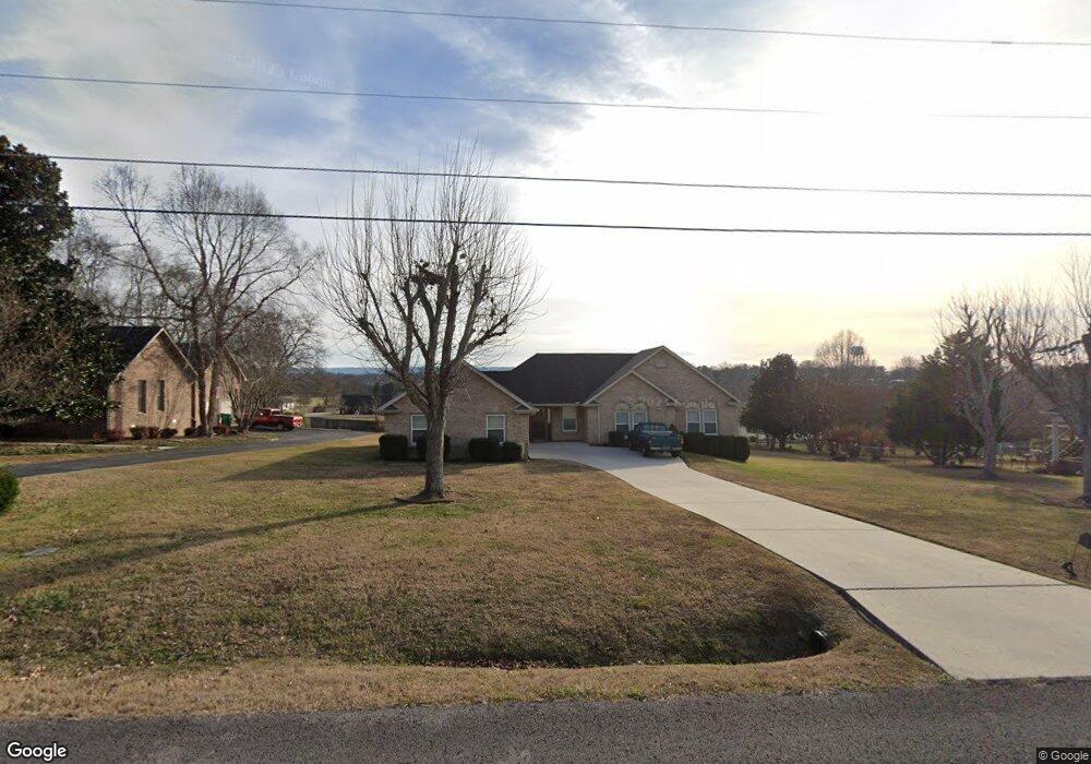
140 Brandi Cir Winchester, TN 37398
Estimated Value: $340,000 - $411,000
--
Bed
2
Baths
1,692
Sq Ft
$218/Sq Ft
Est. Value
About This Home
This home is located at 140 Brandi Cir, Winchester, TN 37398 and is currently estimated at $368,254, approximately $217 per square foot. 140 Brandi Cir is a home located in Franklin County with nearby schools including North Middle School, Franklin County High School, and Winchester Christian Academy.
Ownership History
Date
Name
Owned For
Owner Type
Purchase Details
Closed on
Sep 1, 2000
Sold by
Barclay John R
Bought by
Sanders Randolph and Sanders Joyce A
Current Estimated Value
Purchase Details
Closed on
May 24, 1993
Bought by
Barclay John R and Barclay Elizabeth A
Purchase Details
Closed on
Oct 16, 1992
Bought by
Williams Ryland and Williams Michael R Willi
Purchase Details
Closed on
Oct 12, 1991
Bought by
Yokley Charles T
Create a Home Valuation Report for This Property
The Home Valuation Report is an in-depth analysis detailing your home's value as well as a comparison with similar homes in the area
Home Values in the Area
Average Home Value in this Area
Purchase History
| Date | Buyer | Sale Price | Title Company |
|---|---|---|---|
| Sanders Randolph | $122,500 | -- | |
| Barclay John R | $99,500 | -- | |
| Williams Ryland | $9,400 | -- | |
| Yokley Charles T | $22,000 | -- |
Source: Public Records
Tax History Compared to Growth
Tax History
| Year | Tax Paid | Tax Assessment Tax Assessment Total Assessment is a certain percentage of the fair market value that is determined by local assessors to be the total taxable value of land and additions on the property. | Land | Improvement |
|---|---|---|---|---|
| 2024 | $1,864 | $72,525 | $11,250 | $61,275 |
| 2023 | $1,864 | $72,525 | $11,250 | $61,275 |
| 2022 | $1,828 | $72,525 | $11,250 | $61,275 |
| 2021 | $1,066 | $72,525 | $11,250 | $61,275 |
| 2020 | $1,471 | $41,625 | $5,525 | $36,100 |
| 2019 | $1,471 | $41,625 | $5,525 | $36,100 |
| 2018 | $1,386 | $41,625 | $5,525 | $36,100 |
| 2017 | $1,386 | $41,625 | $5,525 | $36,100 |
| 2016 | $1,265 | $37,975 | $5,025 | $32,950 |
| 2015 | $1,241 | $37,975 | $5,025 | $32,950 |
| 2014 | $1,241 | $37,980 | $0 | $0 |
Source: Public Records
Map
Nearby Homes
- 0 Spring Hill Dr
- 1108 N Jefferson St
- 111 Barefoot Way
- 124 Barefoot Way
- 103 Lisa Cir
- 60 Sharp Cir
- 114 11th Ave NW
- 136 Bel Aire Dr
- 510 N Porter St
- 74 Summerlake Ct
- 0 Summerlake Ct Unit RTC2936678
- 0 Summerlake Ct Unit RTC2936679
- 0 Summerlake Ct Unit RTC2936676
- 0 Summerlake Ct Unit RTC2936675
- 0 Summerlake Ct Unit RTC2936677
- 0 Summerlake Ct Unit RTC2936673
- 0 Summerlake Ct Unit RTC2936674
- 906 N High St
- 120 Dogwood Ln
- 0 N Porter St
- 130 Brandi Cir
- 150 Brandi Cir
- 130 Spring Hill Dr
- 132 Spring Hill Dr
- 141 Brandi Cir
- 171 Brandi Cir
- 120 Brandi Cir
- 131 Brandi Cir
- 126 Spring Hill Dr
- 134 Spring Hill Dr
- 170 Brandi Cir
- 121 Brandi Cir
- 124 Spring Hill Dr
- 136 Spring Hill Dr
- 221 Brandi Cir
- 181 Brandi Cir
- 131 Spring Hill Dr
- 231 Brandi Cir
- 133 Spring Hill Dr
- 129 Spring Hill Dr