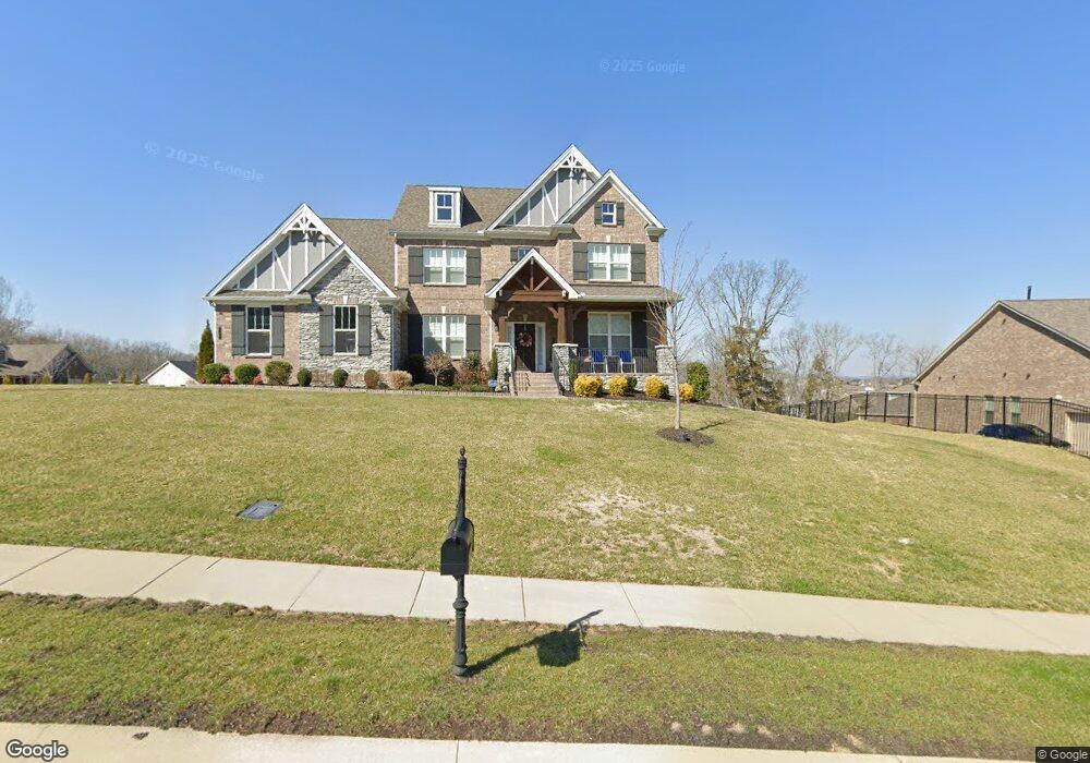
140 Brooksbank Dr Unit 17 Nolensville, TN 37135
Estimated Value: $1,191,474 - $1,325,000
--
Bed
4
Baths
3,820
Sq Ft
$329/Sq Ft
Est. Value
About This Home
This home is located at 140 Brooksbank Dr Unit 17, Nolensville, TN 37135 and is currently estimated at $1,258,237, approximately $329 per square foot. 140 Brooksbank Dr Unit 17 is a home located in Williamson County with nearby schools including Jordan Elementary School, Sunset Middle School, and Nolensville High School.
Ownership History
Date
Name
Owned For
Owner Type
Purchase Details
Closed on
Nov 25, 2021
Sold by
Onyang Ridong and Chen Mengshan
Bought by
Onyang Ridong and Chen Mengshan
Current Estimated Value
Home Financials for this Owner
Home Financials are based on the most recent Mortgage that was taken out on this home.
Original Mortgage
$578,000
Outstanding Balance
$530,369
Interest Rate
3.09%
Mortgage Type
VA
Estimated Equity
$727,868
Purchase Details
Closed on
Jun 28, 2019
Sold by
Ouyang Ridong
Bought by
Ouyang Ridong and Chen Mengshan
Purchase Details
Closed on
Jan 14, 2019
Sold by
The Jones Company Of Tennessee Llc
Bought by
Ouyang Ridong
Home Financials for this Owner
Home Financials are based on the most recent Mortgage that was taken out on this home.
Original Mortgage
$296,745
Interest Rate
4.8%
Mortgage Type
VA
Create a Home Valuation Report for This Property
The Home Valuation Report is an in-depth analysis detailing your home's value as well as a comparison with similar homes in the area
Home Values in the Area
Average Home Value in this Area
Purchase History
| Date | Buyer | Sale Price | Title Company |
|---|---|---|---|
| Onyang Ridong | -- | Tennessee Nations Ttl Agcy I | |
| Ouyang Ridong | -- | Homeland Title Llc | |
| Ouyang Ridong | $635,400 | None Available |
Source: Public Records
Mortgage History
| Date | Status | Borrower | Loan Amount |
|---|---|---|---|
| Open | Onyang Ridong | $578,000 | |
| Closed | Ouyang Ridong | $296,745 |
Source: Public Records
Tax History Compared to Growth
Tax History
| Year | Tax Paid | Tax Assessment Tax Assessment Total Assessment is a certain percentage of the fair market value that is determined by local assessors to be the total taxable value of land and additions on the property. | Land | Improvement |
|---|---|---|---|---|
| 2025 | -- | $310,850 | $81,250 | $229,600 |
| 2024 | -- | $175,700 | $45,000 | $130,700 |
| 2023 | $3,813 | $175,700 | $45,000 | $130,700 |
| 2022 | $3,813 | $175,700 | $45,000 | $130,700 |
| 2021 | $3,813 | $175,700 | $45,000 | $130,700 |
| 2020 | $3,875 | $154,350 | $30,000 | $124,350 |
| 2019 | $3,659 | $154,350 | $30,000 | $124,350 |
| 2018 | $2,160 | $93,900 | $30,000 | $63,900 |
| 2017 | $684 | $30,000 | $30,000 | $0 |
Source: Public Records
Map
Nearby Homes
- 130 Brooksbank Dr
- 9820 Sam Donald Rd
- 1818 Eaves Ct
- 1963 Napa Dr
- 1973 Napa Dr
- 1950 Napa Dr
- 7024 Fishing Creek Rd
- 1969 Napa Dr
- 1958 Napa Dr
- 9902 Amarosa Ct
- 9906 Amarosa Ct
- 9909 Amarosa Ct
- 1953 Napa Dr
- 1974 Napa Dr
- 1971 Napa Dr
- 2004 Vail Trace
- 9905 Elland Rd
- Devonshire II Plan at Telluride - Manor
- Westchester II Plan at Telluride - Manor
- Southhampton Plan at Telluride - Manor
- 140 Brooksbank Dr
- 140 Brooksbank Dr
- 140 Brooksbank Dr
- 144 Brooksbank Dr
- 134 Brooksbank Dr Unit 9
- 134 Brooksbank Dr
- 134 Brooksbank Dr Unit 9
- 305 Redding Ct
- 305 Redding Ct Unit 16
- 143 Brooksbank Dr Unit 53
- 143 Brooksbank Dr
- 304 Redding Ct Unit 10
- 139 Brooksbank Dr
- 139 Brooksbank Dr Unit 54
- 304 Redding Ct
- 404 Barony Ct
- 135 Brooksbank Dr
- 308 Redding Ct
- 308 Redding Ct Unit 11
- 308 Redding Ct