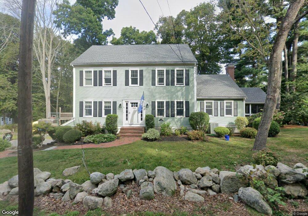
140 Captain Pierce Rd Scituate, MA 02066
Estimated Value: $1,235,388 - $1,337,000
4
Beds
3
Baths
2,906
Sq Ft
$440/Sq Ft
Est. Value
About This Home
This home is located at 140 Captain Pierce Rd, Scituate, MA 02066 and is currently estimated at $1,278,347, approximately $439 per square foot. 140 Captain Pierce Rd is a home located in Plymouth County with nearby schools including Cushing Elementary School, Lester J. Gates Middle School, and Scituate High School.
Ownership History
Date
Name
Owned For
Owner Type
Purchase Details
Closed on
Nov 8, 2019
Sold by
Burns David F and Burns Christa L
Bought by
Denis Nicolas C and Denis Alison
Current Estimated Value
Home Financials for this Owner
Home Financials are based on the most recent Mortgage that was taken out on this home.
Original Mortgage
$604,000
Outstanding Balance
$531,893
Interest Rate
3.65%
Mortgage Type
New Conventional
Estimated Equity
$746,454
Purchase Details
Closed on
Aug 14, 2003
Sold by
Benintende J William and Benintende Martha M
Bought by
Burns David F and Burns Christa L
Purchase Details
Closed on
Jun 22, 1994
Sold by
Wood Arthur O and Wood Dorothy M
Bought by
Benintende J William and Benintende Martha M
Create a Home Valuation Report for This Property
The Home Valuation Report is an in-depth analysis detailing your home's value as well as a comparison with similar homes in the area
Home Values in the Area
Average Home Value in this Area
Purchase History
| Date | Buyer | Sale Price | Title Company |
|---|---|---|---|
| Denis Nicolas C | $755,000 | -- | |
| Burns David F | $621,000 | -- | |
| Benintende J William | $95,000 | -- |
Source: Public Records
Mortgage History
| Date | Status | Borrower | Loan Amount |
|---|---|---|---|
| Open | Denis Nicolas C | $604,000 | |
| Previous Owner | Benintende J William | $329,000 | |
| Previous Owner | Benintende J William | $350,000 | |
| Previous Owner | Benintende J William | $359,000 |
Source: Public Records
Tax History
| Year | Tax Paid | Tax Assessment Tax Assessment Total Assessment is a certain percentage of the fair market value that is determined by local assessors to be the total taxable value of land and additions on the property. | Land | Improvement |
|---|---|---|---|---|
| 2025 | $9,393 | $940,200 | $377,500 | $562,700 |
| 2024 | $9,342 | $901,700 | $343,200 | $558,500 |
| 2023 | $9,237 | $845,600 | $329,300 | $516,300 |
| 2022 | $9,237 | $731,900 | $298,800 | $433,100 |
| 2021 | $8,938 | $670,500 | $284,600 | $385,900 |
| 2020 | $8,601 | $637,100 | $273,600 | $363,500 |
| 2019 | $8,456 | $615,400 | $268,200 | $347,200 |
| 2018 | $8,311 | $595,800 | $279,100 | $316,700 |
| 2017 | $8,059 | $572,000 | $267,900 | $304,100 |
| 2016 | $7,773 | $549,700 | $245,600 | $304,100 |
| 2015 | $7,054 | $538,500 | $234,400 | $304,100 |
Source: Public Records
Map
Nearby Homes
- 629 Country Way
- 54 Woodland Rd
- 33 Rosas Ln
- 7 3 Ring Rd
- 11 Forest Ln
- 9 Forest Ln Unit 9
- 74 Branch St Unit 15
- 26 Mordecai Lincoln Rd
- 327 Country Way
- 537 First Parish Rd
- 20 Lee Ave
- 817 Country Way
- 20 Grace Way Unit 20
- 6 Grace Way Unit 6
- 27 Grace Way
- 627 First Parish Rd
- 115 Elm St
- 111 Elm St
- 17 Bradford Ave
- 38 Lauren Ln
- 140 Captain Peirce Rd
- 142 Captain Pierce Rd
- 145 Captain Pierce Rd
- 126 Captain Peirce Rd
- 126 Captain Pierce Rd
- 124 Captain Peirce Rd
- 148 Captain Peirce Rd
- 125 Captain Pierce Rd
- 560 Country Way
- 147 Captain Pierce Rd
- 566 Country Way
- 60 Captain Pierce Rd
- 127 Captain Peirce Rd
- 574 Country Way
- 157 Captain Pierce Rd
- 118 Captain Peirce Rd
- 158 Captain Pierce Rd
- 546 Country Way
- 117 Captain Peirce Rd
- 563 Country Way
Your Personal Tour Guide
Ask me questions while you tour the home.