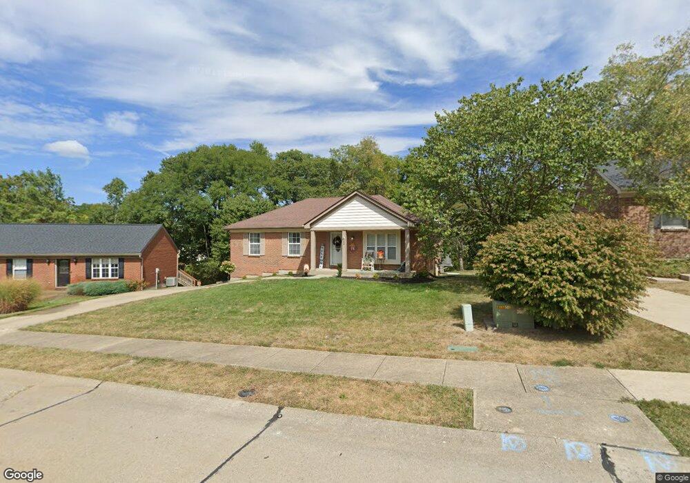
140 Carrie Way Dr Independence, KY 41051
Estimated Value: $261,000 - $304,000
3
Beds
2
Baths
1,176
Sq Ft
$243/Sq Ft
Est. Value
About This Home
This home is located at 140 Carrie Way Dr, Independence, KY 41051 and is currently estimated at $285,905, approximately $243 per square foot. 140 Carrie Way Dr is a home located in Kenton County with nearby schools including Kenton Elementary School, Simon Kenton High School, and St. Cecilia Catholic School.
Ownership History
Date
Name
Owned For
Owner Type
Purchase Details
Closed on
Aug 24, 2022
Sold by
Davenport Thomas S and Davenport Letitia J
Bought by
Plumley David S and Plumley Cynthia M
Current Estimated Value
Home Financials for this Owner
Home Financials are based on the most recent Mortgage that was taken out on this home.
Original Mortgage
$258,896
Outstanding Balance
$247,577
Interest Rate
5.54%
Mortgage Type
VA
Estimated Equity
$38,328
Purchase Details
Closed on
Dec 22, 2006
Sold by
Chapman William N and Chapman Ladonna K
Bought by
Davenport Letitia J
Home Financials for this Owner
Home Financials are based on the most recent Mortgage that was taken out on this home.
Original Mortgage
$133,000
Interest Rate
7.5%
Mortgage Type
Purchase Money Mortgage
Purchase Details
Closed on
Nov 21, 2003
Sold by
Smith Steven C and Smith Jayne W
Bought by
Chapman William Noel and Chapman Ladonna Kay
Create a Home Valuation Report for This Property
The Home Valuation Report is an in-depth analysis detailing your home's value as well as a comparison with similar homes in the area
Home Values in the Area
Average Home Value in this Area
Purchase History
| Date | Buyer | Sale Price | Title Company |
|---|---|---|---|
| Plumley David S | $249,900 | -- | |
| Plumley David S | $249,900 | None Listed On Document | |
| Davenport Letitia J | $133,000 | Homestead Title Agency Ltd | |
| Chapman William Noel | $130,000 | Northern Kentucky Title |
Source: Public Records
Mortgage History
| Date | Status | Borrower | Loan Amount |
|---|---|---|---|
| Open | Plumley David S | $258,896 | |
| Closed | Plumley David S | $258,896 | |
| Previous Owner | Davenport Letitia J | $133,000 |
Source: Public Records
Tax History Compared to Growth
Tax History
| Year | Tax Paid | Tax Assessment Tax Assessment Total Assessment is a certain percentage of the fair market value that is determined by local assessors to be the total taxable value of land and additions on the property. | Land | Improvement |
|---|---|---|---|---|
| 2024 | $3,061 | $249,900 | $30,000 | $219,900 |
| 2023 | $3,154 | $249,900 | $30,000 | $219,900 |
| 2022 | $2,108 | $162,100 | $30,000 | $132,100 |
| 2021 | $2,139 | $162,100 | $30,000 | $132,100 |
| 2020 | $1,805 | $133,000 | $25,000 | $108,000 |
| 2019 | $1,810 | $133,000 | $25,000 | $108,000 |
| 2018 | $1,820 | $133,000 | $25,000 | $108,000 |
| 2017 | $1,771 | $133,000 | $25,000 | $108,000 |
| 2015 | $1,716 | $133,000 | $25,000 | $108,000 |
| 2014 | $1,692 | $133,000 | $25,000 | $108,000 |
Source: Public Records
Map
Nearby Homes
- 84 Sherwood Dr
- 5234 Madison Pike
- 5151 Noble Ct
- 64 Sylvan Dr
- 1897 Independence Rd
- 1365 Cairns Ct
- 5118 Dana Harvey Ln
- 9947 Meadow Glen Dr
- 10347 Petersburg Ct
- 10363 Canberra Dr
- 5238 Belle Dr
- 9972 Meadow Glen Dr
- 1199 Hatcher Ct
- 1228 Bull Run
- 10448 Canberra Dr
- 10323 Manassas Ct
- 1253 Shiloh Ct
- 10447 Canberra Dr
- 1355 Meadowcrest Cir
- 1375 Meadowcrest Cir
- 140 Carrie Way
- 136 Carrie Way Dr
- 144 Carrie Way Dr
- 144 Carrie Way
- 132 Carrie Way
- 132 Carrie Way
- 148 Carrie Way
- 5195 Christopher Dr
- 5195 Christopher Dr Unit L1
- 88 Independence Station Rd
- 128 Carrie Way
- 137 Carrie Way
- 133 Carrie Way
- 141 Carrie Way
- 141 Carrie Way
- 133 Carrie Way Dr
- 5191 Christopher Dr
- 129 Carrie Way
- 124 Carrie Way
- 124 Carrie Way