Estimated Value: $326,819 - $381,000
4
Beds
3
Baths
2,092
Sq Ft
$172/Sq Ft
Est. Value
About This Home
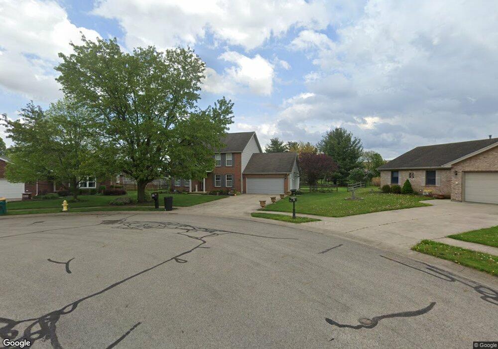
This home is located at 140 Locust View Way, Troy, OH 45373 and is currently estimated at $359,455, approximately $171 per square foot. 140 Locust View Way is a home located in Miami County with nearby schools including Concord Elementary School, Van Cleve Elementary School, and Troy Junior High School.
Ownership History
Date
Name
Owned For
Owner Type
Purchase Details
Closed on
Nov 6, 2020
Sold by
Paul Ann S
Bought by
Paul Babu P and Paul Jessy B
Current Estimated Value
Home Financials for this Owner
Home Financials are based on the most recent Mortgage that was taken out on this home.
Original Mortgage
$172,758
Interest Rate
2.8%
Mortgage Type
New Conventional
Purchase Details
Closed on
Jul 21, 2016
Sold by
Antil Andrew J and Antil Sandra K
Bought by
Paul Baby and Paul Jessy B
Home Financials for this Owner
Home Financials are based on the most recent Mortgage that was taken out on this home.
Original Mortgage
$166,250
Interest Rate
3.6%
Mortgage Type
New Conventional
Purchase Details
Closed on
Dec 28, 2005
Sold by
Horn Jeffrey and Horn Shelly
Bought by
Antil Andrew J and Antil Sandra K
Home Financials for this Owner
Home Financials are based on the most recent Mortgage that was taken out on this home.
Original Mortgage
$147,600
Interest Rate
6.48%
Mortgage Type
New Conventional
Purchase Details
Closed on
Jun 4, 2001
Sold by
Owen Charles W
Bought by
Horn Jeffrey L and Horn Shelly
Home Financials for this Owner
Home Financials are based on the most recent Mortgage that was taken out on this home.
Original Mortgage
$132,000
Interest Rate
7.23%
Mortgage Type
New Conventional
Create a Home Valuation Report for This Property
The Home Valuation Report is an in-depth analysis detailing your home's value as well as a comparison with similar homes in the area
Home Values in the Area
Average Home Value in this Area
Purchase History
| Date | Buyer | Sale Price | Title Company |
|---|---|---|---|
| Paul Babu P | -- | None Available | |
| Paul Baby | $175,000 | First Title | |
| Antil Andrew J | $184,500 | -- | |
| Horn Jeffrey L | $165,000 | -- |
Source: Public Records
Mortgage History
| Date | Status | Borrower | Loan Amount |
|---|---|---|---|
| Previous Owner | Paul Babu P | $172,758 | |
| Previous Owner | Paul Baby | $166,250 | |
| Previous Owner | Horn Jeffrey L | $147,600 | |
| Previous Owner | Horn Jeffrey L | $132,000 |
Source: Public Records
Tax History
| Year | Tax Paid | Tax Assessment Tax Assessment Total Assessment is a certain percentage of the fair market value that is determined by local assessors to be the total taxable value of land and additions on the property. | Land | Improvement |
|---|---|---|---|---|
| 2025 | $3,899 | $109,410 | $13,440 | $95,970 |
| 2024 | $3,899 | $81,450 | $13,440 | $68,010 |
| 2023 | $3,165 | $81,450 | $13,440 | $68,010 |
| 2022 | $2,650 | $81,450 | $13,440 | $68,010 |
| 2021 | $2,353 | $67,870 | $11,200 | $56,670 |
| 2020 | $2,355 | $67,870 | $11,200 | $56,670 |
| 2019 | $2,377 | $67,870 | $11,200 | $56,670 |
| 2018 | $2,154 | $58,600 | $13,620 | $44,980 |
| 2017 | $2,175 | $58,600 | $13,620 | $44,980 |
| 2016 | $2,144 | $58,600 | $13,620 | $44,980 |
| 2015 | $2,064 | $54,250 | $12,600 | $41,650 |
| 2014 | $2,064 | $54,250 | $12,600 | $41,650 |
| 2013 | $2,078 | $54,250 | $12,600 | $41,650 |
Source: Public Records
Map
Nearby Homes
- 2882 Red Oak Cir
- 591 Countryside Dr S
- 173 Countryside Dr N
- 3135 Honeysuckle Dr
- 120 Windmere Dr
- 2550 Broken Woods Dr
- 974 Stony Brook Ln
- 2685 Merrimont Dr
- 0 Lincolnshire Unit 939331
- 1704 Chevington Chase
- 1704 Chevington Chase
- 1245 Wind Rock Dr
- 2672 Pleasant View Dr
- 2650 Pleasant View Dr
- 1234 Wind Rock Dr
- 2215 Merrimont Dr
- 807 Claymore Ct
- 2065 S Co Road 25a
- 1117 Honeydew Dr
- 735 Chaucer Ln
- 2626 Walnut Ridge Dr
- 150 Locust View Way
- 143 Trader Ct
- 2636 Walnut Ridge Dr
- 162 Locust View Way
- 133 Trader Ct
- 2900 Stone Circle Dr
- 148 Trader Ct
- 2633 Walnut Ridge Dr
- 2650 Walnut Ridge Dr
- 175 Green Oak Dr
- 176 Locust View Way
- 181 Green Oak Dr
- 2643 Walnut Ridge Dr
- 125 Trader Ct
- 2664 Walnut Ridge Dr
- 190 Locust View Way
- 185 Locust View Way
- 170 Green Oak Dr
- 2659 Walnut Ridge Dr
Your Personal Tour Guide
Ask me questions while you tour the home.