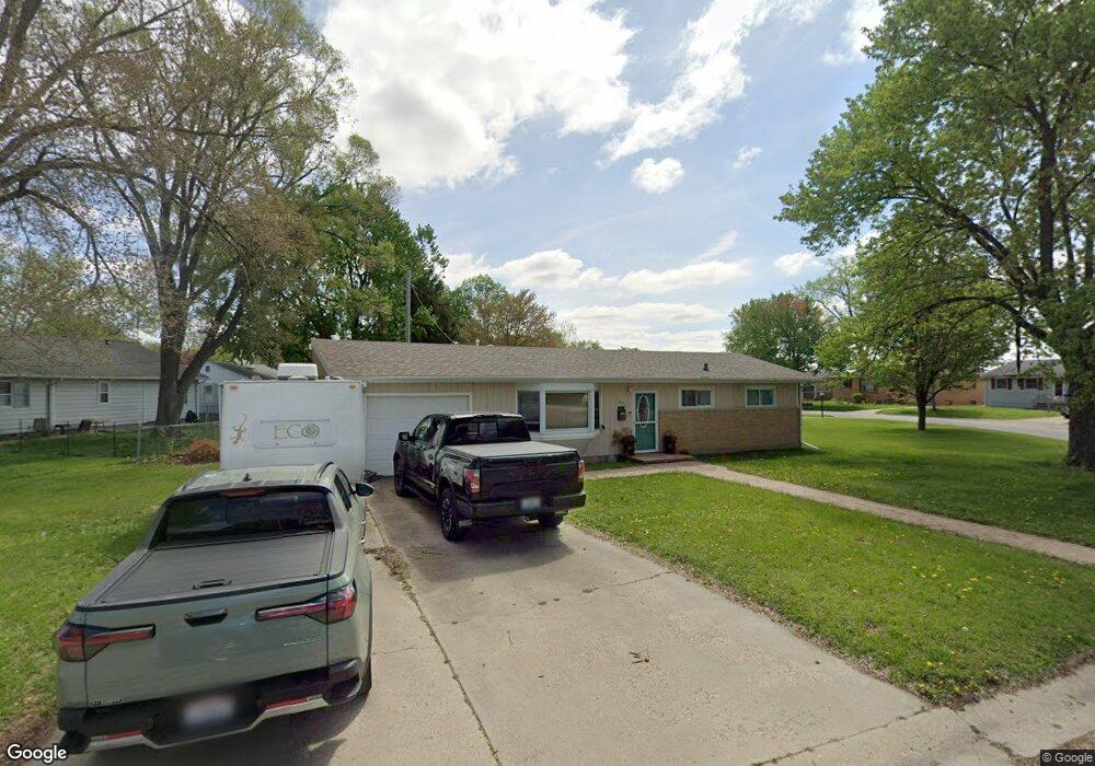
140 Mayfair Dr Lincoln, IL 62656
Estimated Value: $137,659 - $173,000
3
Beds
--
Bath
1,008
Sq Ft
$149/Sq Ft
Est. Value
About This Home
This home is located at 140 Mayfair Dr, Lincoln, IL 62656 and is currently estimated at $150,415, approximately $149 per square foot. 140 Mayfair Dr is a home located in Logan County with nearby schools including Washington-Monroe Elementary School, Adams Elementary School, and Lincoln Junior High School.
Ownership History
Date
Name
Owned For
Owner Type
Purchase Details
Closed on
Jan 24, 2022
Sold by
Pettit Shawn R and Pettit Kacey
Bought by
Pettit Shawn R and Pettit Kacey
Current Estimated Value
Purchase Details
Closed on
May 7, 2020
Sold by
Pettit Shawn R and Pettit Kacey
Bought by
Pettit Shawn R and Pettit Kacey
Purchase Details
Closed on
Sep 17, 2011
Sold by
Jackson Robert E and Jackson Emily A
Bought by
Pettit Shawn R
Home Financials for this Owner
Home Financials are based on the most recent Mortgage that was taken out on this home.
Original Mortgage
$82,849
Interest Rate
4.14%
Mortgage Type
Stand Alone First
Create a Home Valuation Report for This Property
The Home Valuation Report is an in-depth analysis detailing your home's value as well as a comparison with similar homes in the area
Home Values in the Area
Average Home Value in this Area
Purchase History
| Date | Buyer | Sale Price | Title Company |
|---|---|---|---|
| Pettit Shawn R | -- | None Available | |
| Pettit Shawn R | -- | None Available | |
| Pettit Shawn R | $79,900 | -- |
Source: Public Records
Mortgage History
| Date | Status | Borrower | Loan Amount |
|---|---|---|---|
| Previous Owner | Pettit Shawn R | $82,849 |
Source: Public Records
Tax History Compared to Growth
Tax History
| Year | Tax Paid | Tax Assessment Tax Assessment Total Assessment is a certain percentage of the fair market value that is determined by local assessors to be the total taxable value of land and additions on the property. | Land | Improvement |
|---|---|---|---|---|
| 2024 | $2,560 | $33,920 | $15,740 | $18,180 |
| 2023 | $2,402 | $31,400 | $14,570 | $16,830 |
| 2022 | $2,304 | $29,350 | $13,620 | $15,730 |
| 2021 | $2,196 | $28,180 | $13,080 | $15,100 |
| 2020 | $2,160 | $27,770 | $12,890 | $14,880 |
| 2019 | $2,103 | $27,230 | $12,640 | $14,590 |
| 2018 | $2,074 | $26,690 | $12,390 | $14,300 |
| 2017 | $2,062 | $26,690 | $12,390 | $14,300 |
| 2016 | $2,237 | $29,020 | $12,380 | $16,640 |
| 2015 | $1,801 | $24,620 | $7,940 | $16,680 |
| 2014 | $1,801 | $24,620 | $7,940 | $16,680 |
| 2013 | $1,801 | $23,370 | $7,540 | $15,830 |
| 2012 | $1,801 | $23,800 | $7,680 | $16,120 |
Source: Public Records
Map
Nearby Homes
- 180 Regent St
- 145 Half Moon St
- 1503 N Kankakee St
- 102 Crestwood Dr
- 1019 N Mclean St
- 1208 N Kankakee St
- 103 Crestwood Dr
- 1431 N Ottawa St
- 1204 N Ottawa St
- 1107 N Kankakee St
- 311 Davenport St
- 1354 Airport Rd
- 2294 Railsplitter Ave
- 915 Peoria St
- 6 Meadow Ln
- 2354 Railsplitter Ave
- 620 Tremont St
- 330 Water St
- 1624 Delavan St
- 1225 Delavan St
- 180 Mayfair Dr
- 125 Mayfair Dr
- 200 Mayfair Dr
- 115 Mayfair Dr
- 125 Southgate St
- 135 Southgate St
- 175 Mayfair Dr
- 115 Southgate St
- 210 Mayfair Dr
- 185 Mayfair Dr
- 195 Mayfair Dr
- 205 Mayfair Dr
- 105 Southgate St
- 135 Mayfair Dr
- 220 Mayfair Dr
- 120 Southgate St
- 215 Mayfair Dr
- 145 Mayfair Dr
- 155 Mayfair Dr
- 225 Mayfair Dr