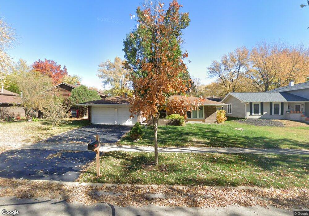
140 Mayfield Dr Unit 2 Bolingbrook, IL 60440
East Bolingbrook NeighborhoodEstimated Value: $299,000 - $338,000
3
Beds
2
Baths
1,700
Sq Ft
$190/Sq Ft
Est. Value
About This Home
This home is located at 140 Mayfield Dr Unit 2, Bolingbrook, IL 60440 and is currently estimated at $322,421, approximately $189 per square foot. 140 Mayfield Dr Unit 2 is a home located in Will County with nearby schools including Oak View Elementary School, Bolingbrook High School, and Midwest Christian Montessori Academy.
Ownership History
Date
Name
Owned For
Owner Type
Purchase Details
Closed on
May 1, 2017
Sold by
Loewe William R and Loewe Lynne K
Bought by
Hughes David and Clayton Aimee
Current Estimated Value
Home Financials for this Owner
Home Financials are based on the most recent Mortgage that was taken out on this home.
Original Mortgage
$168,884
Outstanding Balance
$141,475
Interest Rate
4.37%
Mortgage Type
FHA
Estimated Equity
$180,946
Purchase Details
Closed on
Jun 30, 2011
Sold by
Barry John and Estate Of Melvin E Foss
Bought by
Lowe William R and Loewe Lynne K
Create a Home Valuation Report for This Property
The Home Valuation Report is an in-depth analysis detailing your home's value as well as a comparison with similar homes in the area
Home Values in the Area
Average Home Value in this Area
Purchase History
| Date | Buyer | Sale Price | Title Company |
|---|---|---|---|
| Hughes David | $172,000 | First American Title | |
| Lowe William R | $101,000 | None Available |
Source: Public Records
Mortgage History
| Date | Status | Borrower | Loan Amount |
|---|---|---|---|
| Open | Hughes David | $168,884 |
Source: Public Records
Tax History Compared to Growth
Tax History
| Year | Tax Paid | Tax Assessment Tax Assessment Total Assessment is a certain percentage of the fair market value that is determined by local assessors to be the total taxable value of land and additions on the property. | Land | Improvement |
|---|---|---|---|---|
| 2024 | $7,931 | $93,880 | $19,334 | $74,546 |
| 2023 | $7,931 | $84,470 | $17,396 | $67,074 |
| 2022 | $6,787 | $74,660 | $15,375 | $59,285 |
| 2021 | $6,424 | $69,808 | $14,376 | $55,432 |
| 2020 | $6,222 | $67,512 | $13,903 | $53,609 |
| 2019 | $6,015 | $64,297 | $13,241 | $51,056 |
| 2018 | $5,581 | $59,736 | $12,302 | $47,434 |
| 2017 | $5,306 | $56,622 | $11,661 | $44,961 |
| 2016 | $5,144 | $53,900 | $11,100 | $42,800 |
| 2015 | $5,072 | $51,700 | $10,600 | $41,100 |
| 2014 | $5,072 | $51,700 | $10,600 | $41,100 |
| 2013 | $5,072 | $48,300 | $9,900 | $38,400 |
Source: Public Records
Map
Nearby Homes
- 141 N Lancaster Dr
- 208 Flagstaff Dr
- 534 Cottonwood Cir
- 565 Cottonwood Cir
- 228 Elkhorn Ct Unit B
- 352 Gehrig Cir
- 372 Windsong Ct Unit 4110
- 623 Cochise Cir
- 184 Fairwood Dr
- 23 Wildwood Ln Unit G
- 316 Pueblo Dr
- 210 Mill Stream Dr
- 8 Wildwood Ln Unit G
- 117 Galewood Dr
- 321 Whispering Ct Unit 331
- 227 Lexington Dr
- 321 Candlelight Ct Unit 111
- 621 Sundance Dr
- 129 Galewood Dr
- 118 Springleaf Dr Unit 5
- 144 Mayfield Dr
- 136 Mayfield Dr
- 132 Mayfield Dr
- 148 Mayfield Dr Unit 2
- 145 N Lancaster Dr
- 137 N Lancaster Dr
- 133 N Lancaster Dr
- 149 N Lancaster Dr
- 141 Mayfield Dr
- 137 Mayfield Dr
- 145 Mayfield Dr
- 128 Mayfield Dr
- 152 Mayfield Dr
- 133 Mayfield Dr
- 149 Mayfield Dr
- 129 N Lancaster Dr
- 153 N Lancaster Dr
- 124 Mayfield Dr
- 156 Mayfield Dr
- 153 Mayfield Dr