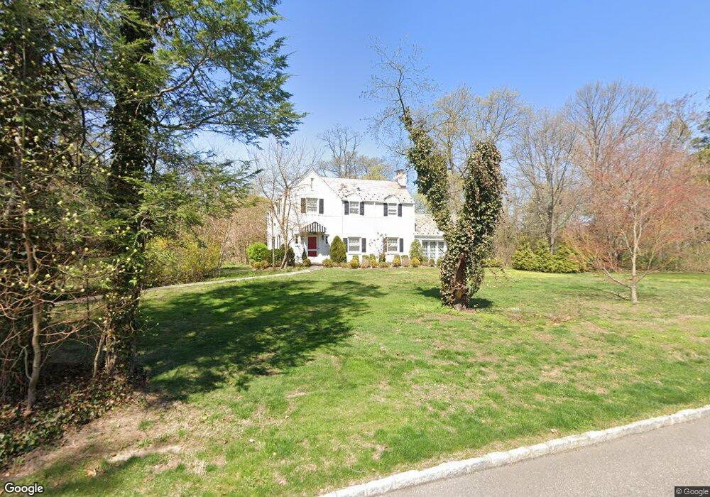
140 Sands Point Rd Port Washington, NY 11050
Estimated Value: $1,708,672 - $2,176,000
--
Bed
4
Baths
2,432
Sq Ft
$799/Sq Ft
Est. Value
About This Home
This home is located at 140 Sands Point Rd, Port Washington, NY 11050 and is currently estimated at $1,942,336, approximately $798 per square foot. 140 Sands Point Rd is a home located in Nassau County with nearby schools including Manorhaven Elementary School, Carrie Palmer Weber Middle School, and Paul D. Schreiber Senior High School.
Ownership History
Date
Name
Owned For
Owner Type
Purchase Details
Closed on
May 31, 2011
Sold by
Buerger Theodore V and Of Anne Luise Buerger
Bought by
Hare Kimberly Moglia and Hare Robert
Current Estimated Value
Purchase Details
Closed on
Apr 23, 2011
Sold by
Buerger-Peck Helene E
Bought by
Buerger Theodore V and Of Anne Luise Buerger
Purchase Details
Closed on
Feb 1, 2003
Sold by
Buerger Anne
Purchase Details
Closed on
Jan 31, 2003
Sold by
Buerger Anne Luise
Create a Home Valuation Report for This Property
The Home Valuation Report is an in-depth analysis detailing your home's value as well as a comparison with similar homes in the area
Home Values in the Area
Average Home Value in this Area
Purchase History
| Date | Buyer | Sale Price | Title Company |
|---|---|---|---|
| Hare Kimberly Moglia | $999,000 | -- | |
| Hare Kimberly Moglia | $999,000 | -- | |
| Hare Kimberly Moglia | $999,000 | -- | |
| Buerger Theodore V | -- | -- | |
| Buerger Theodore V | -- | -- | |
| Buerger Theodore V | -- | -- | |
| -- | -- | -- | |
| -- | -- | -- | |
| -- | -- | -- | |
| -- | -- | -- |
Source: Public Records
Tax History Compared to Growth
Tax History
| Year | Tax Paid | Tax Assessment Tax Assessment Total Assessment is a certain percentage of the fair market value that is determined by local assessors to be the total taxable value of land and additions on the property. | Land | Improvement |
|---|---|---|---|---|
| 2025 | $21,617 | $1,204 | $853 | $351 |
| 2024 | $2,428 | $1,204 | $853 | $351 |
| 2023 | $23,658 | $1,204 | $853 | $351 |
| 2022 | $23,658 | $1,204 | $853 | $351 |
| 2021 | $25,577 | $1,176 | $833 | $343 |
| 2020 | $28,197 | $2,862 | $2,655 | $207 |
| 2019 | $30,231 | $2,862 | $2,655 | $207 |
| 2018 | $28,262 | $2,862 | $0 | $0 |
| 2017 | $21,915 | $2,862 | $2,655 | $207 |
| 2016 | $25,606 | $2,862 | $2,655 | $207 |
| 2015 | $3,560 | $2,776 | $2,655 | $121 |
| 2014 | $3,560 | $2,776 | $2,655 | $121 |
| 2013 | $3,389 | $2,776 | $2,655 | $121 |
Source: Public Records
Map
Nearby Homes
- 130 Sands Point Rd
- 25 Soundview Ln
- 36 Cow Neck Rd
- 78 Edgewood Rd
- 68 Graywood Rd
- 169 Middle Neck Rd
- 59 Edgewood Rd
- 22 Messenger Ln
- 47 Marwood Rd N
- 44 Firwood Rd
- 46 Linwood Rd N Unit A and B
- 46 Linwood Rd N
- 42 Firwood Rd Unit A
- 120 W Creek Farms Rd
- 5 Longwood Rd
- 24 Hickory Rd
- 27 Juniper Rd
- 9 Hilldale Ln
- 55 Driftwood Dr
- 1 Harriman Dr
- 140 Sands Point Rd
- 151 Sands Point Rd
- 30 Tibbits Ln
- 6 Round Hill Ln
- 5 Round Hill Ln
- 137 Sands Point Rd
- 28 Tibbits Ln
- 137 Sands Point Rd
- 155 Sands Point Rd
- 7 Round Hill Ln
- 8 Round Hill Ln
- 157 Sands Point Rd
- 135 Sands Point Rd
- 3 Bridle Ln
- 9 Round Hill Ln
- 1 Oak Tree Ln
- 1 Bridle Ln
- 164 Sands Point Rd
- 161 Sands Point Rd
- 164 Tibbits Ln