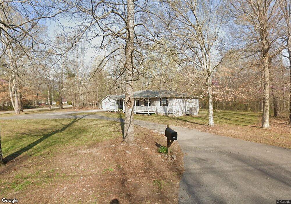
140 Stone Cir S Dunlap, TN 37327
Estimated Value: $223,401 - $329,000
Studio
2
Baths
1,440
Sq Ft
$192/Sq Ft
Est. Value
About This Home
This home is located at 140 Stone Cir S, Dunlap, TN 37327 and is currently estimated at $276,850, approximately $192 per square foot. 140 Stone Cir S is a home located in Sequatchie County with nearby schools including Griffith Elementary School, Sequatchie County Middle School, and Sequatchie County High School.
Ownership History
Date
Name
Owned For
Owner Type
Purchase Details
Closed on
Dec 11, 2020
Sold by
Carbaugh Sarai E and Pierce Sarai E
Bought by
Bussman Judith E and Bussman Judith E
Current Estimated Value
Purchase Details
Closed on
Nov 10, 2011
Sold by
Carbaugh Dennis E
Bought by
Carbaugh Sarai E
Purchase Details
Closed on
Apr 27, 2004
Sold by
Fka Carbaugh Sarai E
Bought by
Carbaugh Dennis E
Home Financials for this Owner
Home Financials are based on the most recent Mortgage that was taken out on this home.
Original Mortgage
$88,000
Interest Rate
5.35%
Purchase Details
Closed on
Oct 17, 1996
Bought by
Hudson Billie Marie
Create a Home Valuation Report for This Property
The Home Valuation Report is an in-depth analysis detailing your home's value as well as a comparison with similar homes in the area
Home Values in the Area
Average Home Value in this Area
Purchase History
| Date | Buyer | Sale Price | Title Company |
|---|---|---|---|
| Bussman Judith E | $210,000 | None Available | |
| Carbaugh Sarai E | -- | -- | |
| Carbaugh Dennis E | -- | -- | |
| Hudson Billie Marie | $198,000 | -- |
Source: Public Records
Mortgage History
| Date | Status | Borrower | Loan Amount |
|---|---|---|---|
| Previous Owner | Hudson Billie Marie | $88,000 |
Source: Public Records
Tax History
| Year | Tax Paid | Tax Assessment Tax Assessment Total Assessment is a certain percentage of the fair market value that is determined by local assessors to be the total taxable value of land and additions on the property. | Land | Improvement |
|---|---|---|---|---|
| 2025 | $839 | $45,700 | $3,800 | $41,900 |
| 2024 | $839 | $45,700 | $3,800 | $41,900 |
| 2023 | $890 | $48,450 | $3,800 | $44,650 |
| 2022 | $716 | $29,300 | $3,075 | $26,225 |
| 2021 | $716 | $29,300 | $3,075 | $26,225 |
| 2020 | $716 | $29,300 | $3,075 | $26,225 |
| 2019 | $716 | $29,300 | $3,075 | $26,225 |
| 2018 | $716 | $29,300 | $3,075 | $26,225 |
| 2017 | $716 | $29,300 | $3,075 | $26,225 |
| 2016 | $731 | $28,450 | $3,075 | $25,375 |
| 2015 | $731 | $28,450 | $3,075 | $25,375 |
| 2014 | $731 | $28,450 | $3,075 | $25,375 |
Source: Public Records
Map
Nearby Homes
- 87 Happy Valley Rd
- 18298 Rankin Ave
- 563 Old Union Rd
- 79 Bear Oak Dr
- 249 Bear Oak Dr
- 1086 River Ridge Dr
- 1086 River Ridge Dr Unit Lot 58
- 157 Bear Oak Dr
- 202 Austin Rd
- 496 Boyd Rd
- 029003.0 Smith Mountain Rd
- 029003.00 Smith Mountain Rd
- 029 Smith Mountain Rd
- 2900300 Smith Mountain Rd
- 029 003 Smith Mountain Rd
- 2398 Old York Hwy
- 2426 Old York Hwy
- 2482 Old York Hwy
- 2496 Old York Hwy
- 0 U S 127 Unit 21317616
- 176 Stone Cir N
- 60 Stone Cir S
- 176 Stone Cir S
- 139 Stone Cir S
- 165 Stone Cir S
- 127 Stone Cir S
- 30 Stone Cir S
- 194 Stone Cir S
- 291 Rock Creek Rd
- 177 Stone Cir S
- 321 Rock Creek Rd
- 200 Stone Cir S
- 7 Stone Cir N
- 193 Stone Cir S
- 326 Rock Creek Rd
- 282 Rock Creek Rd
- 312 Branch Rd
- 290 Branch Rd
- 296 Rock Creek Rd
- 316 Rock Creek Rd
Your Personal Tour Guide
Ask me questions while you tour the home.