Estimated Value: $337,134 - $364,000
5
Beds
2
Baths
1,130
Sq Ft
$308/Sq Ft
Est. Value
About This Home
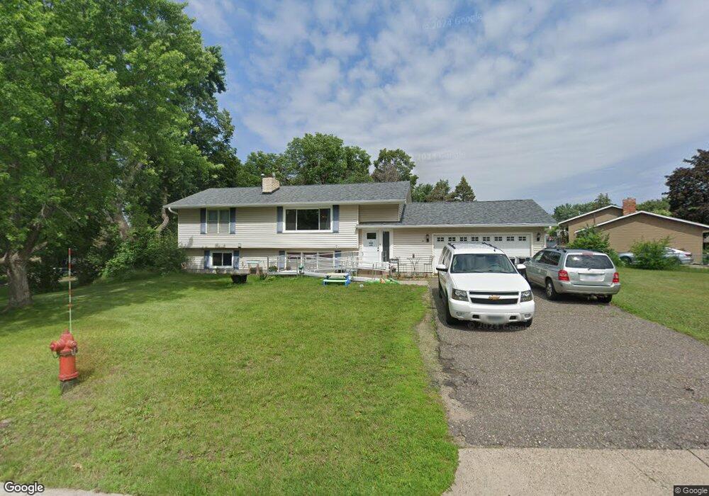
This home is located at 140 Yoho Dr, Anoka, MN 55303 and is currently estimated at $348,284, approximately $308 per square foot. 140 Yoho Dr is a home located in Anoka County with nearby schools including Franklin Elementary School, Anoka Middle School for the Arts - Fred Moor Campus, and Anoka Senior High School.
Ownership History
Date
Name
Owned For
Owner Type
Purchase Details
Closed on
Oct 3, 2011
Sold by
Schoknecht Michael W and Schoknecht Mercedes
Bought by
Moore Natasha M and Moore Herbert M
Current Estimated Value
Home Financials for this Owner
Home Financials are based on the most recent Mortgage that was taken out on this home.
Original Mortgage
$159,150
Outstanding Balance
$109,173
Interest Rate
4.22%
Mortgage Type
VA
Estimated Equity
$239,111
Create a Home Valuation Report for This Property
The Home Valuation Report is an in-depth analysis detailing your home's value as well as a comparison with similar homes in the area
Home Values in the Area
Average Home Value in this Area
Purchase History
| Date | Buyer | Sale Price | Title Company |
|---|---|---|---|
| Moore Natasha M | $157,000 | -- |
Source: Public Records
Mortgage History
| Date | Status | Borrower | Loan Amount |
|---|---|---|---|
| Open | Moore Natasha M | $159,150 |
Source: Public Records
Tax History Compared to Growth
Tax History
| Year | Tax Paid | Tax Assessment Tax Assessment Total Assessment is a certain percentage of the fair market value that is determined by local assessors to be the total taxable value of land and additions on the property. | Land | Improvement |
|---|---|---|---|---|
| 2025 | $27 | $310,400 | $75,000 | $235,400 |
| 2024 | $144 | $300,300 | $75,000 | $225,300 |
| 2023 | $62 | $312,000 | $75,000 | $237,000 |
| 2022 | $24 | $304,000 | $58,000 | $246,000 |
| 2021 | $24 | $242,400 | $51,700 | $190,700 |
| 2020 | $24 | $236,100 | $58,000 | $178,100 |
| 2019 | $24 | $220,400 | $50,000 | $170,400 |
| 2018 | $24 | $211,300 | $0 | $0 |
| 2017 | $24 | $197,800 | $0 | $0 |
| 2016 | $24 | $177,900 | $0 | $0 |
| 2015 | $24 | $177,900 | $52,000 | $125,900 |
| 2014 | -- | $148,700 | $37,000 | $111,700 |
Source: Public Records
Map
Nearby Homes
- 1032 Fremont St
- 1102 Benton St
- 1167 Benton St
- 251 Revere Ln N
- 2642 Yellowstone Blvd
- 706 Benton St
- 13480 Wellington Ct
- 525 Western St
- 504 Douglas St
- 2750 Euclid Ave
- 535 W River Pkwy
- 13348 Linwood Forest Cir
- 11134 Balsam Pointe Trail
- 13217 Union Terrace Ln N
- 13451 Yorktown Ln N
- 13217 Valley Forge Ln N
- 11117 Balsam Pointe Trail
- 3035 Cutters Grove Ave
- 11186 Balsam Pointe Trail
- 11205 Balsam Pointe Trail