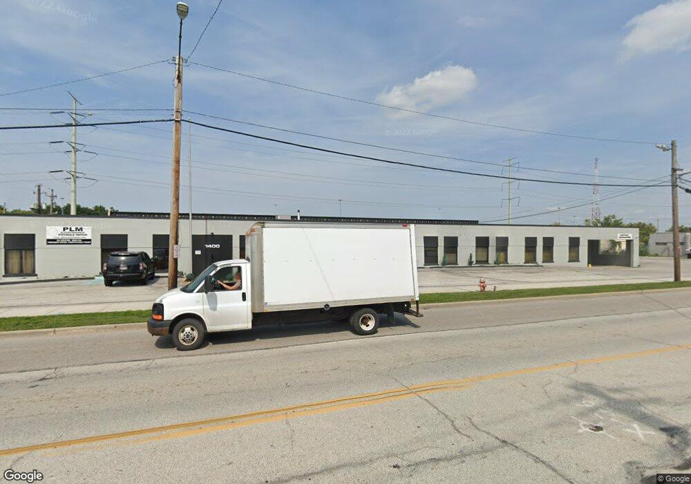
1400 Brookpark Rd Cleveland, OH 44109
Old Brooklyn NeighborhoodEstimated Value: $728,523
--
Bed
--
Bath
114,127
Sq Ft
$6/Sq Ft
Est. Value
About This Home
This home is located at 1400 Brookpark Rd, Cleveland, OH 44109 and is currently estimated at $728,523, approximately $6 per square foot. 1400 Brookpark Rd is a home located in Cuyahoga County with nearby schools including Benjamin Franklin, Artemus Ward School, and Anton Grdina School.
Ownership History
Date
Name
Owned For
Owner Type
Purchase Details
Closed on
Aug 31, 2020
Sold by
Bluestone 1400 Llc
Bought by
1400 Brookpark Llc
Current Estimated Value
Purchase Details
Closed on
Jun 19, 2014
Sold by
Udelson Brookpark Ltd
Bought by
Bluestone 1400 Llc
Purchase Details
Closed on
May 11, 1999
Sold by
Udelson Alan
Bought by
Udelson Brook Park Ltd
Purchase Details
Closed on
Jan 1, 1975
Bought by
Udelson Edward
Create a Home Valuation Report for This Property
The Home Valuation Report is an in-depth analysis detailing your home's value as well as a comparison with similar homes in the area
Home Values in the Area
Average Home Value in this Area
Purchase History
| Date | Buyer | Sale Price | Title Company |
|---|---|---|---|
| 1400 Brookpark Llc | $470,000 | Erie Title Agency | |
| Bluestone 1400 Llc | $500,000 | Guardian Title | |
| Udelson Brook Park Ltd | -- | -- | |
| Udelson Edward | -- | -- |
Source: Public Records
Tax History Compared to Growth
Tax History
| Year | Tax Paid | Tax Assessment Tax Assessment Total Assessment is a certain percentage of the fair market value that is determined by local assessors to be the total taxable value of land and additions on the property. | Land | Improvement |
|---|---|---|---|---|
| 2024 | $18,250 | $176,820 | $167,615 | $9,205 |
| 2023 | $16,430 | $164,510 | $149,000 | $15,510 |
| 2022 | $16,408 | $164,500 | $149,000 | $15,510 |
| 2021 | $16,456 | $164,500 | $149,000 | $15,510 |
| 2020 | $20,959 | $201,600 | $149,000 | $52,610 |
| 2019 | $19,731 | $576,000 | $425,700 | $150,300 |
| 2018 | $19,241 | $201,600 | $149,000 | $52,610 |
| 2017 | $17,071 | $168,070 | $79,100 | $88,970 |
| 2016 | $17,078 | $168,070 | $79,100 | $88,970 |
| 2015 | $17,170 | $168,070 | $79,100 | $88,970 |
| 2014 | $17,170 | $169,760 | $79,910 | $89,850 |
Source: Public Records
Map
Nearby Homes
- 5231 W 16th St
- 4884 W 13th St
- 1716 Tuxedo Ave
- 4859 W 13th St
- 5085 W 6th St
- 2129 North Ave
- 5118 W 4th St
- 2137 Silverdale Ave
- 5554 Landover Ct Unit 282
- 5553 Sunset Ln Unit A15-F
- 1917 Alvin Ave
- 4771 S Hills Dr
- 2302 Brookdale Ave
- 317 Park Dr
- 1025 Timothy Ln
- 2712 Ralph Ave
- 2831 Walbrook Ave
- 2503 Brookdale Ave
- 2446 Fortune Ave
- 624 Timothy Ln
- 1310 Brookpark Rd
- 1409 Brookpark Rd
- 1503 Brookpark Rd
- 1507 Brookpark Rd
- 1314 Brookview Blvd
- 1205 Brookpark Rd
- 1511 Brookpark Rd
- 1310 Brookview Blvd
- 1402 Brookview Blvd
- 5217 W 16th St
- 1306 Brookview Blvd
- 1406 Brookview Blvd
- 1302 Brookview Blvd
- 1410 Brookview Blvd
- 1218 Brookview Blvd
- 1414 Brookview Blvd
- 5221 W 16th St
- 1214 Brookview Blvd
- 1418 Brookview Blvd
- 1210 Brookview Blvd
