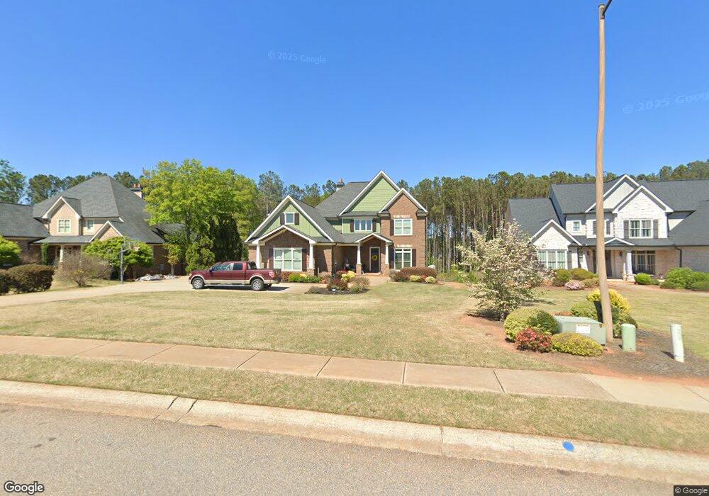
1400 Heather Ln Bogart, GA 30622
Estimated Value: $1,027,000 - $1,371,000
--
Bed
--
Bath
4,785
Sq Ft
$236/Sq Ft
Est. Value
About This Home
This home is located at 1400 Heather Ln, Bogart, GA 30622 and is currently estimated at $1,127,835, approximately $235 per square foot. 1400 Heather Ln is a home with nearby schools including Rocky Branch Elementary School, Malcom Bridge Middle School, and North Oconee High School.
Ownership History
Date
Name
Owned For
Owner Type
Purchase Details
Closed on
Mar 25, 2013
Sold by
D & B Custom Builders Inc
Bought by
Brothers James R
Current Estimated Value
Home Financials for this Owner
Home Financials are based on the most recent Mortgage that was taken out on this home.
Original Mortgage
$496,974
Outstanding Balance
$351,178
Interest Rate
3.57%
Mortgage Type
VA
Estimated Equity
$776,657
Purchase Details
Closed on
Sep 6, 2012
Sold by
Oconee Somerset Partners L
Bought by
D & B Custom Builders Inc
Create a Home Valuation Report for This Property
The Home Valuation Report is an in-depth analysis detailing your home's value as well as a comparison with similar homes in the area
Home Values in the Area
Average Home Value in this Area
Purchase History
| Date | Buyer | Sale Price | Title Company |
|---|---|---|---|
| Brothers James R | $517,500 | -- | |
| D & B Custom Builders Inc | $50,000 | -- |
Source: Public Records
Mortgage History
| Date | Status | Borrower | Loan Amount |
|---|---|---|---|
| Open | Brothers James R | $496,974 |
Source: Public Records
Tax History Compared to Growth
Tax History
| Year | Tax Paid | Tax Assessment Tax Assessment Total Assessment is a certain percentage of the fair market value that is determined by local assessors to be the total taxable value of land and additions on the property. | Land | Improvement |
|---|---|---|---|---|
| 2024 | $7,278 | $409,719 | $45,000 | $364,719 |
| 2023 | $7,660 | $372,468 | $44,000 | $328,468 |
| 2022 | $6,269 | $292,285 | $40,000 | $252,285 |
| 2021 | $5,997 | $259,248 | $30,000 | $229,248 |
| 2020 | $5,703 | $246,173 | $30,000 | $216,173 |
| 2019 | $5,511 | $237,920 | $30,000 | $207,920 |
| 2018 | $5,484 | $231,779 | $30,000 | $201,779 |
| 2017 | $5,484 | $231,779 | $30,000 | $201,779 |
| 2016 | $5,356 | $226,380 | $30,000 | $196,380 |
| 2015 | $5,282 | $222,805 | $30,000 | $192,805 |
| 2014 | $5,020 | $216,079 | $30,000 | $186,079 |
| 2013 | -- | $144,148 | $30,000 | $114,148 |
Source: Public Records
Map
Nearby Homes
- 0 Clotfelter Rd Unit 1025303
- 2082 Wade Dr
- 2163 Heather Ln
- 2479 Eisenhower Ave
- 0 Ruth Jackson Rd Unit 10582108
- 1665 Eisenhower Ave
- 00 Ruth Jackson Rd
- 2165 Harperfield Dr
- 2934 Horseshoe Bend Ln
- 2548 E Princeton Dr
- 1640 Madison Ct
- 1105 Harperfield Dr
- 0 Monroe Hwy Unit 1025452
- 1021 Bedford Trail
- 1120 Liberty Ln
- 1496 Malcom Estates
- 1224 Malcom Estates
- 6601 Hog Mountain Hwy - Hwy 53 Unit PARCEL B
- 1496 Malcom Estates Dr
- 1224 Malcom Estates Point Unit Lot 67
- 1492 Heather Ln
- 1306 Heather Ln
- 1212 Heather Ln
- 1569 Wade Dr
- 1675 Wade Dr
- 1359 Heather Ln
- 1648 Heather Ln
- 1252 Stanley Ave
- 1108 Heather Ln
- 1372 Stanley Ave
- 1351 Wade Dr
- 1235 Heather Ln
- 1500 Stanley Ave
- 1577 Heather Ln
- 1239 Wade Dr
- 0000 Clotfelter Rd
- 1113 Heather Ln
- 0 Clotfelter Rd Unit CM941896
- 0 Clotfelter Rd Unit CM950348
- 0 Clotfelter Rd Unit CM424104