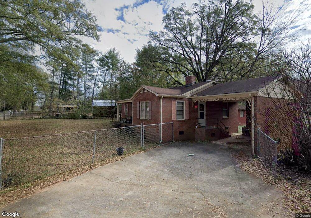
1400 P and N Dr Anderson, SC 29621
Estimated Value: $138,626 - $238,000
3
Beds
1
Bath
1,183
Sq Ft
$142/Sq Ft
Est. Value
About This Home
This home is located at 1400 P and N Dr, Anderson, SC 29621 and is currently estimated at $168,407, approximately $142 per square foot. 1400 P and N Dr is a home located in Anderson County with nearby schools including Nevitt Forest Elementary School, Glenview Middle School, and T.L. Hanna High School.
Ownership History
Date
Name
Owned For
Owner Type
Purchase Details
Closed on
Feb 2, 2010
Sold by
Aurora Loan Services Llc
Bought by
Dos Properties Llc
Current Estimated Value
Purchase Details
Closed on
Aug 19, 2009
Sold by
Long Timothy H and Long Cathy C
Bought by
Aurora Loan Services Llc
Purchase Details
Closed on
Jun 19, 2003
Sold by
Moore Brud
Bought by
Smith Mark
Purchase Details
Closed on
May 20, 2003
Sold by
Ellison Wade
Bought by
Ellison Travis
Purchase Details
Closed on
Apr 28, 2003
Sold by
Master In Equity
Bought by
Provident Bank
Purchase Details
Closed on
Aug 31, 2000
Sold by
Mize Jerry L
Bought by
Hatten Angela
Create a Home Valuation Report for This Property
The Home Valuation Report is an in-depth analysis detailing your home's value as well as a comparison with similar homes in the area
Home Values in the Area
Average Home Value in this Area
Purchase History
| Date | Buyer | Sale Price | Title Company |
|---|---|---|---|
| Dos Properties Llc | $21,500 | -- | |
| Aurora Loan Services Llc | $2,500 | -- | |
| Smith Mark | $68,000 | -- | |
| Ellison Travis | $33,000 | -- | |
| Provident Bank | $52,146 | -- | |
| Hatten Angela | $68,500 | -- |
Source: Public Records
Tax History Compared to Growth
Tax History
| Year | Tax Paid | Tax Assessment Tax Assessment Total Assessment is a certain percentage of the fair market value that is determined by local assessors to be the total taxable value of land and additions on the property. | Land | Improvement |
|---|---|---|---|---|
| 2024 | $605 | $1,690 | $610 | $1,080 |
| 2023 | $605 | $1,690 | $610 | $1,080 |
| 2022 | $562 | $1,690 | $610 | $1,080 |
| 2021 | $514 | $1,350 | $480 | $870 |
| 2020 | $504 | $1,350 | $480 | $870 |
| 2019 | $504 | $1,350 | $480 | $870 |
| 2018 | $498 | $1,350 | $480 | $870 |
| 2017 | -- | $1,350 | $480 | $870 |
| 2016 | $468 | $1,280 | $450 | $830 |
| 2015 | $470 | $1,280 | $450 | $830 |
| 2014 | $459 | $1,280 | $450 | $830 |
Source: Public Records
Map
Nearby Homes
- 1414 P and Dr N
- 109 Woodfern Cir
- 209 Blue Ridge Cir
- 1313 Phyllis Dr
- 1205 Ramona Dr
- 1425 Amity Rd
- 0 Highway 29 N Unit 20292906
- 0 Highway 29 N Unit 20292905
- 0 Highway 29 N Unit 20292904
- 0 Highway 29 N Unit 20292903
- 0 Highway 29 N Unit 22331558
- 0 Highway 29 N Unit 22331556
- 0 Highway 29 N Unit 22331557
- 606 Highway 29 Bypass N
- 701 Shamrock Ln
- 2537 Belhaven Rd
- 2335 Snow Rd
- 2703 Leftwich Ln
- 611 Wh Kay Ln
- 404 Sarah Dr
- 1402 P and N Dr
- 1308 Robbins Dr
- 1401 P and N Dr
- 1403 P and N Dr
- 1306 Robbins Dr
- 1313 P and N Dr
- 1406 P and N Dr
- 1407 P and N Dr
- 1304 Robbins Dr
- 1409 P and N Dr
- 1303 Robbins Dr
- 1303 Robbins Dr
- 1302 Robbins Dr
- 1410 P and N Dr
- 1309 P and N Dr
- 1410 P and N Dr
- 1410 P and N (Withdrawn) Dr
- 1410 P&n Dr
- 1410 P&n Dr Unit (WITHDRAWN)
- 1411 P and N Dr