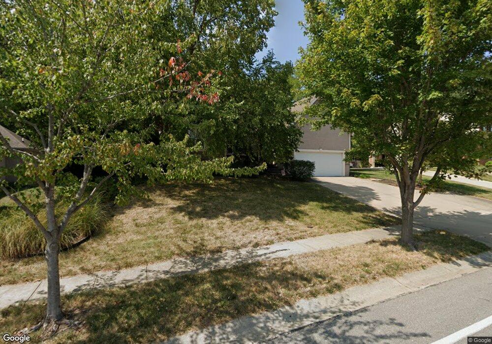
1400 SW Sampson Rd Lees Summit, MO 64081
Longview NeighborhoodEstimated Value: $498,206 - $530,000
4
Beds
4
Baths
2,450
Sq Ft
$211/Sq Ft
Est. Value
About This Home
This home is located at 1400 SW Sampson Rd, Lees Summit, MO 64081 and is currently estimated at $517,052, approximately $211 per square foot. 1400 SW Sampson Rd is a home located in Jackson County with nearby schools including Longview Farm Elementary School, Summit Lakes Middle School, and Lee's Summit West High School.
Ownership History
Date
Name
Owned For
Owner Type
Purchase Details
Closed on
Apr 10, 2001
Sold by
Tindle Thomas D
Bought by
Mcmillian Dennis and Mcmillian Lorraine
Current Estimated Value
Home Financials for this Owner
Home Financials are based on the most recent Mortgage that was taken out on this home.
Original Mortgage
$176,300
Outstanding Balance
$64,894
Interest Rate
7%
Mortgage Type
Purchase Money Mortgage
Estimated Equity
$452,158
Purchase Details
Closed on
Sep 8, 2000
Sold by
Gibbs Carlisle Richard and Gibbs Elaine Candace
Bought by
Tindle Thomas D and Tindle Home Services
Home Financials for this Owner
Home Financials are based on the most recent Mortgage that was taken out on this home.
Original Mortgage
$144,120
Interest Rate
8.15%
Mortgage Type
Purchase Money Mortgage
Create a Home Valuation Report for This Property
The Home Valuation Report is an in-depth analysis detailing your home's value as well as a comparison with similar homes in the area
Home Values in the Area
Average Home Value in this Area
Purchase History
| Date | Buyer | Sale Price | Title Company |
|---|---|---|---|
| Mcmillian Dennis | -- | Coffelt Land Title | |
| Tindle Thomas D | -- | Coffelt Land Title |
Source: Public Records
Mortgage History
| Date | Status | Borrower | Loan Amount |
|---|---|---|---|
| Open | Mcmillian Dennis | $176,300 | |
| Previous Owner | Tindle Thomas D | $144,120 | |
| Closed | Mcmillian Dennis | $22,050 |
Source: Public Records
Tax History
| Year | Tax Paid | Tax Assessment Tax Assessment Total Assessment is a certain percentage of the fair market value that is determined by local assessors to be the total taxable value of land and additions on the property. | Land | Improvement |
|---|---|---|---|---|
| 2025 | $7,539 | $75,130 | $17,037 | $58,093 |
| 2024 | $7,539 | $104,409 | $16,004 | $88,405 |
| 2023 | $7,484 | $104,409 | $15,198 | $89,211 |
| 2022 | $4,586 | $56,810 | $6,726 | $50,084 |
| 2021 | $4,681 | $56,810 | $6,726 | $50,084 |
| 2020 | $4,729 | $56,836 | $6,726 | $50,110 |
| 2019 | $4,600 | $56,836 | $6,726 | $50,110 |
| 2018 | $4,314 | $49,466 | $5,854 | $43,612 |
| 2017 | $4,298 | $49,466 | $5,854 | $43,612 |
| 2016 | $4,298 | $48,780 | $6,268 | $42,512 |
| 2014 | $4,298 | $47,823 | $6,145 | $41,678 |
Source: Public Records
Map
Nearby Homes
- 1428 SW Logos Dr
- 1055 SW Corinthian Ln
- 3238 SW Pergola Park Dr
- 3124 SW Pergola View
- 2762 SW 11th Terrace
- 1216 SE Ranchland St
- 3262 SW Pergola Park Dr
- 2717 SW 12 St
- 3112 SW Pergola Park Dr
- 3108 SW Pergola Park Dr
- 2765 SW 11th St
- 3205 SW Mary St
- 1025 SW Armie St
- 1225 SW Corinthian Ln
- 1224 SW Corinthian Ln
- 1241 SW Corinthian Ln
- 1117 SW Corinthian Ln
- 1120 SW Corinthian Ln
- 1063 SW Corinthian Ln
- 1112 SW Corinthian Ln
- 1404 SW Sampson Rd
- 1312 SW Sampson Rd
- 2913 SW 14th St
- 2912 SW 14th St
- 1308 SW Sampson Rd
- 1408 SW Sampson Rd
- 2908 SW 14th St
- 2909 SW 14th St
- 1304 SW Sampson Rd
- 1412 SW Sampson Rd
- 2904 SW 14th St
- 1436 SW Surrey Trace
- 2905 SW 14th St
- 2919 SW 13th Terrace
- 1300 SW Sampson Rd
- 2915 SW 13th Terrace
- 1432 SW Surrey Trace
- 1416 SW Sampson Rd
- 2900 SW 14th St
- 2901 SW 14th St
Your Personal Tour Guide
Ask me questions while you tour the home.