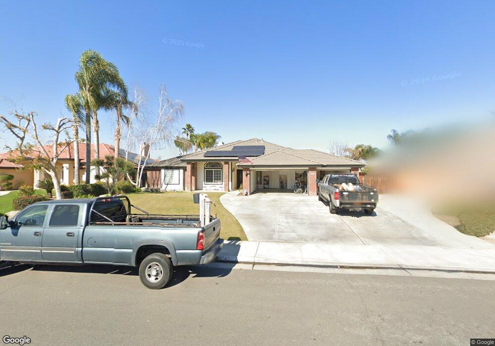
14002 Table Rock Ave Bakersfield, CA 93314
Rosedale AreaEstimated Value: $638,000 - $815,000
About This Home
This home is located at 14002 Table Rock Ave, Bakersfield, CA 93314 and is currently estimated at $722,240, approximately $261 per square foot. 14002 Table Rock Ave is a home located in Kern County with nearby schools including Patriot Elementary School, Freedom Middle School, and Frontier High School.
Ownership History
We collect this data history from publicly available records. To have your information removed, we recommend requesting removal directly through your county’s website.
Purchase Details
Home Financials for this Owner
Home Financials are based on the most recent Mortgage that was taken out on this home.Purchase Details
Purchase Details
Home Financials for this Owner
Home Financials are based on the most recent Mortgage that was taken out on this home.Purchase Details
Home Financials for this Owner
Home Financials are based on the most recent Mortgage that was taken out on this home.Purchase Details
Home Financials for this Owner
Home Financials are based on the most recent Mortgage that was taken out on this home.Purchase Details
Home Financials for this Owner
Home Financials are based on the most recent Mortgage that was taken out on this home.Home Values in the Area
Average Home Value in this Area
Purchase History
We collect this data history from publicly available records. To have your information removed, we recommend requesting removal directly through your county’s website.
| Date | Buyer | Sale Price | Title Company |
|---|---|---|---|
| $292,500 | Placer Title | ||
| -- | None Available | ||
| $341,000 | Placer Title Company | ||
| -- | None Available | ||
| $410,000 | Ticor Title | ||
| $30,000 | First American Title Co | ||
| $260,000 | First American Title Co |
Mortgage History
We collect this data history from publicly available records. To have your information removed, we recommend requesting removal directly through your county’s website.
| Date | Status | Borrower | Loan Amount |
|---|---|---|---|
| Previous Owner | $277,733 | ||
| Previous Owner | $278,300 | ||
| Previous Owner | $265,600 | ||
| Previous Owner | $100,000 | ||
| Previous Owner | $390,000 | ||
| Previous Owner | $328,000 | ||
| Previous Owner | $177,950 | ||
| Previous Owner | $17,125 | ||
| Previous Owner | $177,950 |
Tax History
We collect this data history from publicly available records. To have your information removed, we recommend requesting removal directly through your county’s website.
| Year | Tax Paid | Tax Assessment Tax Assessment Total Assessment is a certain percentage of the fair market value that is determined by local assessors to be the total taxable value of land and additions on the property. | Land | Improvement |
|---|---|---|---|---|
| 2025 | $7,200 | $492,025 | $89,675 | $402,350 |
| 2024 | $7,200 | $482,379 | $87,917 | $394,462 |
| 2023 | $6,987 | $472,922 | $86,194 | $386,728 |
| 2022 | $6,754 | $463,650 | $84,504 | $379,146 |
| 2021 | $6,544 | $454,560 | $82,848 | $371,712 |
| 2020 | $6,418 | $449,901 | $81,999 | $367,902 |
| 2019 | $6,321 | $449,901 | $81,999 | $367,902 |
| 2018 | $6,173 | $432,435 | $78,816 | $353,619 |
| 2017 | $6,084 | $423,957 | $77,271 | $346,686 |
| 2016 | $5,680 | $415,646 | $75,756 | $339,890 |
| 2015 | $5,697 | $409,405 | $74,619 | $334,786 |
| 2014 | $4,725 | $356,386 | $73,158 | $283,228 |
Map
- 14005 Austin Creek Ave
- 14146 Searspoint Ave
- 14146 Searspoint Ave
- 14332 Table Rock Ave
- 4001 Jenkins Rd
- 3849 Jenkins Rd
- 13620 Philip Phelps Ave
- 14515 Southernwood Ave
- 13615 Velma Pearl Way
- 0 Rosedale Unit 202511650
- 13507 Velma Pearl Way
- 13544 Velma Pearl Way
- 13508 Velma Pearl Way
- 4140 Meadow Lake Dr
- 3406 Wicklow Ct
- 3406 Wicklow Ct
- 12403 Hageman Rd
- 12701 Hageman Rd
- 15002 Southernwood Ave
- 13511 Cheyenne Mountain Dr
- 13912 Table Rock Ave
- 14008 Table Rock Ave
- 14001 Cedar Creek Ave
- 14014 Table Rock Ave
- 13906 Table Rock Ave
- 14007 Cedar Creek Ave
- 13917 Cedar Creek Ave
- 14015 Cedar Creek Ave
- 13915 Table Rock Ave
- 14003 Table Rock Ave
- 13911 Cedar Creek Ave
- 13900 Table Rock Ave
- 13909 Table Rock Ave
- 14009 Table Rock Ave
- 14124 Table Rock Ave
- 13905 Cedar Creek Ave
- 13903 Table Rock Ave Unit B
- 13824 Table Rock Ave
- 14121 Cedar Creek Ave
- 14006 Cedar Creek Ave
Ask me questions while you tour the home.