Estimated Value: $166,000 - $204,013
2
Beds
2
Baths
1,330
Sq Ft
$142/Sq Ft
Est. Value
About This Home
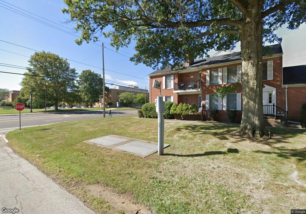
This home is located at 1401 E Main St, Kent, OH 44240 and is currently estimated at $189,503, approximately $142 per square foot. 1401 E Main St is a home located in Portage County with nearby schools including Walls Elementary School, Stanton Middle School, and Theodore Roosevelt High School.
Ownership History
Date
Name
Owned For
Owner Type
Purchase Details
Closed on
Jul 29, 2024
Sold by
Prizm Property Group Of Ohio Llc
Bought by
City Of Kent
Current Estimated Value
Purchase Details
Closed on
Jul 20, 2021
Sold by
Bartkus William A and Bartkus Donna J
Bought by
Prizm Property Group Of Ohio Llc
Purchase Details
Closed on
May 3, 2002
Sold by
Green Joan E
Bought by
Bartkus William A and Bartkus Donna J
Home Financials for this Owner
Home Financials are based on the most recent Mortgage that was taken out on this home.
Original Mortgage
$93,600
Interest Rate
7.16%
Mortgage Type
Balloon
Purchase Details
Closed on
Mar 30, 2001
Sold by
Pfeiffer Bess
Bought by
Green Joan E
Purchase Details
Closed on
Feb 23, 2001
Sold by
Estate Of Ruth L Williams
Bought by
Pfeiffer Bess
Purchase Details
Closed on
Jan 1, 1990
Bought by
Williams Ruth L
Create a Home Valuation Report for This Property
The Home Valuation Report is an in-depth analysis detailing your home's value as well as a comparison with similar homes in the area
Home Values in the Area
Average Home Value in this Area
Purchase History
| Date | Buyer | Sale Price | Title Company |
|---|---|---|---|
| City Of Kent | $5,840 | None Listed On Document | |
| Prizm Property Group Of Ohio Llc | -- | None Available | |
| Bartkus William A | $117,000 | Central Title | |
| Green Joan E | $107,000 | Approved Statewide Title Age | |
| Pfeiffer Bess | -- | -- | |
| Williams Ruth L | -- | -- |
Source: Public Records
Mortgage History
| Date | Status | Borrower | Loan Amount |
|---|---|---|---|
| Previous Owner | Bartkus William A | $93,600 |
Source: Public Records
Tax History
| Year | Tax Paid | Tax Assessment Tax Assessment Total Assessment is a certain percentage of the fair market value that is determined by local assessors to be the total taxable value of land and additions on the property. | Land | Improvement |
|---|---|---|---|---|
| 2024 | $2,579 | $56,070 | $6,300 | $49,770 |
| 2023 | $2,584 | $45,570 | $4,550 | $41,020 |
| 2022 | $2,582 | $45,570 | $4,550 | $41,020 |
| 2021 | $2,587 | $45,570 | $4,550 | $41,020 |
| 2020 | $2,754 | $43,260 | $4,550 | $38,710 |
| 2019 | $2,754 | $43,260 | $4,550 | $38,710 |
| 2017 | $2,698 | $39,200 | $4,550 | $34,650 |
| 2016 | $2,692 | $39,200 | $4,550 | $34,650 |
Source: Public Records
Map
Nearby Homes
- 1103 Oakwood Dr
- 1737 Holly Dr
- 6235 1st Ave
- 1585 Kent St
- 6318 1st Ave
- 1426 Loop Rd Unit 1426
- 1005 Vine St
- 326 Pleasant Ave
- 4363 Ohio 43
- 6297 Westshore Dr
- 0 S Water St
- 146 W Elm St
- 1951 Walton Rd
- 529 Rockwell St
- 1204 Franklin Ave
- 6181 Washington St
- 1024E Cedar Ridge Dr
- 2262 Leonard St
- 0 Meloy Rd Unit 5162435
- 211 Mckinney Blvd
- 1405 E Main St
- 1397 E Main St
- 1403 E Main St Unit E
- 1395 E Main St Unit F
- 1399 E Main St Unit C
- 1359 E Main St
- 122 Overlook Dr
- 130 Overlook Dr
- 35 Overlook Dr
- 123 Overlook Dr
- 1325 E Main St
- 1237 Fairview Dr
- 1235 Fairview Dr
- 204 Overlook Dr
- 1415 E Main St Unit 1
- 131 Overlook Dr
- 1233 Fairview Dr
- 210 Overlook Dr
- 205 Overlook Dr
- Lot 16 Horning Rd