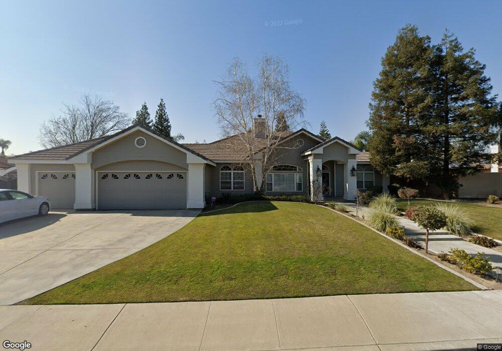
1401 Suffolk St Bakersfield, CA 93312
Brimhall Estates NeighborhoodEstimated Value: $802,000 - $827,000
4
Beds
3
Baths
3,064
Sq Ft
$267/Sq Ft
Est. Value
About This Home
This home is located at 1401 Suffolk St, Bakersfield, CA 93312 and is currently estimated at $818,962, approximately $267 per square foot. 1401 Suffolk St is a home located in Kern County with nearby schools including Independence Elementary School, Rosedale Middle School, and Liberty High School.
Ownership History
Date
Name
Owned For
Owner Type
Purchase Details
Closed on
Oct 2, 2013
Sold by
Fringer Troy L and Fringer Jodi M
Bought by
Fringer Troy and Fringer Jodi
Current Estimated Value
Purchase Details
Closed on
Jan 13, 1997
Sold by
Peterson Warren F and Peterson Jeanne M
Bought by
Fringer Troy L and Fringer Jodi M
Home Financials for this Owner
Home Financials are based on the most recent Mortgage that was taken out on this home.
Original Mortgage
$202,700
Interest Rate
7.93%
Mortgage Type
Construction
Purchase Details
Closed on
Dec 10, 1996
Sold by
Castle & Cooke Homes Inc
Bought by
Peterson Warren F
Home Financials for this Owner
Home Financials are based on the most recent Mortgage that was taken out on this home.
Original Mortgage
$202,700
Interest Rate
7.93%
Mortgage Type
Construction
Create a Home Valuation Report for This Property
The Home Valuation Report is an in-depth analysis detailing your home's value as well as a comparison with similar homes in the area
Home Values in the Area
Average Home Value in this Area
Purchase History
| Date | Buyer | Sale Price | Title Company |
|---|---|---|---|
| Fringer Troy | -- | None Available | |
| Fringer Troy L | $58,500 | First American Title Co | |
| Peterson Warren F | -- | -- |
Source: Public Records
Mortgage History
| Date | Status | Borrower | Loan Amount |
|---|---|---|---|
| Previous Owner | Fringer Troy L | $202,700 |
Source: Public Records
Tax History Compared to Growth
Tax History
| Year | Tax Paid | Tax Assessment Tax Assessment Total Assessment is a certain percentage of the fair market value that is determined by local assessors to be the total taxable value of land and additions on the property. | Land | Improvement |
|---|---|---|---|---|
| 2025 | $6,093 | $497,109 | $89,398 | $407,711 |
| 2024 | $5,960 | $487,364 | $87,646 | $399,718 |
| 2023 | $5,960 | $477,810 | $85,928 | $391,882 |
| 2022 | $5,863 | $468,443 | $84,244 | $384,199 |
| 2021 | $5,708 | $459,260 | $82,593 | $376,667 |
| 2020 | $5,676 | $454,553 | $81,747 | $372,806 |
| 2019 | $5,489 | $454,553 | $81,747 | $372,806 |
| 2018 | $5,403 | $436,906 | $78,574 | $358,332 |
| 2017 | $5,323 | $428,342 | $77,034 | $351,308 |
| 2016 | $4,993 | $419,945 | $75,524 | $344,421 |
| 2015 | $4,918 | $413,639 | $74,390 | $339,249 |
| 2014 | $4,811 | $405,538 | $72,933 | $332,605 |
Source: Public Records
Map
Nearby Homes
- 12401 Longmeadow Way
- 11717 Old Town Rd
- 11808 Wethersfield St
- 12204 Tule River Way
- 11510 Finsbury Ct
- 13010 Fall River Place
- 11917 Leigh River St
- 12008 Stonington St
- 11520 Pinehaven Ave
- 12925 Appaloosa Ave
- 2112 Branch Creek St
- 13115 Nantucket Place
- 12307 Fairburn Way
- 12303 Fairburn Way
- 13207 Phoenix Palm Ct
- 13019 Queen Palm Ct
- 12100 Winger St
- 12023 Winger St
- 307 Coachman Way
- 13306 Monarch Palm Ave
- 1311 Suffolk St
- 1405 Suffolk St
- 1400 Dunaire Dr
- 1404 Dunaire Dr
- 1310 Dunaire Dr
- 1400 Suffolk St
- 1307 Suffolk St
- 1409 Suffolk St
- 1310 Suffolk St
- 1404 Suffolk St
- 1306 Dunaire Dr
- 1408 Dunaire Dr
- 1306 Suffolk St
- 1408 Suffolk St
- 1401 Dunaire Dr
- 1315 Ironstone Dr
- 1303 Suffolk St
- 1415 Suffolk St
- 1311 Dunaire Dr
- 1311 Ironstone Dr