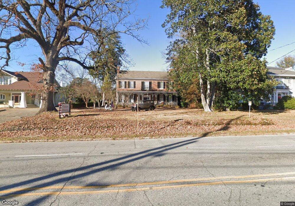
1401 Wynnton Rd Columbus, GA 31906
Wynns Hill NeighborhoodEstimated Value: $377,000 - $476,798
4
Beds
5
Baths
4,871
Sq Ft
$86/Sq Ft
Est. Value
About This Home
This home is located at 1401 Wynnton Rd, Columbus, GA 31906 and is currently estimated at $416,950, approximately $85 per square foot. 1401 Wynnton Rd is a home located in Muscogee County with nearby schools including Richards Middle School, Hardaway High School, and Wynnton Elementary School.
Ownership History
Date
Name
Owned For
Owner Type
Purchase Details
Closed on
Mar 4, 2021
Sold by
M N M Properties Llc
Bought by
Jaad 1 Llc
Current Estimated Value
Purchase Details
Closed on
Sep 18, 2020
Sold by
Another Road Llc
Bought by
M N M Properties Llc
Create a Home Valuation Report for This Property
The Home Valuation Report is an in-depth analysis detailing your home's value as well as a comparison with similar homes in the area
Home Values in the Area
Average Home Value in this Area
Purchase History
| Date | Buyer | Sale Price | Title Company |
|---|---|---|---|
| Jaad 1 Llc | -- | -- | |
| M N M Properties Llc | $237,600 | -- |
Source: Public Records
Tax History Compared to Growth
Tax History
| Year | Tax Paid | Tax Assessment Tax Assessment Total Assessment is a certain percentage of the fair market value that is determined by local assessors to be the total taxable value of land and additions on the property. | Land | Improvement |
|---|---|---|---|---|
| 2025 | $4,747 | $121,268 | $23,248 | $98,020 |
| 2024 | $4,747 | $121,268 | $23,248 | $98,020 |
| 2023 | $4,777 | $121,268 | $23,248 | $98,020 |
| 2022 | $5,056 | $123,816 | $23,248 | $100,568 |
| 2021 | $3,881 | $95,040 | $63,772 | $31,268 |
| 2020 | $6,288 | $184,900 | $63,772 | $121,128 |
| 2019 | $7,576 | $184,900 | $63,772 | $121,128 |
| 2018 | $7,576 | $184,900 | $63,772 | $121,128 |
| 2017 | $7,600 | $184,900 | $63,772 | $121,128 |
| 2016 | $7,652 | $185,508 | $63,456 | $122,052 |
| 2015 | $3,065 | $185,508 | $63,456 | $122,052 |
| 2014 | $3,068 | $185,508 | $63,456 | $122,052 |
| 2013 | -- | $185,508 | $63,456 | $122,052 |
Source: Public Records
Map
Nearby Homes
- 911 Oakview Ave
- 912 Magnolia Ave
- 2551 Wynnton Rd
- 1503 Crest Dr
- 1226 18th Ave Unit A/B
- 1103 Martin Luther King Junior Blvd
- 1242 18th Ave
- 1811 Park Dr
- 1616 Crest Dr
- 1820 Overlook St
- 1917 Dimon St
- 1315 Eberhart Ave
- 1342 16th St
- 1237 Peacock Ave
- 752 Portland Ave
- 1348 Rhodes St
- 1557 18th Ave
- 1622 14th Ave
- 1400 Eberhart Ave
- 2039 8th St
- 1346 Buena Vista Rd
- 1327 Wynnton Rd
- 1344 Buena Vista Rd
- 1342 Buena Vista Rd
- 1340 Buena Vista Rd
- 1410 Wynnton Rd
- 1115 Dinglewood Dr
- 1414 Dinglewood Dr Unit ID1043590P
- 1414 Dinglewood Dr
- 1006 Blandford Ave
- 1011 Blandford Ave
- 1414 W Dinglewood Dr
- 1420 Wynnton Rd
- 1122 E Dinglewood Dr
- 1007 Blandford Ave
- 1411 10th St
- 1500 Dinglewood Dr
- 1510 Dinglewood Dr
- 1321 10th St
- 1321 10th St Unit 6