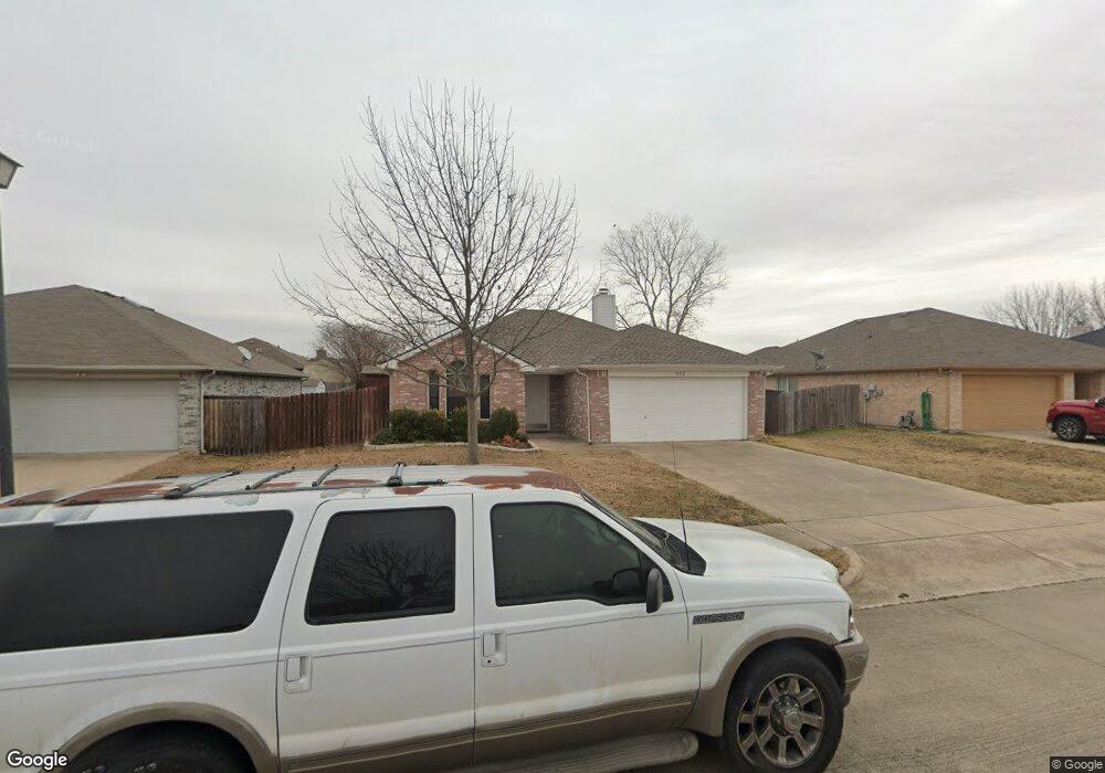
1402 Embercrest Dr Midlothian, TX 76065
Estimated Value: $256,921 - $279,000
3
Beds
2
Baths
1,261
Sq Ft
$212/Sq Ft
Est. Value
About This Home
This home is located at 1402 Embercrest Dr, Midlothian, TX 76065 and is currently estimated at $267,961, approximately $212 per square foot. 1402 Embercrest Dr is a home located in Ellis County with nearby schools including J A Vitovsky Elementary School and Walnut Grove Middle School.
Ownership History
Date
Name
Owned For
Owner Type
Purchase Details
Closed on
Aug 3, 2015
Sold by
Ramzy Patricia M
Bought by
Butler Robert P and Butler Julie A
Current Estimated Value
Purchase Details
Closed on
Jul 5, 2007
Sold by
Secretary Of Hud
Bought by
Ramzy Patricia M
Home Financials for this Owner
Home Financials are based on the most recent Mortgage that was taken out on this home.
Original Mortgage
$85,000
Interest Rate
6.37%
Mortgage Type
New Conventional
Purchase Details
Closed on
Mar 28, 2007
Sold by
Bank Of New York
Bought by
Secretary Of Hud
Purchase Details
Closed on
Nov 15, 2006
Sold by
Cherry Olvin M and Walker Jeanne C
Bought by
Bank Of New York
Purchase Details
Closed on
Nov 14, 2006
Sold by
Bank Of New York
Bought by
Secretary Of Hud
Purchase Details
Closed on
Nov 7, 2006
Sold by
Cherry Olvin M and Walker Jeanne C
Bought by
Bank Of New York
Create a Home Valuation Report for This Property
The Home Valuation Report is an in-depth analysis detailing your home's value as well as a comparison with similar homes in the area
Home Values in the Area
Average Home Value in this Area
Purchase History
| Date | Buyer | Sale Price | Title Company |
|---|---|---|---|
| Butler Robert P | -- | None Available | |
| Ramzy Patricia M | -- | None Available | |
| Secretary Of Hud | -- | None Available | |
| Bank Of New York | -- | None Available | |
| Secretary Of Hud | -- | None Available | |
| Bank Of New York | -- | None Available |
Source: Public Records
Mortgage History
| Date | Status | Borrower | Loan Amount |
|---|---|---|---|
| Previous Owner | Ramzy Patricia M | $85,000 |
Source: Public Records
Tax History
| Year | Tax Paid | Tax Assessment Tax Assessment Total Assessment is a certain percentage of the fair market value that is determined by local assessors to be the total taxable value of land and additions on the property. | Land | Improvement |
|---|---|---|---|---|
| 2025 | $4,831 | $235,755 | $80,000 | $155,755 |
| 2024 | $4,831 | $239,440 | $80,000 | $159,440 |
| 2023 | $4,831 | $259,767 | $70,000 | $189,767 |
| 2022 | $4,845 | $216,267 | $50,000 | $166,267 |
| 2021 | $4,238 | $179,080 | $35,000 | $144,080 |
| 2020 | $4,350 | $172,930 | $35,000 | $137,930 |
| 2019 | $4,356 | $166,340 | $0 | $0 |
| 2017 | $3,744 | $140,640 | $25,000 | $115,640 |
| 2016 | $3,345 | $125,670 | $20,000 | $105,670 |
Source: Public Records
Map
Nearby Homes
- 1410 Embercrest Dr
- 1305 Misty Meadow Dr
- 1214 Misty Meadow Dr
- TBD 1 acre Overlook Dr
- 606 Overlook Dr
- 807 Crockett St
- 0 U S Highway 67
- 902 W Avenue D
- 620 N 6th St
- 900 W Avenue F
- 1834 Rough Ridge Trail
- 4418 Timberdrift St
- 000 N 6th St
- 4434 Verbena St
- 215 S 1st St
- 120 N 5th St
- 1015 Magdalena Way
- 809 Deleon Dr
- 316 S 5th St
- 107 Sewell Ave
- 1318 Embercrest Dr
- 1406 Embercrest Dr
- 1401 Rye Glen Dr
- 1314 Embercrest Dr
- 1405 Rye Glen Dr
- 1317 Rye Glen Dr
- 1321 Embercrest Dr
- 1405 Embercrest Dr
- 1409 Rye Glen Dr
- 1317 Embercrest Dr
- 1313 Rye Glen Dr
- 1310 Embercrest Dr
- 1409 Embercrest Dr
- 1414 Embercrest Dr
- 1413 Rye Glen Dr
- 1309 Rye Glen Dr
- 1413 Embercrest Dr
- 1306 Embercrest Dr
- 1418 Embercrest Dr
- 1322 Beacon Hill Dr
Your Personal Tour Guide
Ask me questions while you tour the home.