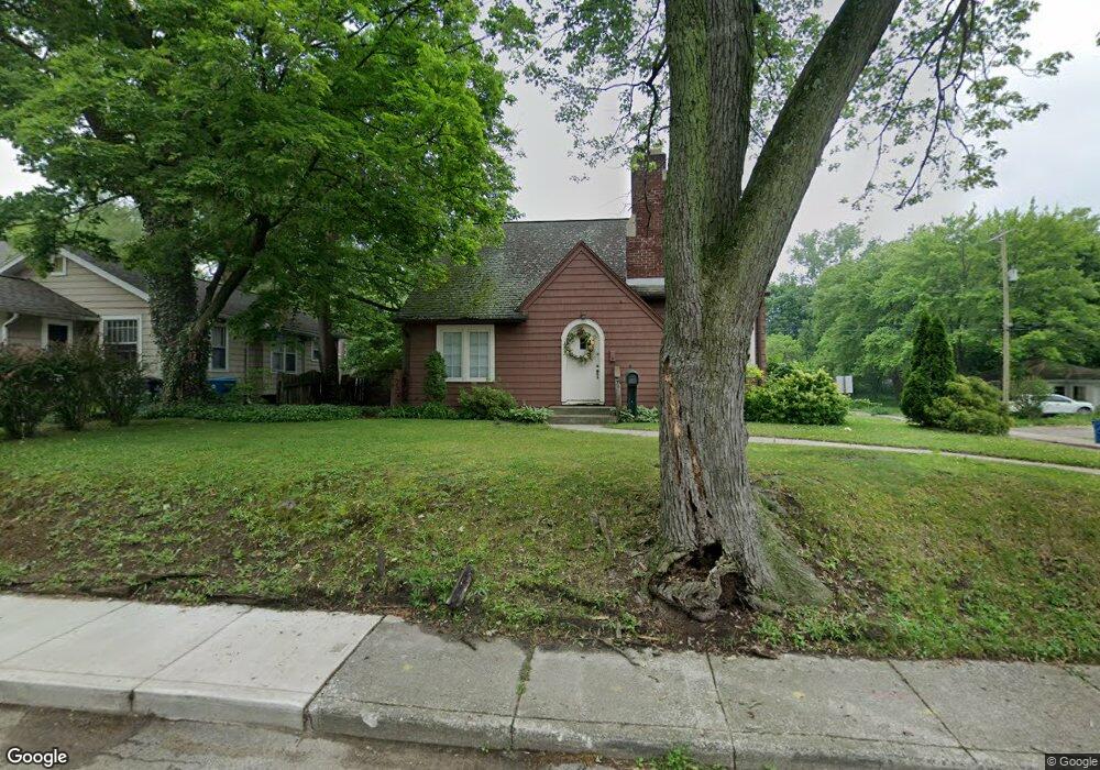
1402 Lane Blvd Kalamazoo, MI 49001
Edison NeighborhoodEstimated Value: $139,094 - $171,000
3
Beds
2
Baths
1,408
Sq Ft
$105/Sq Ft
Est. Value
About This Home
This home is located at 1402 Lane Blvd, Kalamazoo, MI 49001 and is currently estimated at $148,524, approximately $105 per square foot. 1402 Lane Blvd is a home located in Kalamazoo County with nearby schools including Milwood Elementary School, Milwood Magnet School, and Loy Norrix High School.
Ownership History
Date
Name
Owned For
Owner Type
Purchase Details
Closed on
Mar 30, 2018
Sold by
Cartwright Stephen L and Cartwright Sandra J
Bought by
Dunn Martin Earl
Current Estimated Value
Purchase Details
Closed on
Mar 26, 2013
Sold by
Cartwright Stephen L and Cartwright Sandra J
Bought by
Cartwright Stephen L and Cartwright Sandra J
Purchase Details
Closed on
Oct 14, 2009
Sold by
Griffith Kim L and Griffith Robin R
Bought by
Cartwright Steve and Cartwright Sandra
Home Financials for this Owner
Home Financials are based on the most recent Mortgage that was taken out on this home.
Original Mortgage
$40,875
Interest Rate
5.07%
Mortgage Type
New Conventional
Create a Home Valuation Report for This Property
The Home Valuation Report is an in-depth analysis detailing your home's value as well as a comparison with similar homes in the area
Home Values in the Area
Average Home Value in this Area
Purchase History
| Date | Buyer | Sale Price | Title Company |
|---|---|---|---|
| Dunn Martin Earl | $75,000 | None Available | |
| Cartwright Stephen L | -- | None Available | |
| Cartwright Steve | $54,500 | First American Title Ins Co |
Source: Public Records
Mortgage History
| Date | Status | Borrower | Loan Amount |
|---|---|---|---|
| Previous Owner | Cartwright Steve | $40,875 |
Source: Public Records
Tax History
| Year | Tax Paid | Tax Assessment Tax Assessment Total Assessment is a certain percentage of the fair market value that is determined by local assessors to be the total taxable value of land and additions on the property. | Land | Improvement |
|---|---|---|---|---|
| 2025 | $838 | $64,200 | $0 | $0 |
| 2024 | $813 | $51,100 | $0 | $0 |
| 2023 | $775 | $45,500 | $0 | $0 |
| 2022 | $1,321 | $38,600 | $0 | $0 |
| 2021 | $1,277 | $32,800 | $0 | $0 |
| 2020 | $1,251 | $29,100 | $0 | $0 |
| 2019 | $1,192 | $24,100 | $0 | $0 |
| 2018 | $1,023 | $21,600 | $0 | $0 |
| 2017 | $1,409 | $22,100 | $0 | $0 |
| 2016 | $1,409 | $21,700 | $0 | $0 |
| 2015 | $1,409 | $21,300 | $0 | $0 |
| 2014 | $1,409 | $19,700 | $0 | $0 |
Source: Public Records
Map
Nearby Homes
- 1506 Lane Blvd
- 2012 March St
- 1412 E Alcott St
- 1118 E Alcott St
- 1314 Clinton Ave
- 1028 Clinton Ave
- 913 Bryant St
- 1006 Hays Park Ave
- 1411 Egleston Ave
- 915 Hays Park Ave
- 1901 Fulton St
- 1721 Egleston Ave
- 1315 E Stockbridge Ave
- 835 Lay Blvd
- 1517 E Stockbridge Ave
- 1622 Olive St
- 826 Fulton St
- 1212 Washington Ave
- 923 E Stockbridge Ave
- 910 Miller Rd
Your Personal Tour Guide
Ask me questions while you tour the home.