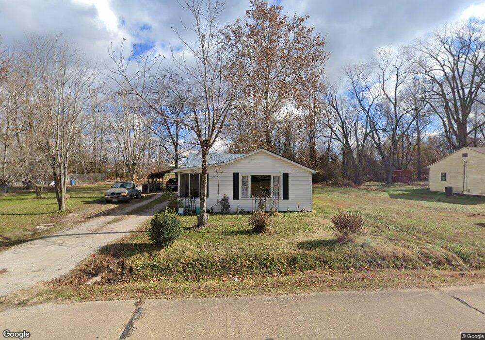
1404 Vincent St Poplar Bluff, MO 63901
Estimated Value: $60,207 - $88,000
--
Bed
--
Bath
947
Sq Ft
$82/Sq Ft
Est. Value
About This Home
This home is located at 1404 Vincent St, Poplar Bluff, MO 63901 and is currently estimated at $77,302, approximately $81 per square foot. 1404 Vincent St is a home with nearby schools including Eugene Field Elementary School, Poplar Bluff Fifth & Sixth Grade Center, and Poplar Bluff Junior High School.
Ownership History
Date
Name
Owned For
Owner Type
Purchase Details
Closed on
Mar 9, 2007
Sold by
Hendrickson James W and Hendrickson Edna M
Bought by
Drew Alton Dewane
Current Estimated Value
Home Financials for this Owner
Home Financials are based on the most recent Mortgage that was taken out on this home.
Original Mortgage
$28,000
Outstanding Balance
$16,939
Interest Rate
6.25%
Mortgage Type
Seller Take Back
Estimated Equity
$60,363
Purchase Details
Closed on
Jul 28, 2006
Sold by
Scholl Joe and Scholl Jewel M
Bought by
Hendrickson James W and Hendrickson Edna M
Create a Home Valuation Report for This Property
The Home Valuation Report is an in-depth analysis detailing your home's value as well as a comparison with similar homes in the area
Home Values in the Area
Average Home Value in this Area
Purchase History
| Date | Buyer | Sale Price | Title Company |
|---|---|---|---|
| Drew Alton Dewane | -- | -- | |
| Hendrickson James W | -- | -- |
Source: Public Records
Mortgage History
| Date | Status | Borrower | Loan Amount |
|---|---|---|---|
| Open | Drew Alton Dewane | $28,000 |
Source: Public Records
Tax History Compared to Growth
Tax History
| Year | Tax Paid | Tax Assessment Tax Assessment Total Assessment is a certain percentage of the fair market value that is determined by local assessors to be the total taxable value of land and additions on the property. | Land | Improvement |
|---|---|---|---|---|
| 2024 | $226 | $4,680 | $0 | $0 |
| 2023 | $226 | $4,680 | $0 | $0 |
| 2022 | $219 | $4,540 | $0 | $0 |
| 2021 | $219 | $4,540 | $0 | $0 |
| 2020 | $208 | $4,260 | $0 | $0 |
| 2019 | $208 | $4,260 | $0 | $0 |
| 2018 | $208 | $4,260 | $0 | $0 |
| 2017 | -- | $4,260 | $0 | $0 |
| 2016 | -- | $4,260 | $0 | $0 |
| 2015 | -- | $4,260 | $0 | $0 |
| 2014 | -- | $4,020 | $0 | $0 |
| 2012 | $165 | $4,020 | $0 | $0 |
Source: Public Records
Map
Nearby Homes
- 622 Nickey St
- 1708 Kentucky Ave
- 1000 W Victor St
- 712 Nickey St
- 1905 Kentucky Ave
- 1910 Arkansas Ave
- 912 Adam St
- 803 Kendall Dr
- 1315 S 11th St
- 2011 Arkansas Ave
- 813 Kendall Dr
- 2015 Arkansas Ave
- 533 Short A St
- 1025 Delano St
- 2318 Arkansas Ave
- 110 Hampton Ct
- 205 S B St
- 318 E Henry St
- 2335 Cheshire Blvd
- 2347 Arkansas Ave