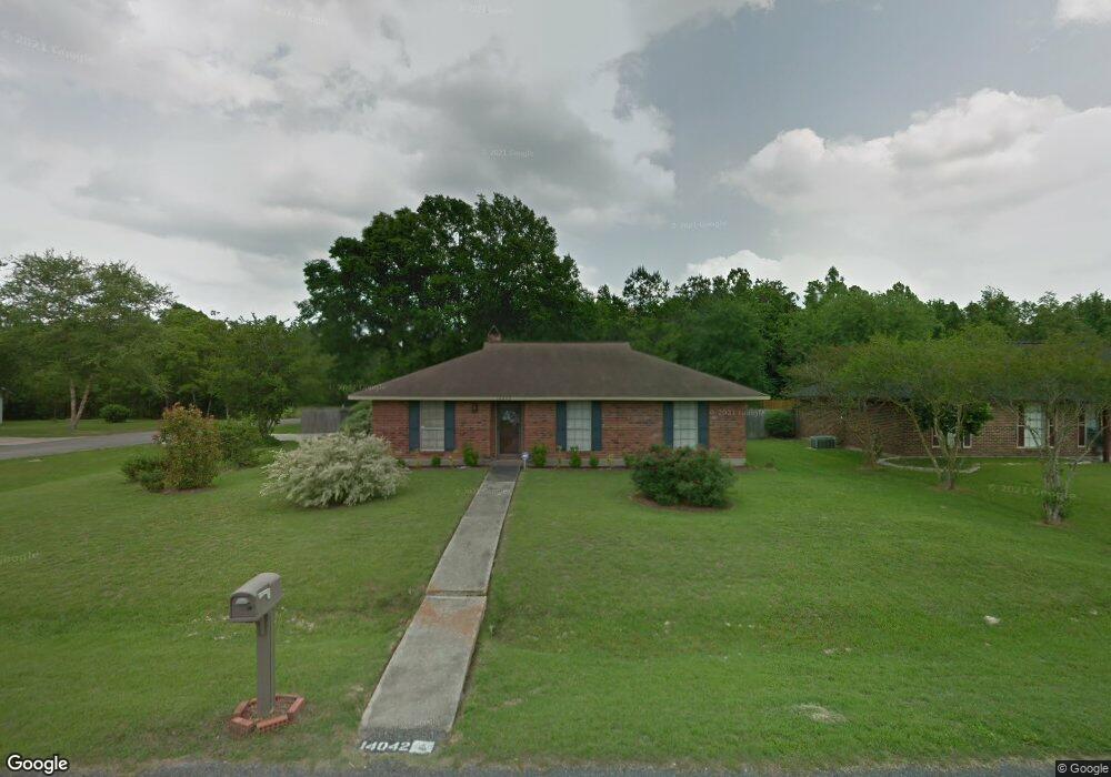
14042 Blairstown Dr Baker, LA 70714
Brownfields NeighborhoodEstimated Value: $160,000 - $203,000
3
Beds
2
Baths
1,405
Sq Ft
$129/Sq Ft
Est. Value
About This Home
This home is located at 14042 Blairstown Dr, Baker, LA 70714 and is currently estimated at $181,168, approximately $128 per square foot. 14042 Blairstown Dr is a home located in East Baton Rouge Parish with nearby schools including Baker Heights Elementary School, Bakerfield Elementary School, and Baker Middle School.
Ownership History
Date
Name
Owned For
Owner Type
Purchase Details
Closed on
Jun 30, 1999
Sold by
Hud
Bought by
Hatch Janice J
Current Estimated Value
Home Financials for this Owner
Home Financials are based on the most recent Mortgage that was taken out on this home.
Original Mortgage
$56,751
Outstanding Balance
$15,457
Interest Rate
7.21%
Mortgage Type
FHA
Estimated Equity
$165,711
Create a Home Valuation Report for This Property
The Home Valuation Report is an in-depth analysis detailing your home's value as well as a comparison with similar homes in the area
Home Values in the Area
Average Home Value in this Area
Purchase History
| Date | Buyer | Sale Price | Title Company |
|---|---|---|---|
| Hatch Janice J | $57,500 | -- |
Source: Public Records
Mortgage History
| Date | Status | Borrower | Loan Amount |
|---|---|---|---|
| Open | Hatch Janice J | $56,751 |
Source: Public Records
Tax History Compared to Growth
Tax History
| Year | Tax Paid | Tax Assessment Tax Assessment Total Assessment is a certain percentage of the fair market value that is determined by local assessors to be the total taxable value of land and additions on the property. | Land | Improvement |
|---|---|---|---|---|
| 2024 | $320 | $10,150 | $1,000 | $9,150 |
| 2023 | $320 | $10,150 | $1,000 | $9,150 |
| 2022 | $1,140 | $10,150 | $1,000 | $9,150 |
| 2021 | $1,130 | $10,150 | $1,000 | $9,150 |
| 2020 | $1,144 | $10,150 | $1,000 | $9,150 |
| 2019 | $1,183 | $10,150 | $1,000 | $9,150 |
| 2018 | $1,168 | $10,150 | $1,000 | $9,150 |
| 2017 | $1,168 | $10,150 | $1,000 | $9,150 |
| 2016 | $43 | $6,948 | $1,000 | $5,948 |
| 2015 | $344 | $10,150 | $1,000 | $9,150 |
| 2014 | $343 | $10,150 | $1,000 | $9,150 |
| 2013 | -- | $10,150 | $1,000 | $9,150 |
Source: Public Records
Map
Nearby Homes
- 13841 Blairstown Dr
- 14137 Blairstown Dr
- LOT 78 Gayden Ave
- 13820 Felicity Dr
- 8724 Pettit Rd
- 16920 Plank Rd
- 13443 Plank Rd
- 7640 Pettit Rd
- 6208 Clermont St
- 22040 Plank Rd
- 6204 Molino Dr
- 13311 Plank Rd
- 13261 Plank Rd
- 15151 Plank Rd
- 7173 Jupiter Dr
- 6505 Stoneview Ave
- 5885 Lavey Ln Unit 128
- 5885 Lavey Ln Unit 46
- 5885 Lavey Ln Unit 131
- 5885 Lavey Ln Unit 123
- 14032 Blairstown Dr
- LOT 83 Blairstown Dr
- LOT 81 Blairstown Dr
- 13923 Blairstown Dr
- LOT 80 Blairstown Dr
- LOT 99 Blairstown Dr
- 0 Blairstown Dr Unit 201210102
- 0 Blairstown Dr Unit 201215721
- 0 Blairstown Dr Unit 201312629
- 0 Blairstown Dr Unit BR2006137506
- 0 Blairstown Dr Unit BR2006121406
- 0 Blairstown Dr Unit BR2006121405
- 0 Blairstown Dr Unit BR2006121403
- 0 Blairstown Dr Unit BR2006121401
- 0 Blairstown Dr Unit BR2006121400
- 0 Blairstown Dr Unit BR2006121393
- 0 Blairstown Dr Unit BR200079013
- 0 Blairstown Dr Unit BR199830275
- 0 Blairstown Dr Unit BR199830272
- 14114 Blairstown Dr