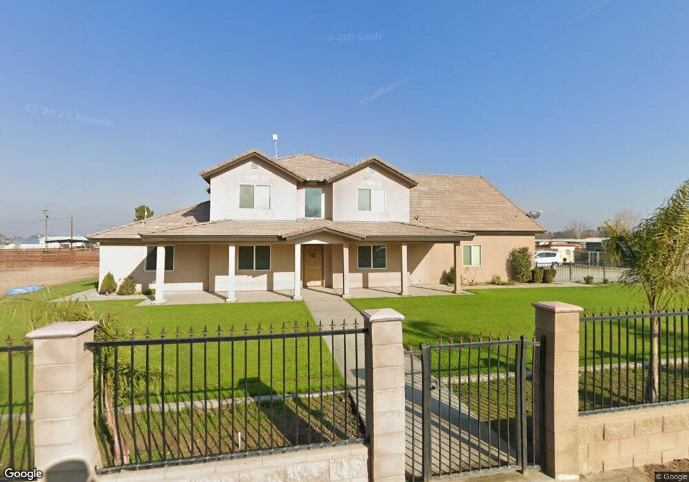
14042 Garrin Rd Bakersfield, CA 93313
Estimated Value: $684,000 - $767,000
4
Beds
4
Baths
1,979
Sq Ft
$368/Sq Ft
Est. Value
About This Home
This home is located at 14042 Garrin Rd, Bakersfield, CA 93313 and is currently estimated at $728,033, approximately $367 per square foot. 14042 Garrin Rd is a home located in Kern County with nearby schools including Lakeside School, General Shafter Elementary School, and Independence High School.
Ownership History
Date
Name
Owned For
Owner Type
Purchase Details
Closed on
Nov 7, 2011
Sold by
Santa Barbara Bank & Trust N A
Bought by
Vincent Richard G
Current Estimated Value
Purchase Details
Closed on
May 20, 2010
Sold by
Evangelista Raul and Luna Maria
Bought by
Santa Barbara Bank & Trust
Purchase Details
Closed on
Nov 10, 2004
Sold by
Brian Rice Constructions Inc
Bought by
Evangelista Raul
Home Financials for this Owner
Home Financials are based on the most recent Mortgage that was taken out on this home.
Original Mortgage
$240,000
Interest Rate
5.37%
Purchase Details
Closed on
Apr 19, 2004
Sold by
Federal Home Loan Mortgage Corporation
Bought by
Brian Rice Construction Inc
Purchase Details
Closed on
Aug 25, 2003
Sold by
Martinez Alfredo and Martinez Mary M
Bought by
Federal Home Loan Mortgage Corporation
Create a Home Valuation Report for This Property
The Home Valuation Report is an in-depth analysis detailing your home's value as well as a comparison with similar homes in the area
Home Values in the Area
Average Home Value in this Area
Purchase History
| Date | Buyer | Sale Price | Title Company |
|---|---|---|---|
| Vincent Richard G | $50,000 | North American Title Co Inc | |
| Santa Barbara Bank & Trust | $110,000 | Accommodation | |
| Evangelista Raul | $300,000 | Chicago Title | |
| Brian Rice Construction Inc | $229,000 | First American Title | |
| Federal Home Loan Mortgage Corporation | $134,651 | -- |
Source: Public Records
Mortgage History
| Date | Status | Borrower | Loan Amount |
|---|---|---|---|
| Previous Owner | Evangelista Raul | $240,000 |
Source: Public Records
Tax History Compared to Growth
Tax History
| Year | Tax Paid | Tax Assessment Tax Assessment Total Assessment is a certain percentage of the fair market value that is determined by local assessors to be the total taxable value of land and additions on the property. | Land | Improvement |
|---|---|---|---|---|
| 2025 | $5,551 | $452,057 | $62,796 | $389,261 |
| 2024 | $5,418 | $443,195 | $61,565 | $381,630 |
| 2023 | $5,418 | $434,506 | $60,358 | $374,148 |
| 2022 | $5,295 | $425,988 | $59,175 | $366,813 |
| 2021 | $5,202 | $417,636 | $58,015 | $359,621 |
| 2020 | $5,128 | $413,355 | $57,421 | $355,934 |
| 2019 | $4,150 | $303,355 | $57,421 | $245,934 |
| 2018 | $3,504 | $298,568 | $55,193 | $243,375 |
| 2017 | $1,343 | $116,244 | $54,111 | $62,133 |
| 2016 | $1,247 | $113,965 | $53,050 | $60,915 |
| 2015 | $1,237 | $112,254 | $52,254 | $60,000 |
| 2014 | $563 | $51,231 | $51,231 | $0 |
Source: Public Records
Map
Nearby Homes
- 7544 Clifford Ct
- 6521 Ryan Park Ct
- 7925 Houghton Rd
- 15313 Gosford Rd
- 6706 Houghton Rd
- 7926 Bear Mountain Blvd
- 11217 Gosford Rd
- 0 Bear Mountain Blvd
- 6200 Whaleback Ave
- Sparrow Plan at Village at Gosford - East Village
- Oriole Plan at Village at Gosford - East Village
- Lark Plan at Village at Gosford - East Village
- Wren Plan at Village at Gosford - East Village
- 5831 Mardal Ave
- 6021 Bogart Dr
- 6028 Bogart Dr
- 6230 Taft Hwy
- 5808 Esmerelda Ave
- 8103 Lush Place
- 8100 Autumn Angels Place
- 7732 Garrin Rd
- 7801 Garrin Rd
- 7739 Garrin Rd
- 7931 Garrin Rd
- 7721 Garrin Rd
- 7660 Garrin Rd
- 7649 Garrin Rd
- 14212 Gosford Rd
- 7534 Julianne Marie Ct
- 7817 Lindsay Rd
- 7701 Lindsay Rd
- 14258 Gosford Rd
- 13920 Gosford Rd
- 7755 Lindsay Rd
- 7747 Lindsay Rd
- 7500 Matlock Ct
- 8130 Shadow Creek Ct
- 7501 Matlock Ct
- 8121 Shadow Creek Ct
- 14039 Gosford Rd