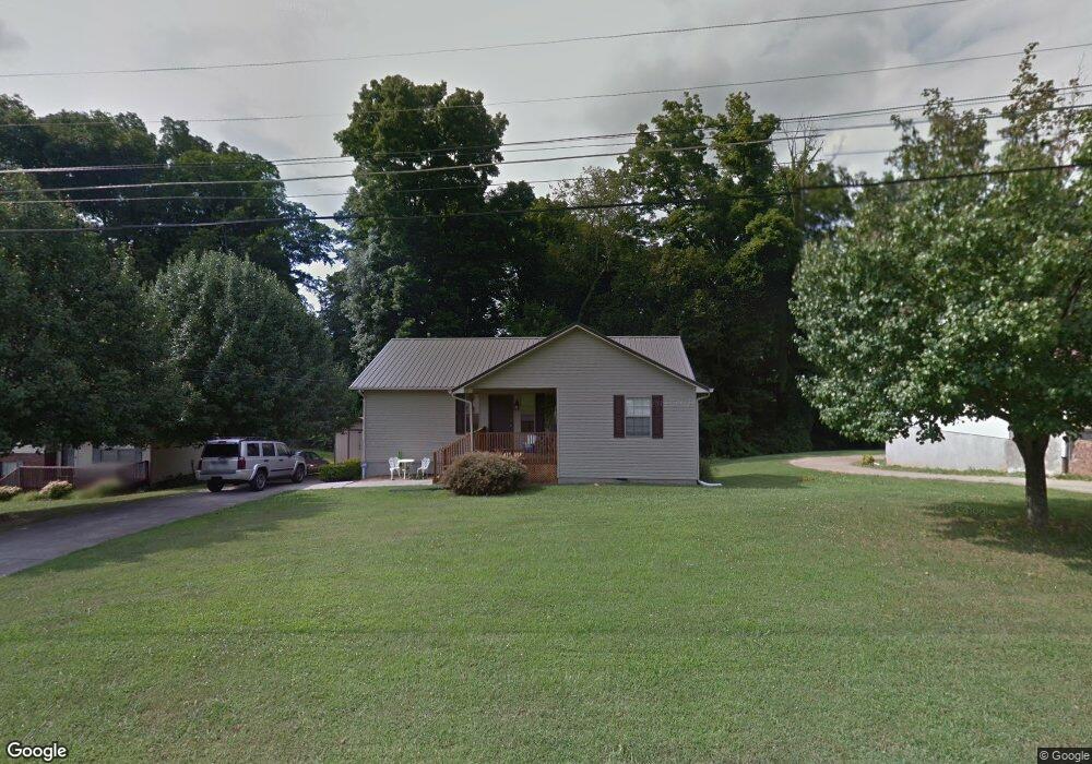
1405 Colony Cir Morristown, TN 37813
Estimated Value: $210,889 - $275,000
--
Bed
2
Baths
1,289
Sq Ft
$195/Sq Ft
Est. Value
About This Home
This home is located at 1405 Colony Cir, Morristown, TN 37813 and is currently estimated at $251,222, approximately $194 per square foot. 1405 Colony Cir is a home located in Hamblen County with nearby schools including Hillcrest Elementary School, Meadowview Middle School, and Morristown East High School.
Ownership History
Date
Name
Owned For
Owner Type
Purchase Details
Closed on
Jul 22, 1997
Sold by
C & R Development Co Inc
Bought by
Southern James
Current Estimated Value
Home Financials for this Owner
Home Financials are based on the most recent Mortgage that was taken out on this home.
Original Mortgage
$82,857
Outstanding Balance
$11,990
Interest Rate
7.61%
Estimated Equity
$239,232
Purchase Details
Closed on
Aug 23, 1989
Bought by
C & R Development Co Inc
Purchase Details
Closed on
Jun 26, 1987
Bought by
Roberts Roberts D and Roberts Edith
Purchase Details
Closed on
Feb 18, 1984
Bought by
Hamilton Bank Of Morristown
Purchase Details
Closed on
Apr 2, 1979
Bought by
Sams Monty F and Sams Robbie
Create a Home Valuation Report for This Property
The Home Valuation Report is an in-depth analysis detailing your home's value as well as a comparison with similar homes in the area
Home Values in the Area
Average Home Value in this Area
Purchase History
| Date | Buyer | Sale Price | Title Company |
|---|---|---|---|
| Southern James | $82,900 | -- | |
| C & R Development Co Inc | $92,000 | -- | |
| Roberts Roberts D | $68,400 | -- | |
| Hamilton Bank Of Morristown | -- | -- | |
| Sams Monty F | $140,000 | -- |
Source: Public Records
Mortgage History
| Date | Status | Borrower | Loan Amount |
|---|---|---|---|
| Open | Sams Monty F | $82,857 |
Source: Public Records
Tax History Compared to Growth
Tax History
| Year | Tax Paid | Tax Assessment Tax Assessment Total Assessment is a certain percentage of the fair market value that is determined by local assessors to be the total taxable value of land and additions on the property. | Land | Improvement |
|---|---|---|---|---|
| 2024 | $550 | $31,225 | $4,000 | $27,225 |
| 2023 | $437 | $31,225 | $0 | $0 |
| 2022 | $987 | $31,225 | $4,000 | $27,225 |
| 2021 | $987 | $31,225 | $4,000 | $27,225 |
| 2020 | $986 | $31,225 | $4,000 | $27,225 |
| 2019 | $966 | $28,425 | $3,175 | $25,250 |
| 2018 | $895 | $28,425 | $3,175 | $25,250 |
| 2017 | $881 | $28,425 | $3,175 | $25,250 |
| 2016 | $841 | $28,425 | $3,175 | $25,250 |
| 2015 | $783 | $28,425 | $3,175 | $25,250 |
| 2014 | -- | $28,425 | $3,175 | $25,250 |
| 2013 | -- | $29,725 | $0 | $0 |
Source: Public Records
Map
Nearby Homes
- 98 Geneva Ln
- Lot 99 Geneva Ln
- Lot 100 Geneva Ln
- Lot 101 Geneva Ln
- 423 Hayter Dr
- 108 Annie Ln
- 109 Annie Ln
- 000 Bacon Ln
- 816 Choctaw St
- 819 Choctaw St
- 1205 Ledford Ave
- 0 Joe Hall Rd Unit 703714
- 828 Overlook Dr
- 1200 Liberty Hall Dr
- 1621 S Cumberland St
- 831 Cave St
- 915 Forgey Ave
- 808 Gaston St
- 0 Russell Cir
- 712 Williams St
- 1409 Colony Cir
- 1413 Colony Cir
- 1408 Colony Cir
- 1412 Colony Cir
- 1404 Colony Cir
- 1416 Colony Cir
- 1417 Colony Cir
- 1402 Colony Cir
- 1400 Colony Cir
- 1421 Colony Cir
- 363 Hayter Dr
- 367 Hayter Dr
- 1425 Colony Cir
- 355 Hayter Dr
- 100 Seminole St
- 351 Hayter Dr
- 375 Hayter Dr
- 347 Hayter Dr
- 364 Hayter Dr
- 368 Hayter Dr