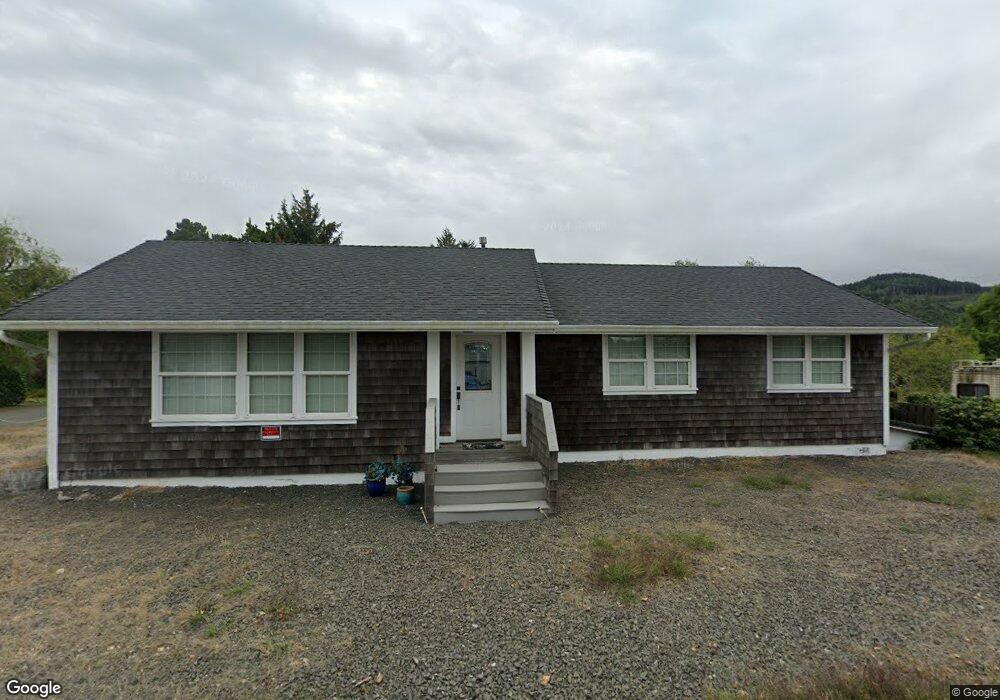
1405 Donnerberg Rd Seaside, OR 97138
Stanley Acres NeighborhoodEstimated Value: $586,263 - $681,000
5
Beds
3
Baths
3,018
Sq Ft
$212/Sq Ft
Est. Value
About This Home
This home is located at 1405 Donnerberg Rd, Seaside, OR 97138 and is currently estimated at $638,316, approximately $211 per square foot. 1405 Donnerberg Rd is a home located in Clatsop County with nearby schools including Seaside High School.
Ownership History
Date
Name
Owned For
Owner Type
Purchase Details
Closed on
Mar 1, 2024
Sold by
Beegle Glenda
Bought by
Beegle David C
Current Estimated Value
Purchase Details
Closed on
Jun 24, 2010
Sold by
Deutsche Bank National Trust Company
Bought by
Beegle David C and Beegle Glenda M
Purchase Details
Closed on
Nov 20, 2009
Sold by
Langmo Douglas H
Bought by
Deutsche Bank National Trust Company
Create a Home Valuation Report for This Property
The Home Valuation Report is an in-depth analysis detailing your home's value as well as a comparison with similar homes in the area
Home Values in the Area
Average Home Value in this Area
Purchase History
| Date | Buyer | Sale Price | Title Company |
|---|---|---|---|
| Beegle David C | -- | None Listed On Document | |
| Beegle David C | $148,000 | None Available | |
| Deutsche Bank National Trust Company | $223,519 | Fidelity |
Source: Public Records
Tax History Compared to Growth
Tax History
| Year | Tax Paid | Tax Assessment Tax Assessment Total Assessment is a certain percentage of the fair market value that is determined by local assessors to be the total taxable value of land and additions on the property. | Land | Improvement |
|---|---|---|---|---|
| 2025 | $4,066 | $320,997 | -- | -- |
| 2024 | $3,941 | $311,648 | -- | -- |
| 2023 | $3,819 | $302,572 | $0 | $0 |
| 2022 | $3,721 | $293,760 | $0 | $0 |
| 2021 | $3,640 | $285,205 | $0 | $0 |
| 2020 | $3,551 | $276,899 | $0 | $0 |
| 2019 | $3,449 | $268,835 | $0 | $0 |
| 2018 | $3,302 | $261,006 | $0 | $0 |
| 2017 | $3,178 | $253,405 | $0 | $0 |
| 2016 | $2,752 | $246,026 | $60,431 | $185,595 |
| 2015 | $2,682 | $238,861 | $58,671 | $180,190 |
| 2014 | $2,584 | $231,905 | $0 | $0 |
| 2013 | -- | $225,151 | $0 | $0 |
Source: Public Records
Map
Nearby Homes
- 1350 13th Ave
- 790 17th Ave
- 0 Vacant Land Unit 159249124
- 802 25th Ave
- 000 Neawanna St
- 820 12th Ave
- 2657 N Hwy 101 Unit 6
- 2624 Neawanna St
- 717 12th Ave
- 739 11th Ave
- 731 11th Ave
- 1299 6th Ave
- 1116 6th Ave
- 1110 6th Ave
- 845 9th Ave
- 835 N Holladay Dr
- 481 Hillside Loop
- 815 N King St
- 460 12th Ave
- 337 16th Ave
- 1905 N Wahanna Rd
- 1425 Donnerberg Rd
- 1900 N Wahanna Rd
- 1865 N Wahanna Rd
- 1445 Donnerberg Rd
- 1946 N Wahanna Rd
- 432 N Wahanna Rd
- 1985 N Wahanna Rd
- 1440 Donnerberg Rd
- 1840 N Wahanna Rd
- 1985 N Wahannna
- 1998 N Wahanna Dr
- 1998 N Wahanna Rd
- 1825 N Wahanna Rd
- 1460 Donnerberg Rd
- 1785 N Wahanna Rd
- 2040 N Wahanna Rd
- 1800 N Wahanna Rd
- 2045 N Wahanna Rd
- 1490 Donnerberg Rd