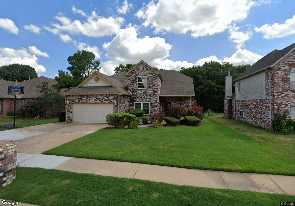
1405 N Umbrella Ave Broken Arrow, OK 74012
Southbrook NeighborhoodEstimated Value: $288,000 - $317,000
4
Beds
3
Baths
2,529
Sq Ft
$118/Sq Ft
Est. Value
About This Home
This home is located at 1405 N Umbrella Ave, Broken Arrow, OK 74012 and is currently estimated at $298,175, approximately $117 per square foot. 1405 N Umbrella Ave is a home located in Tulsa County with nearby schools including Marshall T. Moore Elementary School, Union 8th Grade Center, and Union 6th-7th Grade Center.
Ownership History
Date
Name
Owned For
Owner Type
Purchase Details
Closed on
May 13, 2004
Sold by
Kaplin Bernard D and Kaplin Donna D
Bought by
Bennett Ralph E and Bennett Kathryn M
Current Estimated Value
Purchase Details
Closed on
Nov 8, 2000
Sold by
Tillman Gwendolyn Kay
Bought by
Kaplin Bernard D and Kaplin Donna D
Purchase Details
Closed on
Sep 1, 1992
Create a Home Valuation Report for This Property
The Home Valuation Report is an in-depth analysis detailing your home's value as well as a comparison with similar homes in the area
Home Values in the Area
Average Home Value in this Area
Purchase History
| Date | Buyer | Sale Price | Title Company |
|---|---|---|---|
| Bennett Ralph E | $157,500 | -- | |
| Kaplin Bernard D | $131,000 | Tulsa Abstract & Title Co | |
| -- | $99,000 | -- |
Source: Public Records
Tax History Compared to Growth
Tax History
| Year | Tax Paid | Tax Assessment Tax Assessment Total Assessment is a certain percentage of the fair market value that is determined by local assessors to be the total taxable value of land and additions on the property. | Land | Improvement |
|---|---|---|---|---|
| 2025 | $2,682 | $20,430 | $2,255 | $18,175 |
| 2024 | $2,478 | $19,806 | $2,618 | $17,188 |
| 2023 | $2,478 | $20,199 | $2,591 | $17,608 |
| 2022 | $2,422 | $18,612 | $3,140 | $15,472 |
| 2021 | $2,355 | $18,041 | $3,044 | $14,997 |
| 2020 | $2,298 | $17,486 | $3,353 | $14,133 |
| 2019 | $2,294 | $17,486 | $3,353 | $14,133 |
| 2018 | $2,287 | $17,486 | $3,353 | $14,133 |
| 2017 | $2,304 | $18,380 | $3,524 | $14,856 |
| 2016 | $2,203 | $17,845 | $3,422 | $14,423 |
| 2015 | $2,136 | $17,325 | $3,322 | $14,003 |
| 2014 | $2,124 | $17,325 | $3,322 | $14,003 |
Source: Public Records
Map
Nearby Homes
- 1429 N Yellowood Ave
- 1312 N Willow Ave
- 2416 W Lansing Place
- 4441 W Queens St
- 1316 N Nyssa Ave
- 1216 N Cypress Ave
- 1812 N Butternut Ave
- 3413 W Norman St
- 905 N Butternut Ave
- 911 N Butternut Ct
- 708 N Aster Ave
- 1908 N Cypress Ave
- 11860 E 62nd Place
- 3108 W Norman Cir
- 4501 W Hartford St
- 3033 W Oakland St
- 6727 S 112th East Ave
- 409 N Palm Ave
- 2909 W Oakland St
- 4408 W Elgin St
- 1409 N Umbrella Ave
- 1401 N Umbrella Ave
- 1413 N Umbrella Ave
- 1345 N Umbrella Ave
- 1404 N Umbrella Ave
- 1417 N Umbrella Ave
- 1341 N Umbrella Ave
- 1400 N Umbrella Ave
- 1408 N Umbrella Ave
- 1412 N Umbrella Ave
- 1421 N Umbrella Ave
- 1339 N Umbrella Ave
- 1340 N Umbrella Ave
- 1416 N Umbrella Ave
- 1409 N Willow Ave
- 1405 N Willow Ave
- 1401 N Willow Ave
- 1425 N Umbrella Ave
- 1335 N Umbrella Ave
- 1336 N Umbrella Ave
