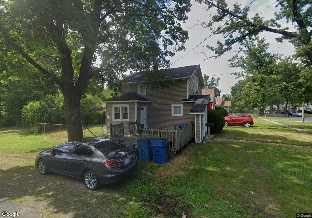
1405 Upland Dr Kalamazoo, MI 49048
Estimated Value: $145,270 - $156,000
2
Beds
1
Bath
956
Sq Ft
$159/Sq Ft
Est. Value
About This Home
This home is located at 1405 Upland Dr, Kalamazoo, MI 49048 and is currently estimated at $151,818, approximately $158 per square foot. 1405 Upland Dr is a home located in Kalamazoo County with nearby schools including Northeastern Elementary School, Linden Grove Middle School, and Kalamazoo Central High School.
Ownership History
Date
Name
Owned For
Owner Type
Purchase Details
Closed on
Mar 18, 2020
Sold by
Crosby Jefrey
Bought by
Crosby Homes And Rentals Llc
Current Estimated Value
Purchase Details
Closed on
Mar 25, 2011
Sold by
Secretary Of Housing & Urban Development
Bought by
Crosby Jeffrey
Purchase Details
Closed on
Sep 7, 2010
Sold by
Citimortgage Inc
Bought by
The Secretary Of Housing & Urban Develop
Purchase Details
Closed on
Mar 4, 2010
Sold by
Russell Dorothy
Bought by
Citimortgage Inc
Create a Home Valuation Report for This Property
The Home Valuation Report is an in-depth analysis detailing your home's value as well as a comparison with similar homes in the area
Home Values in the Area
Average Home Value in this Area
Purchase History
| Date | Buyer | Sale Price | Title Company |
|---|---|---|---|
| Crosby Homes And Rentals Llc | -- | None Available | |
| Crosby Jeffrey | $19,100 | None Available | |
| The Secretary Of Housing & Urban Develop | -- | None Available | |
| Citimortgage Inc | $63,842 | None Available |
Source: Public Records
Tax History Compared to Growth
Tax History
| Year | Tax Paid | Tax Assessment Tax Assessment Total Assessment is a certain percentage of the fair market value that is determined by local assessors to be the total taxable value of land and additions on the property. | Land | Improvement |
|---|---|---|---|---|
| 2025 | $1,879 | $60,400 | $0 | $0 |
| 2024 | $269 | $51,100 | $0 | $0 |
| 2023 | $256 | $45,200 | $0 | $0 |
| 2022 | $1,710 | $41,800 | $0 | $0 |
| 2021 | $1,618 | $36,300 | $0 | $0 |
| 2020 | $1,593 | $33,300 | $0 | $0 |
| 2019 | $1,535 | $30,400 | $0 | $0 |
| 2018 | $1,496 | $25,600 | $0 | $0 |
| 2017 | $0 | $25,600 | $0 | $0 |
| 2016 | -- | $22,900 | $0 | $0 |
| 2015 | -- | $20,700 | $0 | $0 |
| 2014 | -- | $19,800 | $0 | $0 |
Source: Public Records
Map
Nearby Homes
- 1312 Sunnyside Dr
- 1415 Upland Dr
- 1512 Upland Dr
- 1030 Dwillard Dr
- 1242 Nassau St
- 1727 Sunnyside Dr
- 1013 Chrysler St
- 925 Dayton Ave
- 3221 Miami Ave
- 2820 Asbury Ave
- 1320 Nazareth Rd
- 1008 Cooper Ave
- 3305 Kenilworth Ave
- 905 Cooper Ave
- 2535 Gull Rd
- 1934 Nazareth Rd
- 811 Cooper Ave
- 518 Dayton Ave
- 2215 Brook Dr
- 2105 Gull Rd
- 1409 Upland Dr
- 1325 Upland Dr
- 1419 Upland Dr
- 1412 Sunnyside Dr
- 1317 Upland Dr
- 61962 Dwillard Dr
- 1326 Sunnyside Dr
- 1423 Upland Dr
- 1410 Upland Dr
- 1320 Sunnyside Dr
- 1420 Upland Dr
- 1311 Upland Dr
- 1320 Upland Dr
- 1426 Sunnyside Dr
- 1424 Upland Dr
- 1428 Upland Dr
- 1312 Upland Dr
- 1507 Upland Dr
- 1303 Upland Dr
- 1508 Sunnyside Dr