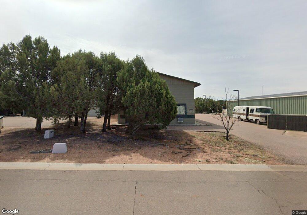
1405 W Red Baron Rd Payson, AZ 85541
Estimated Value: $798,148
--
Bed
--
Bath
3,180
Sq Ft
$251/Sq Ft
Est. Value
About This Home
This home is located at 1405 W Red Baron Rd, Payson, AZ 85541 and is currently estimated at $798,148, approximately $250 per square foot. 1405 W Red Baron Rd is a home located in Gila County with nearby schools including Julia Randall Elementary School, Payson Elementary School, and Rim Country Middle School.
Ownership History
Date
Name
Owned For
Owner Type
Purchase Details
Closed on
Sep 9, 2015
Sold by
Walker Laura Liane
Bought by
Hiticas Dumitru and Hiticas Virginia
Current Estimated Value
Purchase Details
Closed on
Mar 27, 2014
Sold by
Walker David and Walker David Lee
Bought by
Walker David Lee and Walker Laurel Liane
Purchase Details
Closed on
Sep 24, 2007
Sold by
Henson Chris A and Henson Holly L
Bought by
Walker David
Purchase Details
Closed on
Feb 20, 2007
Sold by
Bayer Timothy O
Bought by
Henson Chris A and Henson Holly L
Home Financials for this Owner
Home Financials are based on the most recent Mortgage that was taken out on this home.
Original Mortgage
$100,000
Interest Rate
6.21%
Mortgage Type
Commercial
Purchase Details
Closed on
Mar 9, 2005
Sold by
Town Of Payson
Bought by
Bayer Timothy O
Home Financials for this Owner
Home Financials are based on the most recent Mortgage that was taken out on this home.
Original Mortgage
$35,000
Interest Rate
5.65%
Mortgage Type
Commercial
Create a Home Valuation Report for This Property
The Home Valuation Report is an in-depth analysis detailing your home's value as well as a comparison with similar homes in the area
Home Values in the Area
Average Home Value in this Area
Purchase History
| Date | Buyer | Sale Price | Title Company |
|---|---|---|---|
| Hiticas Dumitru | $350,000 | Pioneer Title Agency | |
| Walker David Lee | -- | None Available | |
| Walker David | $395,000 | Pioneer Title Agency | |
| Henson Chris A | $120,000 | Pioneer Title Agency | |
| Bayer Timothy O | $52,500 | Pioneer Title Agency |
Source: Public Records
Mortgage History
| Date | Status | Borrower | Loan Amount |
|---|---|---|---|
| Previous Owner | Henson Chris A | $100,000 | |
| Previous Owner | Bayer Timothy O | $35,000 |
Source: Public Records
Tax History Compared to Growth
Tax History
| Year | Tax Paid | Tax Assessment Tax Assessment Total Assessment is a certain percentage of the fair market value that is determined by local assessors to be the total taxable value of land and additions on the property. | Land | Improvement |
|---|---|---|---|---|
| 2025 | $5,544 | -- | -- | -- |
| 2024 | $5,544 | $56,583 | $9,878 | $46,705 |
| 2023 | $5,544 | $44,564 | $8,001 | $36,563 |
| 2022 | $5,531 | $47,364 | $8,001 | $39,363 |
| 2021 | $5,341 | $47,364 | $8,001 | $39,363 |
| 2020 | $5,132 | $0 | $0 | $0 |
| 2019 | $4,982 | $0 | $0 | $0 |
| 2018 | $4,687 | $0 | $0 | $0 |
| 2017 | $4,370 | $0 | $0 | $0 |
| 2016 | $4,279 | $0 | $0 | $0 |
| 2015 | $4,316 | $0 | $0 | $0 |
Source: Public Records
Map
Nearby Homes
- 525 N Peak Loop
- 1007 N Aviator Pkwy
- 506 N Peak Loop
- 506 N Wagon Ct
- 507 N Peak Loop
- 505 N Peak Loop
- 2301 W Graff Dr
- 408 N Rim Ranch Point
- 1003 W Falcon Lookout Ln
- 1003 W Falcon Lookout Ln Unit 11
- 2404 W Palmer Dr
- 1200 W Airport Rd
- 1200 W Airport Rd Unit 96F-I
- 802 N Oak Point
- 800 N Oak Point
- 1000 W Falcon Lookout Ln
- 908 W Sherwood Dr
- 1201&1203 W Chatham Dr
- 1050 W Airport Rd
- 1050 W Airport Rd Unit 10
- 1501 W Red Baron Rd
- 1401 W Red Baron Rd Unit 32
- 1401 W Red Baron Rd
- 1503 W Red Baron Rd
- 1302 Earhart Pkwy Unit 111
- 1400 W Red Baron Rd
- 1400 W Airport Rd
- 1400 W Airport Rd
- 1400 W Airport Rd
- 1400 W Airport Rd
- 1400 W Airport Rd
- 1400 W Airport Rd Unit 5 formerly Block 12
- 1400 W Airport Rd Unit 5
- 1900 W Airport Rd
- 1902 W Airport Rd
- 1902 W Airport Rd
- 1900 W Airport Rd
- 1505 W Red Baron Rd
- 1323 W Red Baron Rd
- 1322 W Red Baron Rd