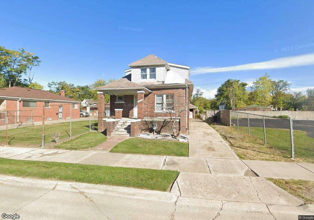
14053 Pfent St Detroit, MI 48205
Franklin NeighborhoodEstimated Value: $18,000 - $84,000
3
Beds
1
Bath
1,359
Sq Ft
$42/Sq Ft
Est. Value
About This Home
This home is located at 14053 Pfent St, Detroit, MI 48205 and is currently estimated at $57,667, approximately $42 per square foot. 14053 Pfent St is a home located in Wayne County with nearby schools including Casimir Pulaski Elementary-Middle School, Edward 'Duke' Ellington Conservatory of Music and Art, and Charles L. Spain Elementary-Middle School.
Ownership History
Date
Name
Owned For
Owner Type
Purchase Details
Closed on
Mar 3, 2025
Sold by
Detroit Land Bank Authority
Bought by
King Jermarion
Current Estimated Value
Purchase Details
Closed on
Dec 18, 2018
Sold by
Wayne County
Bought by
Detroit Land Bank Authority
Purchase Details
Closed on
Dec 16, 2016
Sold by
Park Street Group Lc
Bought by
Owens Brittney
Purchase Details
Closed on
Feb 4, 2016
Sold by
Diversified Investment Associates Llc
Bought by
Park Street Group Llc
Purchase Details
Closed on
Nov 7, 2013
Sold by
Wayne County Treasurer
Bought by
Diversified Investment Associates Llc
Create a Home Valuation Report for This Property
The Home Valuation Report is an in-depth analysis detailing your home's value as well as a comparison with similar homes in the area
Home Values in the Area
Average Home Value in this Area
Purchase History
| Date | Buyer | Sale Price | Title Company |
|---|---|---|---|
| King Jermarion | $17,500 | None Listed On Document | |
| Detroit Land Bank Authority | -- | None Available | |
| Owens Brittney | $10,000 | None Available | |
| Park Street Group Llc | $1,000 | None Available | |
| Diversified Investment Associates Llc | $500 | None Available |
Source: Public Records
Tax History Compared to Growth
Tax History
| Year | Tax Paid | Tax Assessment Tax Assessment Total Assessment is a certain percentage of the fair market value that is determined by local assessors to be the total taxable value of land and additions on the property. | Land | Improvement |
|---|---|---|---|---|
| 2025 | -- | $0 | $0 | $0 |
| 2024 | -- | $0 | $0 | $0 |
| 2023 | $0 | $0 | $0 | $0 |
| 2022 | $0 | $0 | $0 | $0 |
| 2021 | $0 | $0 | $0 | $0 |
| 2019 | $1,135 | $0 | $0 | $0 |
| 2018 | $1,024 | $11,700 | $0 | $0 |
| 2017 | $216 | $11,400 | $0 | $0 |
| 2016 | $715 | $6,200 | $0 | $0 |
| 2015 | $620 | $6,200 | $0 | $0 |
| 2013 | $694 | $6,941 | $0 | $0 |
| 2010 | -- | $10,175 | $520 | $9,655 |
Source: Public Records
Map
Nearby Homes
- 13832 Pinewood St
- 14390 Lappin St
- 14153 Manning St
- 14404 Manning St
- 19230 Mapleview St
- 14405 Manning St
- 14110 E State Fair St
- 14267 Fordham St
- 14504 Coram St
- 14445 Seven Mile E
- 13801 Fordham St
- 14531 Lappin St
- 19170 Schoenherr St
- 14024 Rossini Dr
- 14076 Rossini Dr
- 14124 Rossini Dr
- 13672 E State Fair St
- 19552 Pelkey St
- 14578 Lappin St
- 19188 Pelkey St
- 14043 Pfent St
- 14048 Pinewood St
- 14044 Pinewood St
- 14027 Pfent St
- 14038 Pinewood St
- 14066 Pinewood St
- 14056 Pinewood St
- 14025 Pfent St
- 14028 Pinewood St
- 14062 Pinewood St
- 14028 Pfent St
- 14021 Pfent St Unit Bldg-Unit
- 14021 Pfent St
- 14072 Pinewood St
- 19335 Alwar St
- 14024 Pinewood St
- 14080 Pinewood St
- 19329 Alwar St
- 14017 Pfent St
- 14016 Pinewood St