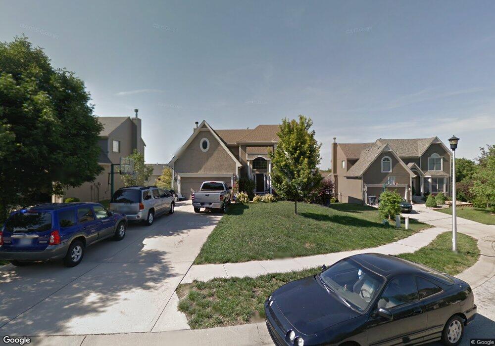
14058 W 130th Place Olathe, KS 66062
Estimated Value: $446,000 - $492,000
4
Beds
3
Baths
2,522
Sq Ft
$186/Sq Ft
Est. Value
About This Home
This home is located at 14058 W 130th Place, Olathe, KS 66062 and is currently estimated at $468,541, approximately $185 per square foot. 14058 W 130th Place is a home located in Johnson County with nearby schools including Regency Place Elementary School, California Trail Middle School, and Olathe East Sr High School.
Ownership History
Date
Name
Owned For
Owner Type
Purchase Details
Closed on
Apr 18, 2001
Sold by
Chris George Homes Inc
Bought by
Gramling Richard T and Gramling Michele M
Current Estimated Value
Home Financials for this Owner
Home Financials are based on the most recent Mortgage that was taken out on this home.
Original Mortgage
$189,860
Outstanding Balance
$69,312
Interest Rate
6.89%
Estimated Equity
$399,229
Purchase Details
Closed on
Feb 19, 2001
Sold by
Eastbrooke Inc
Bought by
Chris George Homes Inc
Home Financials for this Owner
Home Financials are based on the most recent Mortgage that was taken out on this home.
Original Mortgage
$189,860
Outstanding Balance
$69,312
Interest Rate
6.89%
Estimated Equity
$399,229
Create a Home Valuation Report for This Property
The Home Valuation Report is an in-depth analysis detailing your home's value as well as a comparison with similar homes in the area
Home Values in the Area
Average Home Value in this Area
Purchase History
| Date | Buyer | Sale Price | Title Company |
|---|---|---|---|
| Gramling Richard T | -- | Security Land Title Company | |
| Chris George Homes Inc | -- | Security Land Title Company |
Source: Public Records
Mortgage History
| Date | Status | Borrower | Loan Amount |
|---|---|---|---|
| Open | Gramling Richard T | $189,860 |
Source: Public Records
Tax History Compared to Growth
Tax History
| Year | Tax Paid | Tax Assessment Tax Assessment Total Assessment is a certain percentage of the fair market value that is determined by local assessors to be the total taxable value of land and additions on the property. | Land | Improvement |
|---|---|---|---|---|
| 2024 | $5,086 | $45,161 | $8,614 | $36,547 |
| 2023 | $4,928 | $42,941 | $7,835 | $35,106 |
| 2022 | $4,503 | $38,192 | $7,121 | $31,071 |
| 2021 | $4,264 | $34,477 | $7,865 | $26,612 |
| 2020 | $3,977 | $31,890 | $7,151 | $24,739 |
| 2019 | $3,780 | $30,119 | $7,151 | $22,968 |
| 2018 | $3,391 | $29,647 | $6,223 | $23,424 |
| 2017 | $3,531 | $27,657 | $5,652 | $22,005 |
| 2016 | $3,256 | $26,174 | $5,652 | $20,522 |
| 2015 | $3,034 | $24,426 | $5,652 | $18,774 |
| 2013 | -- | $24,046 | $5,652 | $18,394 |
Source: Public Records
Map
Nearby Homes
- 13611 W 129th Terrace
- 13604 W 129th Terrace
- 13641 W 129th St
- 12890 S Greenwood St
- 13404 W 130th St
- 12715 S Rene St
- 12997 S Alden St
- 13005 S Constance St
- 12979 S Constance St
- 13217 Noland St
- 13012 S Constance St
- 13028 S Constance St
- 13030 S Constance St
- 13014 S Constance St
- 14938 W 130th St
- 15026 W 129th Terrace
- 13406 W 126th Place
- 12909 W 129th St
- 12461 S Mullen Cir
- 12416 S Albervan St
- 14068 W 130th Place
- 14048 W 130th Place
- 14078 W 130th Place
- 14053 W 129th Cir
- 14043 W 129th Cir
- 14038 W 130th Place
- 14063 W 129th Cir
- 14049 W 130th Place
- 14059 W 130th Place
- 14073 W 129th Cir
- 14028 W 130th Place
- 14088 W 130th Place
- 14039 W 130th Place
- 14033 W 129th Cir
- 14069 W 130th Place
- 14029 W 130th Place
- 14083 W 129th Cir
- 14020 W 130th Terrace
- 14032 W 129th Cir
- 14030 W 130th Terrace