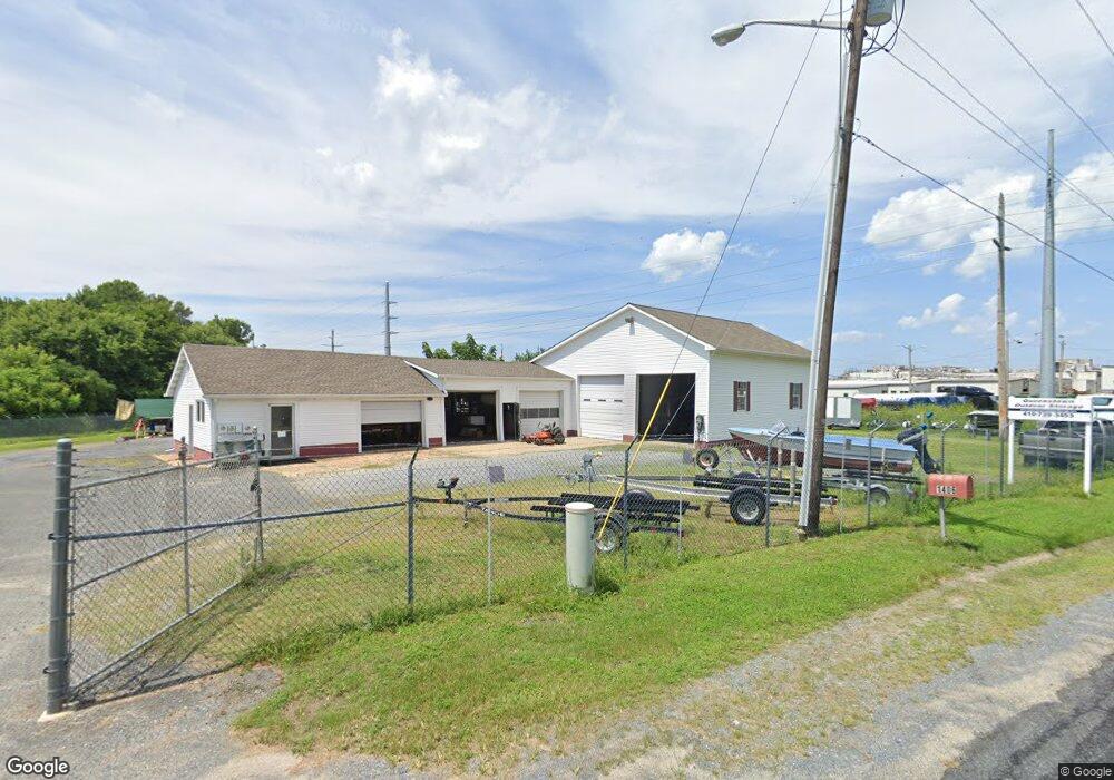
1406 Bloomingdale Rd Queenstown, MD 21658
Estimated Value: $578,981
--
Bed
--
Bath
3,600
Sq Ft
$161/Sq Ft
Est. Value
About This Home
This home is located at 1406 Bloomingdale Rd, Queenstown, MD 21658 and is currently estimated at $578,981, approximately $160 per square foot. 1406 Bloomingdale Rd is a home located in Queen Anne's County with nearby schools including Kennard Elementary School, Centreville Middle School, and Queen Anne's County High School.
Ownership History
Date
Name
Owned For
Owner Type
Purchase Details
Closed on
Mar 6, 2008
Sold by
Ostrowski Stanley W and Ostrowski Denise
Bought by
R & K Property Management Llc
Current Estimated Value
Purchase Details
Closed on
Feb 15, 2008
Sold by
Ostrowski Stanley W and Ostrowski Denise
Bought by
R & K Property Management Llc
Purchase Details
Closed on
Oct 19, 1998
Sold by
Rich Robert Boorman
Bought by
Ostrowski Stanley W and Ostrowski Denise
Purchase Details
Closed on
Jun 8, 1998
Sold by
Rich Robert B and Rich Dorothy A
Bought by
Rich Robert Boorman
Create a Home Valuation Report for This Property
The Home Valuation Report is an in-depth analysis detailing your home's value as well as a comparison with similar homes in the area
Home Values in the Area
Average Home Value in this Area
Purchase History
| Date | Buyer | Sale Price | Title Company |
|---|---|---|---|
| R & K Property Management Llc | $389,500 | -- | |
| R & K Property Management Llc | $389,500 | -- | |
| Ostrowski Stanley W | $128,000 | -- | |
| Rich Robert Boorman | -- | -- |
Source: Public Records
Tax History Compared to Growth
Tax History
| Year | Tax Paid | Tax Assessment Tax Assessment Total Assessment is a certain percentage of the fair market value that is determined by local assessors to be the total taxable value of land and additions on the property. | Land | Improvement |
|---|---|---|---|---|
| 2025 | $3,658 | $381,967 | $0 | $0 |
| 2024 | $3,486 | $363,700 | $233,200 | $130,500 |
| 2023 | $3,460 | $360,933 | $0 | $0 |
| 2022 | $3,434 | $358,167 | $0 | $0 |
| 2021 | $3,355 | $355,400 | $212,000 | $143,400 |
| 2020 | $3,355 | $343,533 | $0 | $0 |
| 2019 | $3,241 | $331,667 | $0 | $0 |
| 2018 | $3,127 | $319,800 | $251,200 | $68,600 |
| 2017 | $2,891 | $295,167 | $0 | $0 |
| 2016 | -- | $270,533 | $0 | $0 |
| 2015 | $3,112 | $245,900 | $0 | $0 |
| 2014 | $3,112 | $245,900 | $0 | $0 |
Source: Public Records
Map
Nearby Homes
- 111 Mt Mills Ln
- 103 Trevors Ct
- 315 Nottingham Ln
- 518 Bryce Rd
- 224 Wye Knot Ct
- 235 Wye Knot Ct
- 6107 Ocean Gateway
- 108 Carriage Ln
- 0 U S 301
- 7204 Main St
- 108 Wall St
- 100 Wall St
- 128 Aker Rd
- 6915 Main St
- 248 Harbor Ln
- 915 Sportsman Neck Rd
- 213 Slippery Hill Ln
- 107 Whitby Ln
- 144 River Run
- 142 Harmony Way
- 1418 Bloomingdale Rd
- 1422 Bloomingdale Rd
- 1420 Bloomingdale Rd
- 100 Bloomingdale Place
- 1110 Bloomingdale Rd
- 140 Deep Landing Ln
- 101 Chestnut Ln
- 105 Chestnut Ln
- 103 Chestnut Ln
- 120 Deer Landing Ln
- 140 Deer Landing Ln
- 107 Chestnut Ln
- 102 Chestnut Ln
- 100 Chestnut Ln
- 104 Chestnut Ln
- 1620 Bloomingdale Rd
- 130 Warrington Farm Ln
- 111 Chestnut Ln
- 106 Chestnut Ln
- 5405 Ocean Gateway