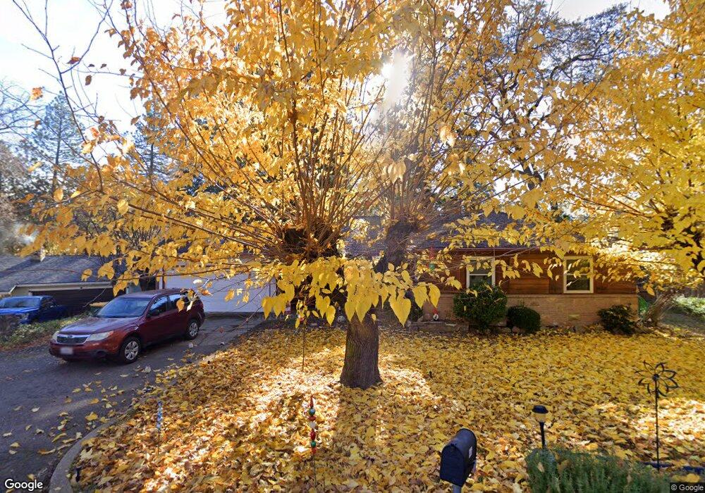
1406 Pierce Ct Placerville, CA 95667
Estimated Value: $332,000 - $467,000
3
Beds
2
Baths
1,530
Sq Ft
$281/Sq Ft
Est. Value
About This Home
This home is located at 1406 Pierce Ct, Placerville, CA 95667 and is currently estimated at $430,262, approximately $281 per square foot. 1406 Pierce Ct is a home located in El Dorado County with nearby schools including El Dorado High School, Country Day Montessori, and El Dorado Adventist School.
Ownership History
Date
Name
Owned For
Owner Type
Purchase Details
Closed on
Jun 25, 2008
Sold by
Weston Carol L and The Stanley K Weston & Norma W
Bought by
Mangone Glenda R
Current Estimated Value
Home Financials for this Owner
Home Financials are based on the most recent Mortgage that was taken out on this home.
Original Mortgage
$296,235
Outstanding Balance
$190,819
Interest Rate
6.04%
Mortgage Type
VA
Estimated Equity
$239,443
Purchase Details
Closed on
Dec 28, 2001
Sold by
Weston Stanley K and Weston Norma
Bought by
Weston Stanley K and Weston Norma
Create a Home Valuation Report for This Property
The Home Valuation Report is an in-depth analysis detailing your home's value as well as a comparison with similar homes in the area
Home Values in the Area
Average Home Value in this Area
Purchase History
| Date | Buyer | Sale Price | Title Company |
|---|---|---|---|
| Mangone Glenda R | $290,000 | Old Republic Title Company | |
| Weston Stanley K | -- | -- |
Source: Public Records
Mortgage History
| Date | Status | Borrower | Loan Amount |
|---|---|---|---|
| Open | Mangone Glenda R | $296,235 |
Source: Public Records
Tax History
| Year | Tax Paid | Tax Assessment Tax Assessment Total Assessment is a certain percentage of the fair market value that is determined by local assessors to be the total taxable value of land and additions on the property. | Land | Improvement |
|---|---|---|---|---|
| 2025 | $3,815 | $373,428 | $141,643 | $231,785 |
| 2024 | $3,815 | $366,107 | $138,866 | $227,241 |
| 2023 | $3,769 | $358,930 | $136,144 | $222,786 |
| 2022 | $3,715 | $351,893 | $133,475 | $218,418 |
| 2021 | $3,672 | $344,994 | $130,858 | $214,136 |
| 2020 | $3,616 | $341,458 | $129,517 | $211,941 |
| 2019 | $3,571 | $334,764 | $126,978 | $207,786 |
| 2018 | $3,464 | $328,201 | $124,489 | $203,712 |
| 2017 | $3,411 | $321,767 | $122,049 | $199,718 |
| 2016 | $3,013 | $283,000 | $107,500 | $175,500 |
| 2015 | $2,633 | $283,000 | $107,500 | $175,500 |
| 2014 | $2,633 | $250,500 | $95,000 | $155,500 |
Source: Public Records
Map
Nearby Homes
- 2655 Mona Dr
- 1131 Bush Ct
- 1015 Utah Dr
- 1016 Utah Dr
- 1000 Utah Dr
- 2940 Anderson Way
- 1012 Utah Dr
- 1008 Utah Dr
- 1006 Utah Dr
- 2350 Big Canyon Creek Rd
- 1004 Utah Dr
- 1002 Utah Dr
- 2399 Kingsgate Rd
- 2660 Clay St
- 1110 Madrone Ln
- 1049 Kimi Way
- 2977 Mosquito Rd
- 2921 Miller Way
- 945 Crawford Drift Ct
- 944 Crawford Drift Ct
- 2699 Prescott Ave
- 1412 Pierce Ct
- 2611 Mona Dr
- 1407 Pierce Ct
- 1413 Pierce Ct
- 2610 Mona Dr
- 2604 Prescott Ave
- 2596 Prescott Ave
- 2583 Prescott Ave
- 2588 Prescott Ave
- 2614 Prescott Ave
- 2637 Mona Ave
- 0 Mona Ave
- 2636 Mona Ave
- 2559 Prescott Ave
- 2637 Mona Dr
- 2636 Mona Dr
- 2639 Mona Ave
- 2620 Prescott Ave
- 2551 Prescott Ave
Your Personal Tour Guide
Ask me questions while you tour the home.