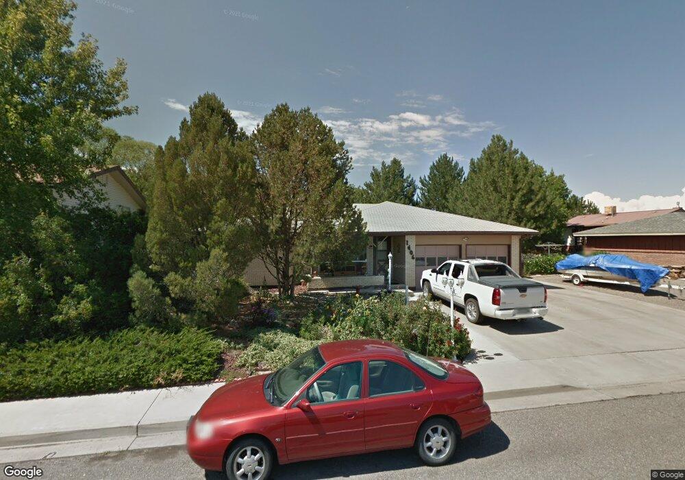
1406 Sherwood Dr Montrose, CO 81401
Estimated Value: $443,000 - $470,000
4
Beds
2
Baths
2,658
Sq Ft
$171/Sq Ft
Est. Value
About This Home
This home is located at 1406 Sherwood Dr, Montrose, CO 81401 and is currently estimated at $453,668, approximately $170 per square foot. 1406 Sherwood Dr is a home located in Montrose County with nearby schools including Pomona Elementary School, Columbine Middle School, and Montrose High School.
Ownership History
Date
Name
Owned For
Owner Type
Purchase Details
Closed on
Sep 30, 2021
Sold by
Rice Brad and Anderson Jackie Kay
Bought by
Rice Brad and Rice Jacqueline Kay
Current Estimated Value
Home Financials for this Owner
Home Financials are based on the most recent Mortgage that was taken out on this home.
Original Mortgage
$220,000
Outstanding Balance
$169,057
Interest Rate
2.1%
Mortgage Type
New Conventional
Estimated Equity
$284,611
Purchase Details
Closed on
Feb 27, 2015
Sold by
Long Charles L
Bought by
Roce Brad and Anderson Jackie Kay
Home Financials for this Owner
Home Financials are based on the most recent Mortgage that was taken out on this home.
Original Mortgage
$212,244
Interest Rate
3.68%
Mortgage Type
New Conventional
Purchase Details
Closed on
Aug 9, 2014
Sold by
Long Charles L and Long Vanjano F
Bought by
Long Charles L
Home Financials for this Owner
Home Financials are based on the most recent Mortgage that was taken out on this home.
Original Mortgage
$164,500
Interest Rate
4.16%
Mortgage Type
New Conventional
Purchase Details
Closed on
Jun 20, 2008
Sold by
Edwards Mark D
Bought by
Long Charles L and Long Vontana F
Home Financials for this Owner
Home Financials are based on the most recent Mortgage that was taken out on this home.
Original Mortgage
$169,600
Interest Rate
6.08%
Mortgage Type
New Conventional
Purchase Details
Closed on
Apr 2, 2004
Sold by
Montrose Federal Credit Union
Bought by
Edwards Mark D
Purchase Details
Closed on
Dec 31, 2003
Sold by
Logan Carla Public Trustee
Bought by
Montrose Federal Credit Union
Purchase Details
Closed on
Sep 18, 1996
Sold by
Keith C Wayne C and Keith Shirley H
Bought by
Hess Lynnda R
Purchase Details
Closed on
Mar 1, 1984
Sold by
H & P Construction Co Inc
Bought by
Keith C Wayne C and Keith Shirley H
Purchase Details
Closed on
Apr 22, 1980
Sold by
Phillips Construction Co Inc
Bought by
H & P Construction Co Inc
Create a Home Valuation Report for This Property
The Home Valuation Report is an in-depth analysis detailing your home's value as well as a comparison with similar homes in the area
Home Values in the Area
Average Home Value in this Area
Purchase History
| Date | Buyer | Sale Price | Title Company |
|---|---|---|---|
| Rice Brad | -- | Fidelity National Title | |
| Roce Brad | $2,080,000 | Land Title Guarantee | |
| Long Charles L | -- | None Available | |
| Long Charles L | $212,000 | First American Heritage Titl | |
| Edwards Mark D | $165,000 | -- | |
| Montrose Federal Credit Union | -- | -- | |
| Hess Lynnda R | $143,500 | -- | |
| Keith C Wayne C | $80,300 | -- | |
| H & P Construction Co Inc | $421,200 | -- |
Source: Public Records
Mortgage History
| Date | Status | Borrower | Loan Amount |
|---|---|---|---|
| Open | Rice Brad | $220,000 | |
| Closed | Roce Brad | $212,244 | |
| Previous Owner | Long Charles L | $164,500 | |
| Previous Owner | Long Charles L | $169,600 |
Source: Public Records
Tax History Compared to Growth
Tax History
| Year | Tax Paid | Tax Assessment Tax Assessment Total Assessment is a certain percentage of the fair market value that is determined by local assessors to be the total taxable value of land and additions on the property. | Land | Improvement |
|---|---|---|---|---|
| 2024 | $1,939 | $26,900 | $3,240 | $23,660 |
| 2023 | $1,939 | $31,730 | $3,820 | $27,910 |
| 2022 | $1,476 | $21,150 | $2,780 | $18,370 |
| 2021 | $1,520 | $21,760 | $2,860 | $18,900 |
| 2020 | $1,326 | $19,500 | $2,470 | $17,030 |
| 2019 | $1,334 | $19,500 | $2,470 | $17,030 |
| 2018 | $1,113 | $15,850 | $1,990 | $13,860 |
| 2017 | $1,104 | $15,850 | $1,990 | $13,860 |
| 2016 | $968 | $14,130 | $2,010 | $12,120 |
| 2015 | $951 | $14,130 | $2,010 | $12,120 |
| 2014 | $892 | $14,160 | $2,010 | $12,150 |
Source: Public Records
Map
Nearby Homes
- 1510 Kent Ave Unit A
- 1510 Kent Ave
- 2136 Stratford Dr Unit A
- 2210 Devon St
- 2125 Hartford Way Unit A
- 2135 Winston Way Unit B
- 2130 Devon St
- 1323 Manchester Dr
- 2055 Princeton Way Unit A
- 2038 Winston Way Unit A
- 1119 Phillips Ct
- 1119 Phillips Ct Unit G
- 1119 Phillips Ct Unit A
- 1239 Leeds Ave
- 2036 Scarborough Way Unit J
- 2409 Pecan St
- 1205 Dover Rd
- 1219 Peppertree Dr
- 2250 Phillips Cir
- 1131 S 12th St
- 1412 Sherwood Dr
- 2244 Cambridge Dr
- 1400 Sherwood Dr
- 1339 Stratford Dr
- 2238 Cambridge Dr
- 1405 Stratford Dr
- 0 Bradford Dr Unit 601952
- 0 Bradford Dr Unit 633096
- 0 Bradford Dr Unit 645309
- 0 Bradford Dr Unit 662068
- 0 Bradford Dr Unit 675181
- 0 Bradford Dr Unit 678415
- 0 Bradford Dr Unit A Drive 679815
- 0 Bradford Dr
- 2233 Bradford Dr
- 1409 Sherwood Dr
- 1341 Sherwood Dr
- 1417 Sherwood Dr
- 1331 Stratford Dr
- 2223 Bradford Dr