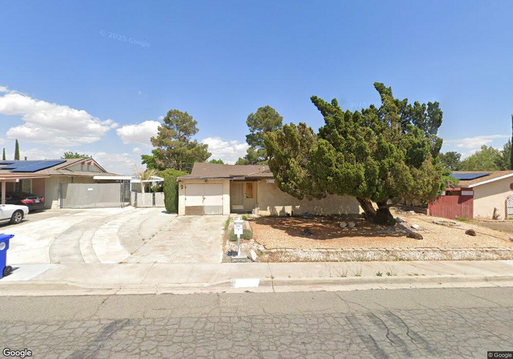
14063 Burning Tree Dr Victorville, CA 92395
Estimated Value: $309,000 - $363,000
2
Beds
2
Baths
1,217
Sq Ft
$275/Sq Ft
Est. Value
About This Home
This home is located at 14063 Burning Tree Dr, Victorville, CA 92395 and is currently estimated at $334,968, approximately $275 per square foot. 14063 Burning Tree Dr is a home located in San Bernardino County with nearby schools including Del Rey Elementary School, Green Tree East Elementary School, and Lakeview Leadership Academy.
Ownership History
Date
Name
Owned For
Owner Type
Purchase Details
Closed on
Nov 5, 2002
Sold by
Hedge William E
Bought by
Hedge William E
Current Estimated Value
Purchase Details
Closed on
Aug 27, 1998
Sold by
Hedge Beverly Ann
Bought by
Hedge William E
Home Financials for this Owner
Home Financials are based on the most recent Mortgage that was taken out on this home.
Original Mortgage
$25,000
Interest Rate
6.93%
Purchase Details
Closed on
Sep 11, 1995
Sold by
Hedge James A
Bought by
Hedge William E
Create a Home Valuation Report for This Property
The Home Valuation Report is an in-depth analysis detailing your home's value as well as a comparison with similar homes in the area
Home Values in the Area
Average Home Value in this Area
Purchase History
| Date | Buyer | Sale Price | Title Company |
|---|---|---|---|
| Hedge William E | -- | -- | |
| Hedge William E | -- | First American Title Co | |
| Hedge William E | $35,000 | -- |
Source: Public Records
Mortgage History
| Date | Status | Borrower | Loan Amount |
|---|---|---|---|
| Closed | Hedge William E | $25,000 |
Source: Public Records
Tax History Compared to Growth
Tax History
| Year | Tax Paid | Tax Assessment Tax Assessment Total Assessment is a certain percentage of the fair market value that is determined by local assessors to be the total taxable value of land and additions on the property. | Land | Improvement |
|---|---|---|---|---|
| 2025 | $910 | $75,099 | $24,016 | $51,083 |
| 2024 | $910 | $73,626 | $23,545 | $50,081 |
| 2023 | $899 | $72,182 | $23,083 | $49,099 |
| 2022 | $882 | $70,766 | $22,630 | $48,136 |
| 2021 | $866 | $69,378 | $22,186 | $47,192 |
| 2020 | $850 | $68,667 | $21,959 | $46,708 |
| 2019 | $836 | $67,320 | $21,528 | $45,792 |
| 2018 | $889 | $66,000 | $21,106 | $44,894 |
| 2017 | $871 | $64,706 | $20,692 | $44,014 |
| 2016 | $854 | $63,437 | $20,286 | $43,151 |
| 2015 | $824 | $62,484 | $19,981 | $42,503 |
| 2014 | $808 | $61,260 | $19,590 | $41,670 |
Source: Public Records
Map
Nearby Homes
- 14035 Wimbleton Dr
- 13997 Wimbleton Dr
- 0 Wimbleton Dr
- 14172 La Paz Dr
- 13958 Burning Tree Dr
- 13951 Burning Tree Dr
- 14185 Burning Tree Dr
- 16253 Pebble Beach Dr
- 0 Green Tree Blvd Unit AR25254768
- 13916 Burning Tree Dr
- 14299 La Paz Dr Unit 32
- 14299 La Paz Dr Unit 40
- 14299 La Paz Dr Unit 6
- 13925 Burning Tree Dr
- 14268 Burning Tree Dr
- 16321 Pebble Beach
- 13835 Burning Tree Dr
- 16340 Camelback Dr
- 14166 Riviera Dr
- 0 Iron Rock Place
- 14051 Burning Tree Dr
- 14073 Burning Tree Dr
- 14041 Burning Tree Dr
- 14081 Burning Tree Dr
- 16098 Camelback Dr
- 16093 Pebble Beach Dr
- 16113 Pebble Beach Dr
- 16147 Pebble Beach Dr
- 14101 Burning Tree Dr
- 16095 Camelback Dr
- 14019 Burning Tree Dr
- 16086 Pebble Beach Dr
- 16101 Camelback Dr
- 16155 Pebble Beach Dr
- 14107 Burning Tree Dr
- 16123 Camelback Dr
- 14007 Burning Tree Dr
- 16165 Pebble Beach Dr
- 14027 Wimbleton Dr
- 14115 Burning Tree Dr