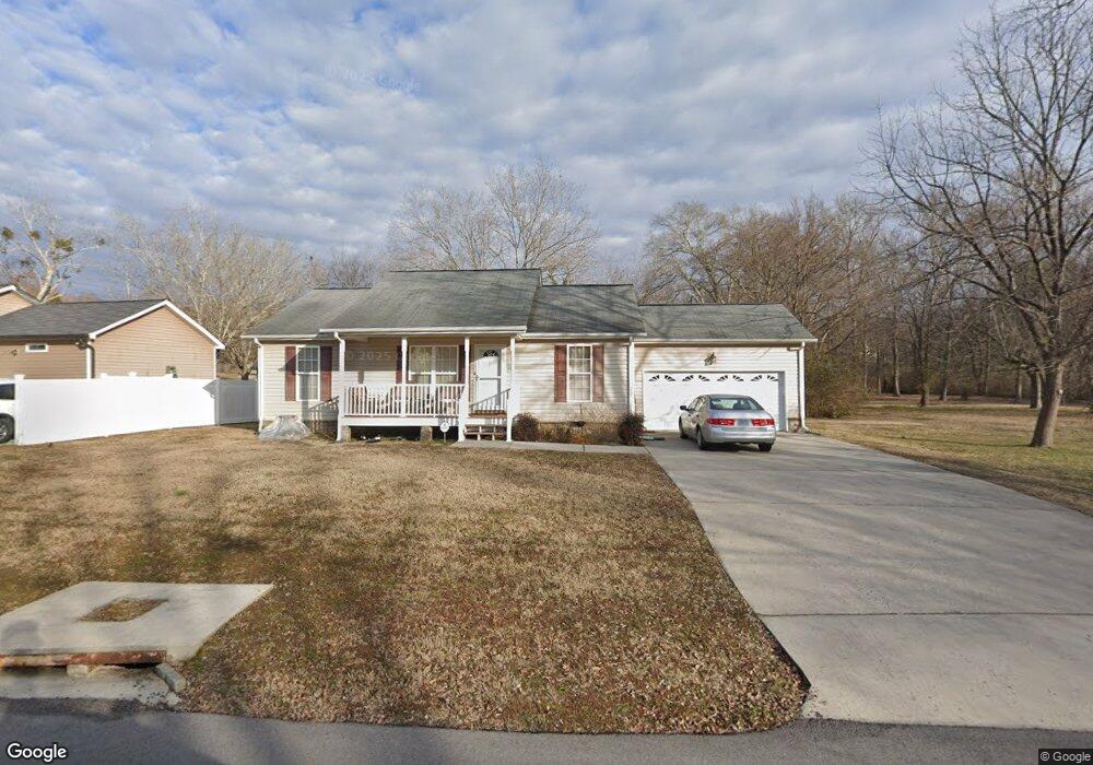
1407 Williams Rd Hixson, TN 37343
Dupont NeighborhoodEstimated Value: $271,813 - $292,000
Studio
1
Bath
1,120
Sq Ft
$251/Sq Ft
Est. Value
About This Home
This home is located at 1407 Williams Rd, Hixson, TN 37343 and is currently estimated at $280,953, approximately $250 per square foot. 1407 Williams Rd is a home located in Hamilton County with nearby schools including DuPont Elementary School, Hixson Middle School, and Hixson High School.
Ownership History
Date
Name
Owned For
Owner Type
Purchase Details
Closed on
Sep 28, 2007
Sold by
Redden Michael
Bought by
Strange Patricia A
Current Estimated Value
Home Financials for this Owner
Home Financials are based on the most recent Mortgage that was taken out on this home.
Original Mortgage
$118,755
Outstanding Balance
$74,149
Interest Rate
6.57%
Mortgage Type
FHA
Estimated Equity
$206,804
Purchase Details
Closed on
May 15, 2006
Sold by
Wild Michael L and Wild Harry S
Bought by
Redden Michael
Purchase Details
Closed on
Nov 22, 2005
Sold by
Whitbeck Ai L
Bought by
Wild Michael L and Wild Harry S
Home Financials for this Owner
Home Financials are based on the most recent Mortgage that was taken out on this home.
Original Mortgage
$17,000
Interest Rate
6%
Mortgage Type
Fannie Mae Freddie Mac
Create a Home Valuation Report for This Property
The Home Valuation Report is an in-depth analysis detailing your home's value as well as a comparison with similar homes in the area
Home Values in the Area
Average Home Value in this Area
Purchase History
| Date | Buyer | Sale Price | Title Company |
|---|---|---|---|
| Strange Patricia A | $130,000 | Northgate Title Escrow Inc | |
| Redden Michael | $39,000 | Northgate Title Escrow Inc | |
| Wild Michael L | $17,000 | First Title |
Source: Public Records
Mortgage History
| Date | Status | Borrower | Loan Amount |
|---|---|---|---|
| Open | Strange Patricia A | $118,755 | |
| Previous Owner | Wild Michael L | $17,000 |
Source: Public Records
Tax History
| Year | Tax Paid | Tax Assessment Tax Assessment Total Assessment is a certain percentage of the fair market value that is determined by local assessors to be the total taxable value of land and additions on the property. | Land | Improvement |
|---|---|---|---|---|
| 2025 | $1,090 | $71,900 | $0 | $0 |
| 2024 | $1,018 | $45,500 | $0 | $0 |
| 2023 | $1,018 | $45,500 | $0 | $0 |
| 2022 | $1,018 | $45,500 | $0 | $0 |
| 2021 | $1,018 | $45,500 | $0 | $0 |
| 2020 | $1,004 | $36,325 | $0 | $0 |
| 2019 | $1,004 | $36,325 | $0 | $0 |
| 2018 | $954 | $36,325 | $0 | $0 |
| 2017 | $1,004 | $36,325 | $0 | $0 |
| 2016 | $889 | $0 | $0 | $0 |
| 2015 | $1,747 | $32,150 | $0 | $0 |
| 2014 | $1,747 | $0 | $0 | $0 |
Source: Public Records
Map
Nearby Homes
- 1315 Northgate Cir
- 1218 Cranbrook Dr
- 1332 Koblan Dr
- 4326 Comet Trail
- 1415 Highland Way
- 1512 Ely Rd
- 1416 Highland Way
- 1313 Michael Ln
- 4703 Clover Ln
- 4705 Clover Ln
- 4607 Cloverdale Loop
- 1705 Bagwell Ave
- 4609 Plaza Hills Ln
- 810 Forest Dale Ln
- 1322 Vanessa Dr
- 936 Sherry Cir
- 1636 Green Hill Dr
- 961 Ashland Terrace
- 4981 N Eldridge Rd
- 4810 Delashmitt Rd
- 4404 Norcross Rd
- 1403 Williams Rd
- 4406 Norcross Rd
- 1402 Williams Rd
- 1408 Williams Rd
- 1411 Williams Rd
- 1401 Oneal Rd
- 1380 Orbit Dr
- 1410 Williams Rd
- 4408 Norcross Rd
- 4408 Norcross Rd Unit 1
- 4411 Norcross Rd
- 1412 Williams Rd
- 1405 Oneal Rd
- 1405 O'Neal Rd
- 1378 Orbit Dr
- 4420 Norcross Rd
- 1414 Williams Rd
- 4413 Norcross Rd
- 1409 Oneal Rd
Your Personal Tour Guide
Ask me questions while you tour the home.