Estimated Value: $175,186 - $213,000
--
Bed
2
Baths
1,690
Sq Ft
$110/Sq Ft
Est. Value
About This Home
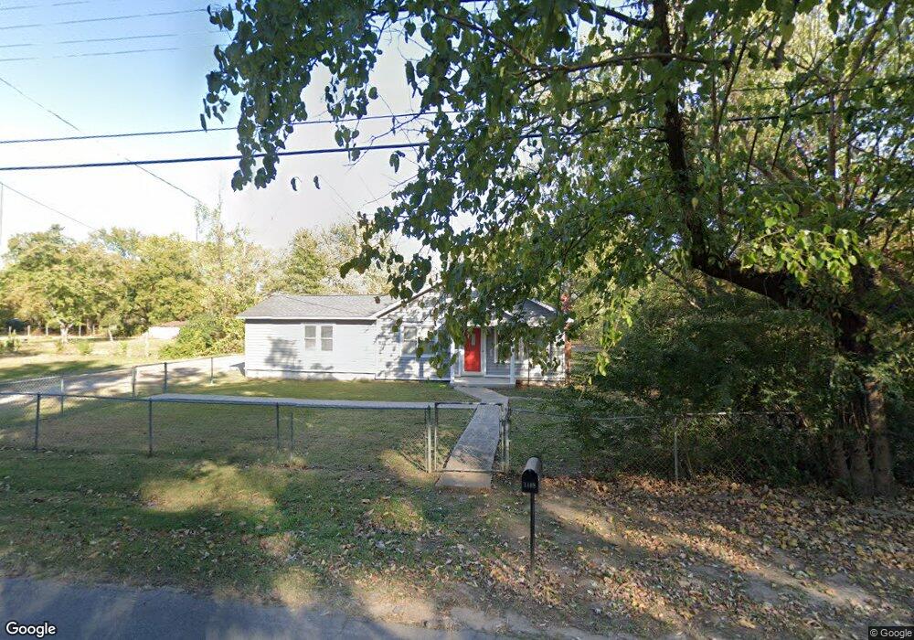
This home is located at 1408 Airport Rd, Alma, AR 72921 and is currently estimated at $186,047, approximately $110 per square foot. 1408 Airport Rd is a home located in Crawford County with nearby schools including Alma Primary School, Alma Intermediate School, and Alma Middle School.
Ownership History
Date
Name
Owned For
Owner Type
Purchase Details
Closed on
Nov 14, 2006
Sold by
Allured Robert A and Allured Sharon J
Bought by
Watts John and Watts Tammy
Current Estimated Value
Home Financials for this Owner
Home Financials are based on the most recent Mortgage that was taken out on this home.
Original Mortgage
$73,469
Outstanding Balance
$43,622
Interest Rate
6.37%
Mortgage Type
New Conventional
Estimated Equity
$142,425
Purchase Details
Closed on
Jan 26, 2004
Bought by
Allured-Allured Trust (3)
Purchase Details
Closed on
Aug 11, 1994
Bought by
State-Wilson
Create a Home Valuation Report for This Property
The Home Valuation Report is an in-depth analysis detailing your home's value as well as a comparison with similar homes in the area
Home Values in the Area
Average Home Value in this Area
Purchase History
| Date | Buyer | Sale Price | Title Company |
|---|---|---|---|
| Watts John | $72,000 | -- | |
| Allured-Allured Trust (3) | -- | -- | |
| State-Wilson | -- | -- |
Source: Public Records
Mortgage History
| Date | Status | Borrower | Loan Amount |
|---|---|---|---|
| Open | Watts John | $73,469 |
Source: Public Records
Tax History Compared to Growth
Tax History
| Year | Tax Paid | Tax Assessment Tax Assessment Total Assessment is a certain percentage of the fair market value that is determined by local assessors to be the total taxable value of land and additions on the property. | Land | Improvement |
|---|---|---|---|---|
| 2025 | $325 | $26,720 | $3,300 | $23,420 |
| 2024 | $384 | $26,720 | $3,300 | $23,420 |
| 2023 | $419 | $26,720 | $3,300 | $23,420 |
| 2022 | $429 | $15,110 | $3,300 | $11,810 |
| 2021 | $429 | $15,110 | $3,300 | $11,810 |
| 2020 | $429 | $15,110 | $3,300 | $11,810 |
| 2019 | $444 | $15,110 | $3,300 | $11,810 |
| 2018 | $436 | $15,110 | $3,300 | $11,810 |
| 2017 | $40 | $13,810 | $3,000 | $10,810 |
| 2016 | $40 | $13,810 | $3,000 | $10,810 |
| 2015 | $396 | $13,810 | $3,000 | $10,810 |
| 2014 | $363 | $13,810 | $3,000 | $10,810 |
Source: Public Records
Map
Nearby Homes
- 1211 Harris Dr
- 1037 Harris Dr
- 308 Emily Dr
- 1322 Riley Cir
- 254 E Main St
- 1736 Riley Cir
- TBD Old Macedonia Rd
- 123 Oak St
- 36 Ash St
- TBD W Cherry St
- 3.42 Acres W Cherry St
- 3300 Eagles Way
- 211 Honeysuckle St
- 133 Honeysuckle St
- 109 Meadors Dr
- 447 Thicksten Dr
- 1928 Plum Creek Ln
- 1238 Orrick Rd
- 0 Interstate 40
- 2417 Highway 64 E
- 1330 Airport Rd
- 1411 Airport Rd
- 1422 Airport Rd
- 1409 Harris Dr
- 1403 Harris Dr
- 1417 Harris Dr
- 1333 Harris Dr
- 1329 Airport Rd
- 1400 Airport Rd
- 1320 Airport Rd
- 1423 Harris Dr
- 1329 Harris Dr
- 1419 Seals St
- 1416 Seals St
- 1429 Harris Dr
- 1323 Harris Dr
- 1321 Airport Rd Unit A
- 1408 Harris Dr
- 1412 Seals St
- 1317 Harris Dr