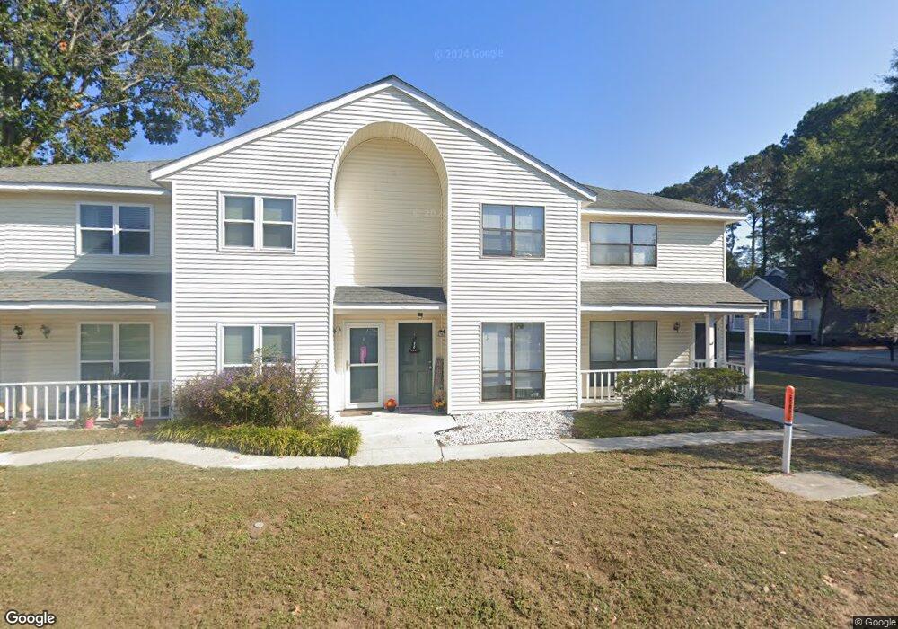
1408 Camp Rd Unit A Charleston, SC 29412
James Island NeighborhoodEstimated Value: $272,000 - $293,080
2
Beds
2
Baths
1,000
Sq Ft
$283/Sq Ft
Est. Value
About This Home
This home is located at 1408 Camp Rd Unit A, Charleston, SC 29412 and is currently estimated at $282,770, approximately $282 per square foot. 1408 Camp Rd Unit A is a home located in Charleston County with nearby schools including Harbor View Elementary School, Camp Road Middle, and James Island Charter High School.
Ownership History
Date
Name
Owned For
Owner Type
Purchase Details
Closed on
Nov 30, 2021
Sold by
Meyers Jason C
Bought by
Young Steven
Current Estimated Value
Purchase Details
Closed on
Dec 20, 2006
Sold by
Edgell Geoff
Bought by
Myers Charles D and Myers Jason C
Purchase Details
Closed on
May 11, 2005
Sold by
Smith Michael M
Bought by
Edgell Geoff
Purchase Details
Closed on
Jan 5, 2005
Sold by
Blanton Street Investments Llc
Bought by
Smith Michael M
Create a Home Valuation Report for This Property
The Home Valuation Report is an in-depth analysis detailing your home's value as well as a comparison with similar homes in the area
Home Values in the Area
Average Home Value in this Area
Purchase History
| Date | Buyer | Sale Price | Title Company |
|---|---|---|---|
| Young Steven | $152,000 | None Listed On Document | |
| Young Steven | $152,000 | None Listed On Document | |
| Myers Charles D | $150,000 | None Available | |
| Edgell Geoff | $125,000 | -- | |
| Smith Michael M | $475,000 | -- |
Source: Public Records
Tax History Compared to Growth
Tax History
| Year | Tax Paid | Tax Assessment Tax Assessment Total Assessment is a certain percentage of the fair market value that is determined by local assessors to be the total taxable value of land and additions on the property. | Land | Improvement |
|---|---|---|---|---|
| 2024 | $1,384 | $10,000 | $0 | $0 |
| 2023 | $1,384 | $6,080 | $0 | $0 |
| 2022 | $2,507 | $9,120 | $0 | $0 |
| 2021 | $1,755 | $6,350 | $0 | $0 |
| 2020 | $1,743 | $6,350 | $0 | $0 |
| 2019 | $1,598 | $5,520 | $0 | $0 |
| 2017 | $1,530 | $5,520 | $0 | $0 |
| 2016 | $1,483 | $5,520 | $0 | $0 |
| 2015 | $1,419 | $5,520 | $0 | $0 |
| 2014 | $1,287 | $0 | $0 | $0 |
| 2011 | -- | $0 | $0 | $0 |
Source: Public Records
Map
Nearby Homes
- 1418 Kentwood Cir
- 1453 Camp Rd
- 1402 Camp Rd Unit 5E
- 1402 Camp Rd Unit 6E
- 1402 Camp Rd Unit 1H
- 1402 Camp Rd Unit 8B
- 1402 Camp Rd Unit 9C
- 1402 Camp Rd Unit 12F
- 1 S Anderson Ave
- 17 S Anderson Ave Unit A,B,C, D
- 1014 Arborwood Dr
- 1359 White House Blvd
- 27 Brockman Dr Unit 27B
- 27 Brockman Dr Unit 27C
- 1 Maplecrest Dr
- 14 Maplecrest Dr
- 9 Maplecrest Dr
- 1 Willingham Ct
- 1336 Briarfield Ave
- 1030 Pauline Ave
- 1408 Camp Rd
- 1408 Camp Rd Unit C
- 1408 Camp Rd Unit B
- 1408 Camp Rd Unit 38
- 1408 Camp Rd
- 1408 Camp Rd Unit D
- 1408 Camp Rd Unit 36
- 1412 Camp Rd Unit C
- 1412 Camp Rd Unit B
- 1412 Camp Rd Unit H
- 1412 Camp Rd Unit A
- 1412 Camp Rd
- 1412 Camp Rd Unit 32
- 1005 Renwood Dr
- 850 Sedge Ct
- 854 Sedge Ct
- 1411 Dove Run Dr Unit C
- 1411 Dove Run Dr Unit B
- 1411 Dove Run Dr Unit 5
- 1411 Dove Run Dr Unit A